Loading
Just a moment…
Loading
Just a moment…
Loading
Unrolling the scrolls…
Atlas Expedition
Build a mental map of Europe, the Mediterranean, and the route network behind classical history.
Why it matters: Mark the place on a small Europe/Mediterranean sketch and add one route note.
Map
Locate the country or feature, then point to the sea, mountain, or neighbor that frames it.
Explain
Explain how the location shaped travel, empire, language, trade, or culture.
Parent proof
Parent proof: student can place the answer in Europe or the Mediterranean and describe one border, sea, or route.
What is the capital of the United Kingdom?
C2 🏳️London
Located on the River Thames
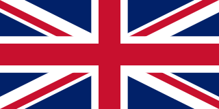
London has been the seat of the UK Parliament and the monarchy for centuries, making it the national capital. Edinburgh is Scotland's capital, not the seat of the UK government.
What is the capital of France?
C2 🏳️Paris
Known as the 'City of Light'
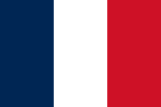
France uses Paris for its seat of government. Known as the 'City of Light,' it is home to the Eiffel Tower, the Louvre, and Notre-Dame Cathedral. Choosing Brussels swaps in Belgium's geography; the requested pairing stays with Paris.
What is the capital of Germany?
C2 🏳️Berlin
This city was divided by a famous wall
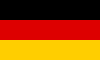
Berlin anchors Germany's national government. Berlin was famously divided by the Berlin Wall from 1961 to 1989 during the Cold War. Vienna sends the learner toward Austria, while the evidence here resolves to Berlin.
What is the capital of Spain?
C2 🏳️Madrid
Located in the center of the Iberian Peninsula
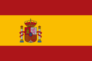
Madrid sits near the center of Spain on the Meseta Central plateau, making it the nation's capital. Barcelona lies on Spain's northeastern Mediterranean coast and leads the region of Catalonia, but it has never been the national capital.
What is the capital of Italy?
C2 🏳️Rome
The center of the ancient Roman Empire
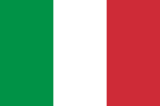
Rome grew along the Tiber River in central Italy, where the Colosseum still stands as a landmark of the ancient Roman Empire. Athens sits on Greece's Attica peninsula, crowned by the Parthenon, and is Greece's capital, not Italy's.
What is the capital of Greece?
C2 🏳️Athens
Named after the goddess of wisdom
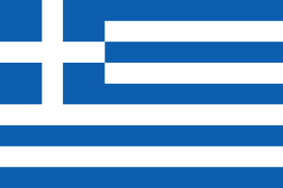
Greece is paired with Athens. Athens is named after Athena, the goddess of wisdom, and was the cradle of Western democracy, philosophy, and the arts. Sofia would answer a neighboring pairing for Bulgaria, not the one anchored by Athens.
What is the capital of Russia?
C2 🏳️Moscow
Home of the Kremlin and Red Square
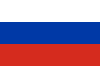
Moscow stands on the Moskva River in western Russia, where the Kremlin and Red Square anchor the national government. Kyiv sits on the Dnieper River and is the capital of Ukraine, a separate country to Russia's southwest.
What is the capital of Portugal?
C2 🏳️Lisbon
Westernmost capital city in continental Europe
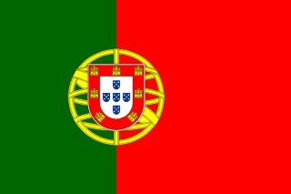
Lisbon sits where the Tagus River meets the Atlantic Ocean on Portugal's western coast, making it the capital. Porto lies farther north on the Douro River and is famous for port wine, not for housing the government.
What is the capital of the Netherlands?
C2 🏳️Amsterdam
Known for its canals and tulips
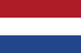
Amsterdam is enshrined in the Dutch constitution as the nation's capital, even though it is not the seat of government. The Hague hosts the Dutch parliament, royal residence, and international courts, but is not the constitutional capital.
What is the capital of Sweden?
C2 🏳️Stockholm
Built on 14 islands connected by bridges
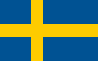
Sweden's capital is Stockholm. Sweden is the largest Scandinavian country, occupying the eastern side of the Scandinavian Peninsula, bordered by Norway to the west and Finland to the northeast. Oslo is Norway's capital, which is why it distracts from Stockholm.
What is the capital of Norway?
C2 🏳️Oslo
Located at the head of a fjord
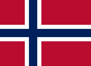
Oslo sits at the head of the Oslofjord in southeastern Norway, making it the country's capital. Stockholm is built across islands on Sweden's Baltic coast and governs Sweden, a separate Scandinavian country.
What is the capital of Poland?
C2 🏳️Warsaw
Located on the Vistula River
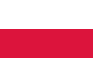
Warsaw sits on the Vistula River in east-central Poland and has served as the nation's capital for centuries. Krakow lies farther south along that same river and was the historic royal capital, not today's seat of government.
What is the capital of Austria?
C2 🏳️Vienna
Famous for classical music composers like Mozart
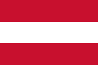
Vienna sits on the Danube River in northeastern Austria, where the Habsburg emperors once ruled. Salzburg lies farther west near the German border and is famous as Mozart's birthplace, not as Austria's capital.
What is the capital of Denmark?
C2 🏳️Copenhagen
Home of the Little Mermaid statue
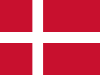
Denmark is matched with Copenhagen in the capital column. Denmark is a Scandinavian country in northern Europe, bordering Germany to the south. Choosing Oslo swaps in Norway's geography; the requested pairing stays with Copenhagen.
What is the capital of Finland?
C2 🏳️Helsinki
The northernmost capital of an EU member state on the European mainland
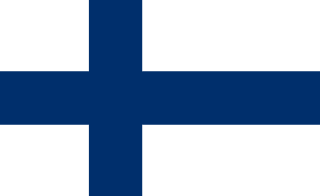
Helsinki names the capital city connected to Finland. Finland is bordered by Russia to the east, Norway to the north, and Sweden to the northwest. Stockholm sends the learner toward Sweden, while the evidence here resolves to Helsinki.
What is the capital of Ireland?
C2 🏳️Dublin
Located on the River Liffey
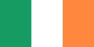
Dublin sits where the River Liffey meets the Irish Sea on Ireland's east coast, making it the Republic's capital. Belfast lies to the north and governs Northern Ireland, which is part of the United Kingdom.
What is the capital of Hungary?
C2 🏳️Budapest
Split by the Danube into Buda and Pest
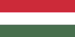
Budapest serves as Hungary's capital. Hungary is a landlocked country in central Europe bordered by Austria, Slovakia, Ukraine, Romania, Serbia, Croatia, and Slovenia. The Bucharest option carries another place-label, so it cannot replace Budapest here.
What is the capital of Czechia (Czech Republic)?
C2 🏳️Prague
Known as the 'City of a Hundred Spires'
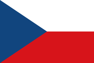
Czechia (Czech Republic) is paired with Prague, the 'City of a Hundred Spires' known for medieval architecture. It is bordered by Germany (west/northwest), Poland (north), Slovakia (east), and Austria (south). Budapest is the Hungarian capital, a different country's seat.
What is the capital of Romania?
C2 🏳️Bucharest
Sometimes called the 'Little Paris of the East'
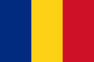
Bucharest sits on the Dambovita River in southern Romania, serving as that country's capital. Budapest straddles the Danube River in Hungary, a different country to Romania's west.
What is the capital of Belgium?
C2 🏳️Brussels
Also the de facto capital of the European Union
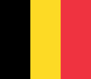
Brussels holds the capital role for Belgium. Brussels serves as the de facto capital of the European Union and is home to NATO headquarters. Choosing Amsterdam swaps in the Netherlands's geography; the requested pairing stays with Brussels.
What is the capital of Croatia?
C2 🏳️Zagreb
Located in the northwestern part of the country, not coastal Dubrovnik
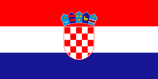
Zagreb sits on the Sava River in northern Croatia, inland from the coast, and serves as the capital. Dubrovnik is a walled city on the Adriatic coast far to the south, known for tourism, not government.
What is the capital of Ukraine?
C2 🏳️Kyiv
Located on the Dnieper River
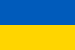
Ukraine is paired with Kyiv. Ukraine is the largest country entirely within Europe and borders Russia, Belarus, Poland, Slovakia, Hungary, Romania, and Moldova. Moscow is tied to Russia; that association is why it can distract from Kyiv.
What is the capital of Bulgaria?
C2 🏳️Sofia
Named after the Saint Sofia Church in the city center
Sofia is Bulgaria's capital. Bulgaria is in southeastern Europe on the Balkan Peninsula, bordered by Romania, Serbia, North Macedonia, Greece, and Turkey, with a Black Sea coast to the east. Bucharest is a different capital; the answer here is Sofia.
What major river flows through Vienna, Budapest, and Belgrade?
C2 🌊Danube River
The second-longest river in Europe, flowing through Vienna, Budapest, and Belgrade
The Danube River is the second-longest river in Europe, flowing eastward through 10 countries including Germany, Austria, Hungary, Serbia, and Romania before emptying into the Black Sea. Rhine River may sound nearby, but the geography described here is Danube River.
What sea lies between Great Britain, Scandinavia, and continental Europe?
C2 🌊North Sea
Rich in oil and natural gas reserves under the seabed
The North Sea lies between Great Britain to the west, Scandinavia to the north and east, and continental Europe to the south. The Baltic Sea sits farther east, ringed by Scandinavia, the Baltic states, Poland, and Germany.
What sea is surrounded by Scandinavia, Finland, and the Baltic states?
C2 🌊Baltic Sea
One of the largest bodies of brackish water in the world — almost enclosed by land
The Baltic Sea is an inland sea bordered by Scandinavia, Finland, the Baltic states, Poland, Germany, and Denmark. The North Sea instead lies west of Scandinavia, between Great Britain and continental Europe.
What peninsula contains Spain and Portugal?
C2 ⛰️Iberian Peninsula
The southwestern peninsula of Europe — home to Spain and Portugal
The Iberian Peninsula sits in Europe's far southwest, bordered by the Atlantic and Mediterranean, and holds Spain and Portugal. The Italian Peninsula extends south from the Alps, dominated by Italy, which surrounds the microstates San Marino and Vatican City.
What peninsula is shaped like a boot and contains Italy?
C2 ⛰️Italian Peninsula
Shaped like a boot extending south into the Mediterranean Sea
The Italian Peninsula juts into the Mediterranean Sea in a boot shape, home to Italy. The Iberian Peninsula instead lies farther west and holds Spain and Portugal, not Italy.
What peninsula contains Norway and Sweden?
C2 ⛰️Scandinavian Peninsula
Located in northern Europe — contains Norway and Sweden, bordered by the North Sea and Baltic Sea
The Scandinavian Peninsula holds Norway along its western coast and Sweden along its eastern side. The Jutland Peninsula instead extends north from Germany and forms mainland Denmark, a separate landmass from Norway and Sweden.
Which world region includes Norway, Sweden, and Denmark?
C2 🌍Scandinavia
It is the northern European region famous for fjords and Nordic languages
Scandinavia usually refers to Norway, Sweden, and Denmark. Balkans may sound nearby, but the geography described here is Scandinavia.
Which world region includes Greece, Albania, Serbia, and Bulgaria?
C2 🌍The Balkans
It is a peninsula region in southeastern Europe
The Balkans occupy southeastern Europe, the peninsula bordered by the Adriatic, Aegean, and Black Seas. Scandinavia refers to Norway, Sweden, and Denmark in far northern Europe, not the southeast.
The Danube River flows through more countries than any other river in the world. How many countries does it pass through?
C2 🌊10
It begins in Germany's Black Forest and ends at the Black Sea in Romania — passing through 10 countries
The Danube begins in Germany's Black Forest and flows through 10 countries before reaching the Black Sea, more than any river on Earth. Eight would skip nations the Danube crosses, such as Serbia mid-course and Romania at its mouth.
The Rhine River begins in which country's Alps before flowing north to the North Sea?
C2 🌊Switzerland
The Rhine begins in the Swiss Alps — Switzerland is the small, mountainous, neutral country in central Europe
The Rhine rises in the Swiss Alps and flows north through Germany to the North Sea. Austria borders only a short stretch of the upper Rhine near Liechtenstein, not the river's actual source.
What famous Carthaginian general crossed the Alps with war elephants to invade Rome in 218 BC?
C2 ⛰️Hannibal
Hannibal was from Carthage in North Africa (modern-day Tunisia) — he crossed the Alps from the north
Hannibal Barca, a Carthaginian general, led his army and war elephants over the Alps in 218 BC to attack Rome from the north. Julius Caesar was a Roman general who later conquered Gaul, not the elephant-led invader of Italy.
In which city would you find the Colosseum, the ancient amphitheater where gladiators fought?
C2 ⛰️Rome, Italy
This city was the center of the Roman Empire — it sits on the Tiber River in central Italy
The Colosseum stands in Rome, Italy, built under Emperor Vespasian and his son Titus around 70-80 AD for gladiator contests. Athens, Greece is famous instead for the Parthenon and its own ancient theaters, not the Colosseum.
The Parthenon, a temple dedicated to the goddess Athena, stands atop the Acropolis in which city?
C2 ⛰️Athens, Greece
This city is considered the birthplace of democracy and philosophy — home of Socrates, Plato, and Aristotle
The Parthenon is a temple dedicated to the goddess Athena, built around 447-432 BC, and stands atop the Acropolis hill in Athens, Greece. Rome, Italy may sound nearby, but the geography described here is Athens, Greece.
Many people think Istanbul is the capital of Turkey. What is the actual capital?
C2 🏳️Ankara
Istanbul is the largest city, but the government sits in a different city in central Turkey
Ankara became Turkey's capital in 1923 when Mustafa Kemal Atatürk moved the government there from Istanbul. Istanbul sits on the Bosphorus as Turkey's largest city and historic seat of empires, not its modern capital.
Many people guess Zurich or Geneva, but what is the actual capital of Switzerland?
C2 🏳️Bern
Zurich is the largest city and Geneva hosts the UN, but neither is the capital
Bern has served as Switzerland's federal capital since 1848, sitting on a hill above a bend in the Aare River. Zurich is Switzerland's largest city and banking center, on Lake Zurich in the country's northeast, not its capital.
What river flows through more European countries than any other, ending at the Black Sea?
C2 🌊Danube River
It flows through Vienna, Budapest, and Bratislava before emptying into the Black Sea
The Danube flows about 1,770 miles eastward from Germany through ten countries before reaching the Black Sea near Romania. The Rhine flows north from the Swiss Alps through fewer countries to empty into the North Sea, not the Black Sea.
What major European river begins in Switzerland and flows north to the North Sea?
C2 🌊Rhine River
Famous for its castles and vineyards along the valley — it forms part of the Germany-France border
The Rhine rises in the Swiss Alps and flows about 760 miles north through Germany and the Netherlands to the North Sea. The Danube starts in Germany's Black Forest and runs eastward across Europe to the Black Sea, not north.
What is the longest river in Europe, flowing through Russia to the Caspian Sea?
C2 🌊Volga River
Often called 'Mother Volga' by Russians — it flows south to the Caspian Sea, not an ocean
The Volga River flows about 2,300 miles across Russia into the landlocked Caspian Sea, making it Europe's longest river. The Danube instead drains central Europe eastward into the Black Sea, not the Caspian.
What mountain range runs through France, Switzerland, Italy, Austria, and Germany?
C2 ⛰️Alps range
The highest peak is Mont Blanc; Hannibal famously crossed these mountains with elephants during the Second Punic War
The Alps arc roughly 750 miles across France, Switzerland, Italy, Austria, and Germany, forming Europe's tallest mountain wall. The Apennines run down the length of Italy alone, not through those five countries.
What mountain range in Russia forms the traditional boundary between Europe and Asia?
C2 ⛰️Ural Mountains
They run north to south through Russia, forming the traditional boundary between Europe and Asia
The Ural Mountains run about 1,550 miles from the Arctic Ocean to the Ural River, the traditional Europe-Asia line. The Caucasus Mountains sit further south, between the Black and Caspian Seas, and mark the border between Russia and Georgia instead.
What mountain range forms the natural border between France and Spain?
C2 ⛰️Pyrenees
The small country of Andorra is nestled within this range — it separates France from Spain
The Pyrenees run about 300 miles from the Bay of Biscay to the Mediterranean, separating France from Spain. The Alps lie farther east, crossing France, Switzerland, and Italy, not along the Spanish border.
What mountain range curves through Poland, Slovakia, Ukraine, and Romania in central-eastern Europe?
C2 ⛰️Carpathian Mountains
Transylvania, the region associated with Dracula legends, is within these mountains
The Carpathian Mountains arc about 900 miles through Poland, Slovakia, Ukraine, and Romania in central-eastern Europe. The Tatra Mountains are just the Carpathians' highest section, confined to the Poland-Slovakia border, not the full arc.
What sea is enclosed between Europe, Africa, and Asia and means 'middle of the earth'?
C2 🌊Mediterranean Sea
The Romans called it 'mare nostrum' (our sea) — it was the center of the ancient world
The Mediterranean Sea sits between Europe, Africa, and Asia, linked to the Atlantic Ocean only through the narrow Strait of Gibraltar. The Black Sea instead lies northeast of it, bordered by Europe and Asia but not Africa.
What sea is bordered by Turkey, Romania, Bulgaria, Ukraine, Russia, and Georgia?
C2 🌊Black Sea
The Danube, Dnieper, and Don rivers all empty into this sea — it connects to the Mediterranean via two narrow straits
The Black Sea borders Turkey, Romania, Bulgaria, Ukraine, Russia, and Georgia, forming a crossroads between Europe and Asia. The Sea of Azov, connected to the Black Sea by the Kerch Strait, touches only Russia and Ukraine.
A place has dry summers and mild, wet winters near an inland sea. Which climate fits best?
C2 ⛰️Mediterranean
Think of lands around the Mediterranean Sea
Mediterranean climates often have hot dry summers and mild wet winters.
A country is shaped like a boot reaching into the Mediterranean Sea. Which European country is it?
C2 ⛰️Italy
The boot-shaped peninsula is famous
Italy is the boot-shaped peninsula extending into the Mediterranean Sea.
A country shares the Iberian Peninsula with Portugal and has Madrid as its capital. Which country is it?
C2 🏳️Spain
Madrid is Spain's capital
Spain is on the Iberian Peninsula in southwestern Europe, and Madrid is its capital.
Greece, southern Italy, and coastal Spain are most closely tied to which sea-centered region?
C2 ⛰️Mediterranean
These places border the Mediterranean Sea
The Mediterranean region includes lands around the Mediterranean Sea, including Greece, southern Italy, and coastal Spain.
Vienna, Bratislava, and Budapest each grew into capital cities directly on the banks of the Danube. What does this clustering of inland capitals along one river best illustrate about how settlement sites are chosen?
C1 🏳️A large navigable river offers transport, trade, water, and a defensible crossing point that draws major settlements to its banks
These cities are far from any coast, yet all three sit on the same waterway — think about what a navigable river provides that a random inland spot does not.
River corridors made early European capitals easier to supply, defend, and trade with. Natural harbors matter for seaports, not inland river siting.
The border between France and Spain runs almost exactly along the crest of the Pyrenees for most of its length. Why do mountain ranges so often end up serving as political boundaries between states?
C1 🏳️A high mountain crest is a clear, hard-to-cross divide that historically separated peoples and armies, so settled frontiers tended to follow it
Think about what a tall ridge does to movement and contact between two populations long before any treaty is signed.
The Pyrenees work as a boundary because a high mountain crest impedes movement. The Ebro is a river within Spain, not the border barrier.
Czechia, Hungary, Switzerland, and Austria are all completely landlocked, yet they support major industrial cities and busy ports. How can a landlocked European state still function as a shipping hub?
C1 🏳️Navigable rivers and canals connect interior cities to the sea, so river ports move freight to ocean harbors without the country touching the coast
Think about how the Rhine and Danube link inland cities like Basel and Vienna to the North Sea and Black Sea.
There is no EU-granted coastline, and while cargo aircraft exist, the bulk of heavy freight moves by inland waterway, not air.
Tsar Peter the Great moved Russia's capital from Moscow to a newly built city, St. Petersburg, on the Baltic coast in 1712. From a geographic standpoint, what was the main strategic motive for choosing that location?
C1 🏳️A Baltic seaport gave Russia direct maritime access and a 'window on Europe' for trade and naval power toward the western powers
Moscow is deep in the interior; the new site faced the sea toward the European powers Peter wanted to trade with and rival.
Peter the Great chose St. Petersburg for Baltic access to European trade. The Ural Mountains lie far east and do not provide a seaport.
A traveler notes that Norway allows passport-free crossing into Sweden. Yet Norway sits outside the European Union and uses the euro nowhere. Sweden, by contrast, is an EU member that still keeps its own krona instead of the euro. What do these cases show about Europe's overlapping institutions?
C1 🏳️EU membership, the euro currency zone, and the passport-free Schengen Area are three separate arrangements, and a country can belong to some but not all
Notice that one country is in the passport-free zone but outside the EU, while another is in the EU but keeps its own currency.
Membership in one does not require membership in the others, so Norway can be in Schengen but outside the EU, while Sweden is in the EU yet keeps its own krona.
The North European Plain stretches in a broad lowland belt from France across Germany and Poland into Russia. Historically, this region has been both Europe's most densely farmed and its most frequently invaded land. Why would one landform produce both effects?
C1 🏳️Flat, fertile lowland is easy to farm and settle densely, but the same openness also lets armies advance across it with few natural barriers to stop them
Ask what a wide, flat, open landscape does for a farmer's plow — and then what it does for a marching army.
The North European Plain supports dense farming because it is broad, flat, and fertile. An active fault line would create hazards, not easy settlement.
Switzerland's largest cities are Zurich, Geneva, Bern, and Basel. Most of the population lives with them on the Swiss Plateau, the lower land between the Jura and the Alps. Few people settle up in the high Alps themselves. What best explains this settlement pattern?
C1 🏳️Lower elevations offer milder temperatures, flatter buildable land, and better farming and transport routes than the steep, cold high mountains
Think about temperature, slope, and how easy it is to farm or build a road as you climb from a valley up to a high peak.
Alpine settlement thins with altitude as temperatures fall, slopes steepen, and growing seasons shorten. A Mediterranean coastline would not explain high-elevation limits.
Landlocked Slovakia must move its exports overland or by river to a foreign seaport before they can reach world markets, while coastal Portugal loads container ships directly from its own harbors. What is the main economic consequence of Slovakia's landlocked position?
C3 🏳️Extra transit costs and dependence on neighboring countries' infrastructure to reach a coastline for overseas trade
Slovakia's goods still reach the sea eventually — think about what crossing another country's territory and infrastructure adds to the trip.
A landlocked country can still trade overseas, but its goods must travel through another country's roads, railways, rivers, or ports before reaching ocean shipping.
In the early 1990s, Yugoslavia broke apart into Slovenia, Croatia, Bosnia and Herzegovina, Serbia, and others, redrawing the map of southeastern Europe. What best explains why this single country split into several new states rather than staying unified?
C3 🏳️Long-standing ethnic, religious, and linguistic divisions among its constituent republics fractured the federation once central authority weakened
The republics did not physically separate — think about what held the federation together and what happened when that weakened.
Yugoslavia's breakup was political and cultural, not a physical separation of land. When central authority weakened, long-standing national, religious, and linguistic divisions among the republics helped turn one federation into several independent states.
Basque and Catalan speakers live on both sides of the France-Spain border, and German is spoken natively in parts of Belgium, Switzerland, and Italy, not just Germany. What do these cases demonstrate about the relationship between language regions and political borders?
C3 🏳️Cultural-linguistic regions often cross political borders, since language communities formed independently of where later national boundaries were drawn
Notice that the same language community is split by a modern political line — ask which came first, the language community or the border.
Language regions often formed before modern political borders and can spill across them. Basque, Catalan, and German-speaking communities show that cultural regions and state boundaries do not always line up neatly.
Serbia and Ukraine are geographically part of Europe and have applied to join the European Union, but as of now neither is a full EU member. What does this best show about the difference between 'geographic Europe' and 'the European Union'?
C3 🏳️Geographic Europe is a continent defined by physical extent, while the EU is a political-economic club that a European country may apply to but has not yet joined
Being located on a continent and belonging to a political organization are two separate facts — one is physical, one is a membership status.
Geographic Europe describes a continent or broad physical-cultural region, while the European Union is a political and economic organization with formal membership rules. A country can be geographically European without yet belonging to the EU.
The 1951 Treaty of Paris that founded the European Coal and Steel Community pooled French and West German coal and steel production under a shared authority before broader European economic integration began. What was the geographic-economic logic behind starting integration with exactly these two industries?
C3 🏳️Coal and steel were the core inputs for war-making, so binding French and German production together made renewed conflict between them materially harder.
Consider what raw materials armies and weapons factories depend on most.
Coal and steel fed war industries, so pooling them made renewed conflict harder. Last-industries-left is wrong because the logic was strategic interdependence.
Germany's population pyramid shows a narrow base, a bulge in the middle-aged cohorts, and a shrinking labor-age population despite steady immigration. According to demographic transition theory, which stage does this pattern place Germany in?
C3 🏳️Stage 5, where birth rates have fallen below replacement level and the population would decline without immigration.
A narrow base on a population pyramid signals very few recent births relative to older cohorts.
Germany's low fertility and aging structure fit this pattern, and net immigration, not natural increase, has kept its population from contracting.
Belgium, the Netherlands, and Luxembourg formed a customs union in 1948, years before the broader European Economic Community existed. What economic-geographic advantage made these three small, adjoining states the natural first movers toward regional integration?
C3 🏳️Their small markets and shared borders meant removing internal tariffs expanded each country's effective market size at low cost.
Think about what small, adjacent economies gain most immediately from dropping trade barriers between them.
Small adjacent markets gained scale by removing internal tariffs. War-undamaged is wrong because the customs-union logic was shared borders and market size.
Ukraine's black-earth (chernozem) belt makes it one of the world's most productive grain-growing regions, a fact repeatedly cited in analyses of the country's strategic importance. What soil property specifically explains chernozem's exceptional fertility?
C3 🏳️A thick, dark topsoil layer built up from centuries of decomposed prairie grass, rich in organic matter and stable soil structure.
The name itself, black earth, describes what built up in the topsoil over a long time.
Chernozem forms from deep prairie grass roots decomposing into dark, structured topsoil. Volcanic ash is wrong because the fertility is grassland organic matter.
Poland is a full European Union member but still uses the zloty rather than the euro, while non-EU member Iceland belongs to the passport-free Schengen Area. What does this pairing best demonstrate about how European institutions actually overlap?
C3 🏳️EU membership, Schengen, and the eurozone are separate systems a country can join independently, in any combination.
Look at what Poland has NOT joined and what Iceland HAS joined despite its own EU status.
The European Union, the Schengen Area, and the eurozone are governed by separate treaties with separate membership criteria.
A ship sails from the Atlantic Ocean into the Mediterranean Sea between Spain and Morocco. Which water passage is it using?
C2 🌊Strait of Gibraltar
It connects the Atlantic and Mediterranean
The Strait of Gibraltar is the narrow passage between Spain and Morocco that connects the Atlantic Ocean with the Mediterranean Sea.
Madrid is the capital of which European country?
C2 🏳️Spain
Madrid is near the center of the Iberian Peninsula
Madrid is the capital of Spain.
What river flows through London and empties into the North Sea?
C2 🌊Thames River
London's historic river — the Tower of London and Tower Bridge both stand on its banks
The Thames flows about 215 miles from the Cotswolds through London before emptying into the North Sea. The Seine flows through Paris instead, emptying into the English Channel at Le Havre, not the North Sea.
What river flows through Paris and empties into the English Channel?
C2 🌊Seine River
The Eiffel Tower and Notre-Dame Cathedral stand on its banks in Paris
The Seine flows about 485 miles from Burgundy through Paris and empties into the English Channel at Le Havre. The Thames flows through London instead, reaching the North Sea rather than the English Channel.
What river flows through Rome and was the lifeblood of the ancient Roman civilization?
C2 🌊Tiber River
Ancient Rome was founded on its banks — the Vatican City also sits along this river
The Tiber flows about 252 miles from the Apennines through the heart of Rome to the Tyrrhenian Sea. The Arno flows through Florence and Pisa in Tuscany, well north of Rome, not through the capital itself.
What is the longest river in Europe, flowing through Russia and emptying into the Caspian Sea?
C2 🌊Volga River
Russians call it 'Mother Volga' — it flows south through Russia to the world's largest landlocked lake
The Volga is Europe's longest river at about 2,294 miles, flowing from the Valdai Hills through Russia into the Caspian Sea. The Danube is Europe's second-longest river, flowing through ten countries from Germany to the Black Sea, not the Caspian.
What narrow strait separates Europe (Spain) from Africa (Morocco) and connects the Atlantic to the Mediterranean?
C2 🌊Strait of Gibraltar
At its narrowest, only 9 miles separate Spain from Morocco — the 'Pillars of Hercules' of ancient legend
The Strait of Gibraltar narrows to about eight miles between Spain and Morocco, linking the Atlantic Ocean to the Mediterranean Sea. The Bosphorus Strait instead lies in Turkey, joining the Black Sea to the Sea of Marmara.
What body of water separates England from France and is the world's busiest shipping lane?
C2 🌊English Channel
The Channel Tunnel (Chunnel) runs beneath it — at its narrowest (Strait of Dover) only 21 miles wide
The English Channel stretches about 350 miles from the Atlantic to the North Sea, separating southern England from northern France. The Strait of Dover is only its narrowest stretch, about 21 miles wide, not the entire channel.
What sea lies between Greece and Turkey, dotted with thousands of islands?
C2 🌊Aegean Sea
Ancient Greek city-states and the Trojan War took place on its shores — it is part of the Mediterranean
The Aegean Sea lies between Greece to the west and Turkey to the east, scattered with thousands of islands. The Ionian Sea instead lies west of Greece, between Greece and Italy.
What is the highest mountain in the Alps and in Western Europe, on the border of France and Italy?
C2 ⛰️Mont Blanc
Its name means 'White Mountain' in French — it stands at 15,774 feet on the French-Italian border
Mont Blanc rises 15,774 feet on the France-Italy border near Chamonix, the highest peak in the Alps. The Matterhorn instead stands on the Switzerland-Italy border, famous for its pyramid shape, not the range's tallest.
What distinctively pyramid-shaped peak in the Swiss-Italian Alps is one of the most iconic mountains in the world?
C2 ⛰️Matterhorn
Its perfect four-sided pyramid shape makes it one of the most recognizable mountains — on the Swiss-Italian border
The Matterhorn is a distinctive pyramid-shaped peak in the Alps, standing at 14,692 feet on the border of Switzerland and Italy near the Swiss town of Zermatt. Mont Blanc may sound nearby, but the geography described here is Matterhorn.
What is the capital of Egypt?
C1 🏳️Cairo
Located near the Great Pyramids of Giza
Cairo is the city to remember for Egypt's government. Cairo is the largest city in Africa and the Arab world. Khartoum would answer a neighboring pairing for Sudan, not the one anchored by Cairo.
On which continent is the country at the southern tip below Namibia, Botswana, and Mozambique located?
C1 🏳️Africa
The country name contains the continent name.
Namibia, Botswana, and Mozambique are all nations in southern Africa, placing the country they border squarely on that continent. South America's southern tip lies in Argentina and Chile, nowhere near Namibia or Botswana.
What is the largest city in South Africa?
C1 🏳️Johannesburg
This city is the economic hub and is NOT one of the three capitals.
Johannesburg is South Africa's largest city, grown from Gauteng's gold-mining boom of the late 1800s. Cape Town sits on the Atlantic coast at the country's southwestern tip and is the legislative capital, but has fewer people than Johannesburg.
What is the executive capital of South Africa?
C1 🏳️Pretoria
South Africa has 3 capitals: Pretoria (executive/president), Cape Town (legislative/parliament), Bloemfontein (judicial/courts)
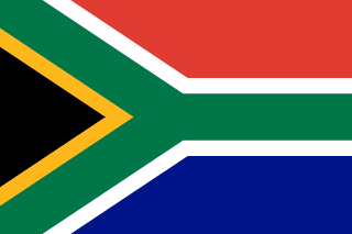
Pretoria sits in Gauteng province in South Africa's north, where the Union Buildings house the president's office. Cape Town lies far southwest on the coast and is the legislative capital, home to Parliament instead.
What is the capital of Kenya?
C1 🏳️Nairobi
Famous for nearby wildlife safari parks on the East African savanna
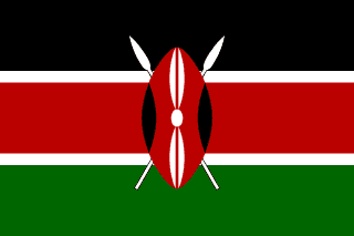
Nairobi holds the capital role for Kenya. Nairobi is one of Africa's major cities and a hub for East African commerce and tourism. Kampala is tied to Uganda; that association is why it can distract from Nairobi.
What is the capital of Ethiopia?
C1 🏳️Addis Ababa
Its name means 'New Flower' in Amharic, the official language
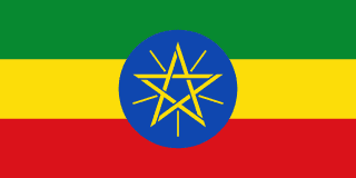
Addis Ababa sits high in Ethiopia's central highlands, at roughly 7,700 feet above sea level. Nairobi lies farther south near Kenya's Great Rift Valley and governs Kenya, a separate East African country.
What is the capital of Morocco?
C1 🏳️Rabat
Not Casablanca (largest city) or Marrakech (famous tourist city) — Rabat is on the Atlantic coast
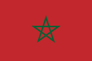
Rabat sits on Morocco's Atlantic coast at the mouth of the Bou Regreg River, serving as the capital. Casablanca lies farther south along that same coast and is Morocco's largest city, but not its seat of government.
What is the capital of Ghana?
C1 🏳️Accra
Located on the southern coast of West Africa on the Gulf of Guinea
Accra sits on the Gulf of Guinea coast in southern Ghana, serving as that nation's capital. Lagos lies farther east on Nigeria's coast and is Nigeria's largest city and former capital, not Ghana's.
What is the capital of Tanzania?
C1 🏳️Dodoma
Not Dar es Salaam, the largest city and former capital — Dodoma is in the interior
Dodoma sits near Tanzania's geographic center and has been the official capital since 1996. Dar es Salaam is Tanzania's largest city and main Indian Ocean port, but it is not the capital.
What is the capital of the Democratic Republic of the Congo?
C1 🏳️Kinshasa
Located across the Congo River from Brazzaville, the capital of the Republic of Congo
Kinshasa is the capital and largest city of the Democratic Republic of the Congo, sitting on the bank of the Congo River. Brazzaville is the capital of the separate, neighboring Republic of Congo, located just across the river.
What is the capital of Sudan?
C1 🏳️Khartoum
Located where the Blue and White Nile rivers meet in northeastern Africa
Sudan uses Khartoum as its capital. Sudan is bordered by Egypt, Eritrea, Ethiopia, South Sudan, the Central African Republic, Chad, Libya, and the Red Sea. Cairo is tied to Egypt; that association is why it can distract from Khartoum.
What is the capital of Algeria?
C1 🏳️Algiers
Algeria is the largest country in Africa by area — its capital sits on the Mediterranean coast
Algiers is Algeria's capital and largest city, sitting on the Mediterranean coast of North Africa. Tunis is not in Algeria; it is the capital of neighboring Tunisia, farther east along the same coast.
Which city is the capital of the North African country near ancient Carthage?
C1 🏳️Tunis
Ancient Carthage (the great rival of Rome) was located just outside this city
Tunis is the capital of Tunisia, a small country in North Africa on the Mediterranean coast. Algiers would answer a neighboring pairing for Algeria, not the one anchored by Tunis.
What is the capital of Libya?
C1 🏳️Tripoli
Located on the coast of the Mediterranean Sea in North Africa
Tripoli is Libya's capital and largest city, located on the Mediterranean coast in the northwest of the country. Tunis is not in Libya; it is Tunisia's capital, sitting further west along North Africa's coast.
What is the capital of Senegal?
C1 🏳️Dakar
Located on the Cap-Vert Peninsula — the westernmost point of mainland Africa
Senegal is matched with Dakar in the capital column. Senegal is in West Africa, bordered by Mauritania, Mali, Guinea, and Guinea-Bissau. Choosing Accra swaps in Ghana's geography; the requested pairing stays with Dakar.
What is the capital of Cameroon?
C1 🏳️Yaoundé
Not Douala (largest city) — the capital sits on a central plateau, not on the coast
Yaoundé is Cameroon's capital, set among hills in the country's central region. Douala is Cameroon's largest city and its main seaport, but it is not the capital.
What is the capital of Uganda?
C1 🏳️Kampala
Located on the northern shore of Lake Victoria, the source of the White Nile
Kampala is Uganda's capital. Uganda is a landlocked country in East Africa, bordered by South Sudan, the DRC, Rwanda, Tanzania, and Kenya. Nairobi is tied to Kenya; that association is why it can distract from Kampala.
What is the capital of Zimbabwe?
C1 🏳️Harare
Located in the northeast of Zimbabwe; formerly called Salisbury during British colonial rule
Harare is Zimbabwe's capital and largest city, and was renamed from Salisbury when the country gained independence in 1980. Bulawayo is Zimbabwe's second-largest city, historically an industrial hub, but it has never been the national capital.
What is the capital of Mozambique?
C1 🏳️Maputo
A port city on the southern coast, formerly called Lourenço Marques under Portuguese rule
Mozambique uses Maputo for its seat of government. Formerly called Lourenço Marques under Portuguese colonial rule, it sits near the borders of South Africa and Eswatini. Harare would answer a neighboring pairing for Zimbabwe, not the one anchored by Maputo.
What is the capital of Madagascar?
C1 🏳️Antananarivo
Located in the central highlands of the world's fourth-largest island, off Africa's east coast
Antananarivo is Madagascar's capital, located in the island's central highlands. Maputo is not on Madagascar; it is the capital of Mozambique, on the African mainland's coast.
What is the capital of Rwanda?
C1 🏳️Kigali
Rwanda is a tiny landlocked country known as the 'Land of a Thousand Hills' — its capital is named Kigali
Kigali holds the capital role for Rwanda. Despite a devastating genocide in 1994, Rwanda has rebuilt into one of Africa's most stable and organized nations. Choosing Kampala swaps in Uganda's geography; the requested pairing stays with Kigali.
What is the political capital of Ivory Coast (Côte d'Ivoire)?
C1 🏳️Yamoussoukro
Not Abidjan (largest city) — the official capital is inland and home to the Basilica of Our Lady of Peace
Yamoussoukro is the political capital of Côte d'Ivoire (Ivory Coast), located in the center of the country. Abidjan may sound nearby, but the geography described here is Yamoussoukro.
What is the capital of Angola?
C1 🏳️Luanda
A port city on the Atlantic coast of southwestern Africa, bordering the DRC to the north
Angola is paired with Luanda. Angola is bordered by the Democratic Republic of Congo and the Republic of Congo to the north, Zambia to the east, and Namibia to the south. Kinshasa is the DRC's capital, not Angola's.
What is the capital of Namibia?
C1 🏳️Windhoek
Located in the central highlands; Namibia contains both the Namib Desert (Atlantic coast) and the Kalahari
Windhoek names the capital city connected to Namibia. Namibia is bordered by Angola, Zambia, Botswana, South Africa, and the Atlantic Ocean. The Luanda option carries another place-label, so it cannot replace Windhoek here.
What is the longest river in Africa?
C1 🌊Nile River
Ancient Egyptian civilization depended on its annual floods to fertilize farmland
The Nile flows north through northeastern Africa for roughly 4,000 miles before reaching the Mediterranean Sea in Egypt. The Congo River is Africa's second-longest river, cutting through the Congo Basin in central Africa to the Atlantic Ocean.
What sea lies between Africa and the Arabian Peninsula?
C1 🌊Red Sea
Moses parted this sea in the book of Exodus when leading Israel out of Egypt
The Red Sea is a narrow sea separating northeastern Africa from the Arabian Peninsula, linking to the Indian Ocean. The Black Sea lies far to the north, bordered by Turkey, Ukraine, and other European and Asian countries.
What is the tallest mountain in Africa?
C1 ⛰️Mount Kilimanjaro
Located in Tanzania near the equator, yet it has a permanently snow-capped peak
Mount Kilimanjaro rises 19,341 feet in Tanzania, making it Africa's tallest peak. Mount Kenya is Africa's second-tallest peak, standing in Kenya to the north, not Tanzania.
What large desert covers parts of Botswana, Namibia, and South Africa?
C1 ⛰️Kalahari Desert
Home to the San Bushmen (Khoisan) people in southern Africa
The Kalahari Desert spans much of Botswana and reaches into Namibia and South Africa as a semi-arid inland basin. The Namib Desert instead hugs Namibia's Atlantic coastline, a narrower coastal desert distinct from the inland Kalahari.
What world region lies south of the Sahara Desert across Africa?
C1 🌍The Sahel
It is a semi-arid belt between desert and savanna
The Sahel is a semi-arid belt stretching across Africa just south of the Sahara Desert. The Amazon Basin is a rainforest region in South America, drained by the Amazon River.
Which world region includes Ethiopia, Somalia, Eritrea, and Djibouti?
C1 🌍The Horn of Africa
It juts into the Arabian Sea and Gulf of Aden
The Horn of Africa is the peninsula jutting into the Indian Ocean, home to Ethiopia, Somalia, Eritrea, and Djibouti. The Maghreb refers to Morocco, Algeria, and Tunisia in northwest Africa instead.
Which world region includes Morocco, Algeria, and Tunisia?
C1 🌍The Maghreb
It is the northwest region of Africa along the Mediterranean and Atlantic
The Maghreb is the region of northwest Africa that includes Morocco, Algeria, and Tunisia, along the Mediterranean coast west of Egypt. The Levant refers to the eastern Mediterranean lands such as Lebanon, Syria, and Jordan, far to the east.
The Nile River flows northward through eastern Africa and empties into what sea?
C1 🌊Mediterranean Sea
The Nile delta fans out in northern Egypt — the river empties into the Mediterranean, not the Red Sea
The Nile River flows northward through northeastern Africa, passing through Sudan and Egypt before emptying into the Mediterranean Sea through a large delta. Red Sea may sound nearby, but the geography described here is Mediterranean Sea.
The Atlas Mountains stretch across which part of Africa?
C1 ⛰️Northwest Africa (Morocco, Algeria, Tunisia)
Named after the Greek titan Atlas — these mountains separate the Mediterranean coast from the Sahara
The Atlas Mountains stretch across Morocco, Algeria, and Tunisia in the northwestern corner of Africa, near the Mediterranean coast. Kenya and Tanzania lie in East Africa instead, home to Mount Kilimanjaro rather than the Atlas range.
Nigeria's most populous city is Lagos, but what inland city has been the capital since 1991?
C1 🏳️Abuja
It was chosen as capital because of its central location in the country
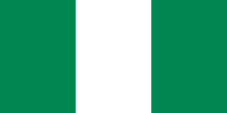
Abuja became Nigeria's capital in 1991, a centrally located city chosen to sit at the country's geographic and ethnic crossroads. Lagos remains Nigeria's largest city and a coastal port on the Gulf of Guinea, not the political capital today.
South Africa is unique in having three capital cities. Pretoria is the executive capital, Cape Town is the legislative capital. What is the judicial capital?
C1 🏳️Bloemfontein
The Supreme Court of Appeal sits in this city in the Free State province
South Africa has three capitals: Pretoria is the executive capital (President and ministries); Cape Town the legislative capital (Parliament); Bloemfontein the judicial capital (Supreme Court of Appeal). Johannesburg is not one of the three; the answer here is Bloemfontein.
What is the longest river in the world, flowing north through Africa to the Mediterranean?
C1 🌊Nile River
Ancient Egyptian civilization was built on its banks — it flows north through Sudan and Egypt
The Nile flows north about 4,130 miles from East Africa's highlands to the Mediterranean Sea, making it the world's longest river. The Amazon carries far more water and flows eastward across South America to the Atlantic, not the Mediterranean.
What is the deepest river in the world, flowing through central Africa to the Atlantic?
C1 🌊Congo River
It forms the border of the Democratic Republic of Congo and the Republic of Congo in central Africa
The Congo River plunges to depths over 700 feet in places as it crosses central Africa to empty into the Atlantic Ocean. The Nile is Africa's longest river, but flows north into the Mediterranean, not the Atlantic.
What mountain range crosses Morocco, Algeria, and Tunisia in northwestern Africa?
C1 ⛰️Atlas Mountains
Named after the Greek titan who held up the sky; the Sahara Desert lies to their south
The Atlas Mountains stretch roughly 1,600 miles across Morocco, Algeria, and Tunisia in Africa's northwest corner. The Drakensberg range instead runs along South Africa and Lesotho, thousands of miles to the south.
What is the largest hot desert in the world, covering most of northern Africa?
C1 ⛰️Sahara Desert
Its name comes from the Arabic word for 'desert'; it spans about 3.5 million square miles across northern Africa
The Sahara stretches across northern Africa from the Atlantic Ocean to the Red Sea, covering roughly 3.6 million square miles. The Arabian Desert is a separate hot desert covering the Arabian Peninsula, far to the east in the Middle East.
What waterfall on the Zambezi River, on the border of Zambia and Zimbabwe, is one of the largest in the world?
C1 ⛰️Victoria Falls
Named by Scottish explorer David Livingstone after Queen Victoria — it is the world's largest waterfall by width
Victoria Falls plunges over a mile-wide curtain of the Zambezi River on the border between Zambia and Zimbabwe. Blue Nile Falls sits on the Blue Nile River in Ethiopia, far to the north and unrelated to the Zambezi.
A city is built along the Nile River. Which world region is most closely connected with this clue?
C1 ⛰️Africa
The Nile flows north through northeastern Africa
The Nile flows north through northeastern Africa, past cities like Cairo and Khartoum, tying Africa to Nile clues. Europe lies north of the Mediterranean and is drained by rivers such as the Rhine and Danube, not the Nile.
A country in northeast Africa contains the Nile Delta and has Cairo as its capital. Which country is it?
C2 🏳️Egypt
Cairo and the Nile Delta point to Egypt
Egypt is in northeast Africa. The Nile Delta and Cairo are important geographic clues.
Ethiopia's construction of a massive dam on the Blue Nile has caused tension with Egypt, far downstream. What is the core geographic source of this transboundary water dispute?
C2 🌊A dam upstream can control the flow that downstream nations depend on for water.
Think about who controls the tap when a river crosses more than one country.
An upstream dam can control water and silt that downstream Egypt depends on. The dispute is flow control, not ownership of a source lake.
If you are visiting Cairo, which country are you in?
C1 🏳️Egypt
Cairo is the capital city
Cairo is the capital of Egypt, so a traveler in Cairo is in Egypt.
A map clue says the capital is Nairobi and the country borders Tanzania and Uganda. Which African country is it?
C1 🏳️Kenya
Nairobi is the capital city
Nairobi is the capital of Kenya, an East African country that borders Tanzania and Uganda.
The Nile River splits into many branches and drops sediment before entering the Mediterranean Sea. What landform is this?
C1 ⛰️Delta
Look for river branches and deposited sediment at the mouth
A delta forms where a river slows near its mouth, splits into channels, and deposits sediment, as the Nile does before reaching the Mediterranean.
A river flows north through Egypt before reaching the Mediterranean Sea. Which major river is it?
C1 🌊Nile River
It is the famous river of Egypt
The Nile River flows north through Egypt and reaches the Mediterranean Sea, supporting settlement along its valley and delta.
What river in southern Africa creates Victoria Falls and empties into the Indian Ocean?
C1 🌊Zambezi River
Victoria Falls — one of the world's largest waterfalls — is on this river on the Zambia-Zimbabwe border
The Zambezi flows east through Zambia and Zimbabwe, plunging over Victoria Falls before reaching the Indian Ocean in Mozambique. The Limpopo River forms part of South Africa's northern border and empties separately into the Indian Ocean near Mozambique's coast.
What major West African river flows through Guinea, Mali, Niger, and Nigeria before reaching the Atlantic?
C1 🌊Niger River
The country Nigeria is named after this river — it forms an unusual arc through western Africa
The Niger River arcs from Guinea through Mali and Niger into Nigeria, emptying into the Gulf of Guinea. The Nile flows through East Africa instead, running north through Sudan and Egypt to the Mediterranean Sea.
What is the tallest peak in Africa, a dormant volcano in Tanzania that has snow year-round despite being near the equator?
C1 ⛰️Mount Kilimanjaro
A freestanding volcano in Tanzania — its summit glaciers are disappearing due to climate change
Mount Kilimanjaro rises 19,341 feet in northeastern Tanzania near the Kenyan border, Africa's tallest peak with snow despite lying near the equator. Mount Kenya, Africa's second-highest peak, stands to the north inside Kenya itself.
What is the largest lake in Africa and the source of the White Nile, shared by Uganda, Tanzania, and Kenya?
C1 🌊Lake Victoria
The largest tropical lake in the world — the White Nile flows out of its northern shore
Lake Victoria borders Uganda, Tanzania, and Kenya, and its outflow at Jinja forms the source of the White Nile. Lake Tanganyika instead lies along the Rift Valley border of Tanzania and Congo, feeding the Congo River, not the Nile.
Along with the Euphrates, what river formed ancient Mesopotamia?
C2 🌊Tigris River
Mesopotamia means 'land between the rivers' — the Tigris and Euphrates formed this ancient region
The Tigris rises in eastern Turkey and flows through Iraq, joining the Euphrates near the Persian Gulf to form Mesopotamia. The Nile flows through Egypt and Sudan, far from Mesopotamia, and never meets the Euphrates.
Along with the Tigris, what river formed ancient Mesopotamia?
C2 🌊Euphrates River
The longest river in western Asia, flowing through Turkey, Syria, and Iraq
The Euphrates rises in Turkey and flows through Syria and Iraq, forming Mesopotamia together with the Tigris. The Nile flows through Egypt in northeastern Africa, far from the Tigris-Euphrates river system of the Middle East.
What body of water lies between Iran and the Arabian Peninsula?
C2 🌊Persian Gulf
An important waterway for oil transportation from the Arabian Peninsula
The Persian Gulf sits between Iran to the north and the Arabian Peninsula to the south, opening into the Gulf of Oman. The Red Sea instead separates northeastern Africa from the Arabian Peninsula, nowhere near Iran's coastline.
Which world region includes Israel, Jordan, Lebanon, and Syria?
C2 🌍The Levant
It is the eastern Mediterranean region
The Levant is the eastern Mediterranean coastal region encompassing Israel, Lebanon, Jordan, and Syria. The Sahel lies far south in Africa, the semi-arid belt below the Sahara Desert.
The Euphrates River flows through Turkey, Syria, and Iraq on which continent?
C2 🌊Asia
The Middle East is part of the western portion of Asia — Turkey, Syria, and Iraq are all in Asia
The Euphrates rises in eastern Turkey and flows through Syria and Iraq toward the Persian Gulf, all within Asia. Europe includes a small part of Turkey west of the Bosporus, but the Euphrates rises well east of there, in Asia.
The Tigris and Euphrates rivers formed the 'Cradle of Civilization.' What is the ancient name for this region?
C2 🌊Mesopotamia
'Mesopotamia' is Greek for 'land between the rivers' — referring to the Tigris and Euphrates
The land between the Tigris and Euphrates in modern Iraq was called Mesopotamia, Greek for 'land between rivers.' Babylon was actually just one city within that region, not the name for the whole area.
The Jordan River flows between Israel and Jordan and empties into what famously salty body of water?
C2 🌊Dead Sea
The Dead Sea is the lowest point on Earth's land surface — about 1,400 feet below sea level
The Jordan River flows south from the Sea of Galilee through the Jordan Valley and empties into the Dead Sea. The Red Sea lies far to the south along the Arabian Peninsula, well outside the Jordan's path.
What sea separates the Arabian Peninsula from northeast Africa and connects to the Suez Canal?
C2 🌊Red Sea
Moses is said to have parted this body of water in the Book of Exodus when fleeing Egypt
The long, narrow Red Sea stretches about 1,400 miles between the Arabian Peninsula (Saudi Arabia, Yemen) to the east and northeast Africa (Egypt, Sudan, Eritrea, Djibouti) to the west. The Arabian Sea is a different sea entirely.
What body of water on the Israel-Jordan border is the lowest point on Earth's surface?
C2 🌊Dead Sea
Its salt concentration is so high that people float effortlessly — it sits 1,412 feet below sea level
The Dead Sea is the lowest point on Earth's land surface, sitting roughly 1,400 feet below sea level on the Israel-Jordan border. The Sea of Galilee, farther north in Israel, sits several hundred feet higher, though still below sea level.
What body of water between the Arabian Peninsula and Iran contains some of the world's largest oil reserves?
C2 🌊Persian Gulf
Bordered by Saudi Arabia, Kuwait, Iraq, Iran, UAE, Qatar, and Bahrain — crucial to global oil shipping
The Persian Gulf lies between Iran and Arabia and holds roughly half the world's proven oil reserves. The Gulf of Oman links the Persian Gulf to the Arabian Sea via the Strait of Hormuz, a separate, smaller sea.
What desert covers most of the Arabian Peninsula and is the largest hot desert in Asia?
C2 ⛰️Arabian Desert
Covers Saudi Arabia, Yemen, Oman, UAE, and other Gulf states — home to the Rub al Khali (Empty Quarter)
The Arabian Desert spans nearly all of the Arabian Peninsula, making it the largest desert in Asia. The Sahara Desert is larger still, but it stretches across North Africa, not Asia.
How many continents are there?
C1 🌍7
The seven are Africa, Antarctica, Asia, Australia, Europe, North America, South America
There are 7 continents: Africa, Antarctica, Asia, Australia (Oceania), Europe, North America, and South America. 5 may sound nearby, but the geography described here is 7.
What is the largest continent by area?
C1 🌍Asia
It contains China, India, Russia, and more — roughly 60% of the world's population
Asia is the largest continent, stretching from the Ural Mountains to the Pacific and covering nearly a third of Earth's land. Africa is the second-largest, stretching from the Mediterranean coast in the north to Cape Agulhas at its southern tip.
What is the smallest continent by area?
C1 🌍Australia
It is both a continent and a country — uniquely, one nation covers an entire continent
Australia is the smallest continent, an island continent between the Indian and Pacific Oceans covering under 3 million square miles. Europe is much larger, stretching across the northern landmass from the Atlantic to the Ural Mountains.
What is the second-largest continent by area?
C1 🌍Africa
Home to the Sahara Desert, the Nile River, and 54 countries
Africa is the second-largest continent, home to the Sahara Desert and the Nile River running through its northeast. Asia is larger still, ranking first and covering nearly a third of the world's land area.
What imaginary line divides the Earth into Northern and Southern hemispheres?
C1 🌍Equator
It is at 0 degrees latitude — the imaginary line halfway between the North and South Poles
The Equator circles Earth at zero degrees latitude, splitting the planet into the Northern and Southern Hemispheres. The Prime Meridian runs at zero degrees longitude through Greenwich, England, dividing Earth into the Eastern and Western Hemispheres instead.
What imaginary line at 0 degrees longitude divides the Earth into Eastern and Western hemispheres?
C1 🌍Prime Meridian
It passes through Greenwich, England — all longitude is measured east or west of this line
The Prime Meridian sits at 0 degrees longitude, passing through Greenwich, England, and splits Earth into Eastern and Western Hemispheres. The Equator instead marks 0 degrees latitude, dividing the planet into Northern and Southern Hemispheres.
How many oceans are there?
C1 🌍5
Pacific, Atlantic, Indian, Arctic, and Southern — the Southern Ocean was recognized by National Geographic in 2021
Geographers now recognize five oceans: the Pacific, Atlantic, Indian, Arctic, and the Southern Ocean surrounding Antarctica, widely recognized as the fifth ocean in 2021. Older maps counted only four, leaving out the Southern Ocean as a distinct body.
What is the largest ocean on Earth?
C1 🌍Pacific Ocean
It covers more area than all land on Earth combined
The Pacific Ocean is the largest and deepest ocean, stretching from the Americas to Asia and Australia and holding the Mariana Trench. The Atlantic Ocean is smaller, separating the Americas from Europe and Africa.
What is the largest and deepest ocean, covering more than a third of Earth's surface?
C1 🌊Pacific Ocean
Its name means 'peaceful sea'; Magellan named it after the calm weather he encountered in 1520
The Pacific Ocean covers about 63 million square miles, more than all Earth's land combined, making it the largest and deepest ocean. The Atlantic Ocean is second-largest, covering roughly 41 million square miles, well short of the Pacific's span.
What ocean lies between the Americas to the west and Europe and Africa to the east?
C1 🌊Atlantic Ocean
Named after the Greek titan Atlas; Columbus crossed it in 1492 sailing from Spain to the Caribbean
The Atlantic Ocean separates the Americas on the west from Europe and Africa on the east, covering about 41 million square miles. The Pacific Ocean instead lies beyond the Americas, bordering Asia and Australia, not Europe or Africa.
What ocean is bounded by Africa, Asia, and Australia, and is warmest of the major oceans?
C1 🌊Indian Ocean
Named after the country of India, which juts southward into its waters
The Indian Ocean is bounded by Africa, Asia, and Australia, and it is the warmest of the major oceans. The Pacific Ocean instead stretches between Asia and the Americas, without an African coastline.
What ocean surrounds Antarctica and is the fourth-largest ocean?
C1 🌊Southern Ocean
Also called the Antarctic Ocean; recognized by National Geographic in 2021 (IHO proposal, 2000)
The Southern Ocean surrounds Antarctica, formed where the Pacific, Atlantic, and Indian Oceans meet cold polar waters near 60 degrees south. The Arctic Ocean surrounds the North Pole, not Antarctica, and ranks as the smallest ocean rather than the fourth-largest.
What is the smallest and shallowest of Earth's five oceans, largely covered by sea ice?
C1 🌊Arctic Ocean
It surrounds the North Pole and borders Russia, Canada, Greenland, Norway, and Alaska
The Arctic Ocean, covering about 5.4 million square miles around the North Pole, is Earth's smallest, shallowest ocean, largely capped by sea ice. The Southern Ocean instead encircles Antarctica at the opposite pole, and it is larger than the Arctic.
A narrow body of water connects two larger bodies of water. What is this feature called?
C1 🌊Strait
The Strait of Gibraltar is a famous example
A strait is a narrow water channel joining two larger seas, such as the Strait of Gibraltar linking the Atlantic and Mediterranean. A peninsula is land surrounded by water on three sides, like Florida, not a water passage at all.
Most maps put north at the top, but how can you tell which way a particular map is actually oriented?
C1 🌍Check the compass rose or north arrow
A map shows its orientation with a symbol, not just by which edge is on top
Most maps are drawn with north at the top, but not all are — always check the map's compass rose or north arrow to find its true orientation instead of assuming the top edge is north.
If north is at the top of a map, which direction is to the right?
C1 🌍East
Remember: Never Eat Soggy Waffles
When north is up, east is to the right and west is to the left.
Which intermediate direction lies halfway between south and west?
C1 🌍Southwest
Combine south and west
Southwest is the direction halfway between south and west.
A river flows from its source toward its mouth. What map skill helps describe that path?
C1 🌊Direction
You can say the river flows north, south, east, or west
Direction helps describe the path a river takes from its source to its mouth.
What map feature shows north, south, east, and west?
C1 🌍Compass rose
It is shaped like a directional marker
A compass rose shows the cardinal and sometimes intermediate directions on a map.
If a route moves north, then east, what final intermediate direction describes the overall movement?
C2 🌍Northeast
Combine the two directions
Moving north and east gives an overall northeast direction.
If a place has a larger latitude number above the equator, it is generally farther which direction?
C2 🌍North
North latitude increases as you move away from the equator
Larger north latitude numbers usually mean a place is farther north of the equator.
What part of a map explains what symbols and colors mean?
C1 🌍Legend
It unlocks the meaning of the symbols
A map legend explains the symbols, colors, and patterns used on a map.
On many maps, what does a star symbol usually mark?
C2 🏳️A capital city
Look for stars near city names
A star often marks a national or state capital, though the legend always gives the final answer.
A blue winding line on a physical map usually represents what?
C1 🌊A river
Blue usually marks water
A blue winding line usually represents a river or stream. Always confirm with the legend.
What does a dashed line often show on a political map?
C3 🌍A boundary
Political maps show borders
Dashed lines often show boundaries or disputed borders, but the legend explains the exact meaning.
Which map feature helps estimate real-world distance?
C2 🌍Scale bar
It compares map length with real distance
A scale bar shows how distance on the map relates to real-world distance.
On a topographic map, closely spaced contour lines usually mean what?
C2 ⛰️Steep land
Lines close together mean elevation changes quickly
Closely spaced contour lines show steep land because elevation changes quickly over a short distance.
If a map symbol is unfamiliar, what should you check first?
C1 🌍The legend
The map explains its own symbols
The legend should be checked first because map symbols are not identical on every map.
A map colors one area green and another tan. What tells you what those colors mean?
C2 🌍The legend
Colors are part of the map key
The legend explains color meanings, such as elevation, climate, vegetation, or political regions.
Which climate zone is usually warm all year and often near the equator?
C1 ⛰️Tropical
Think rainforests and equatorial regions
Tropical climates are generally warm all year and are often found near the equator.
Which climate zone is coldest and found near the poles?
C1 ⛰️Polar
The North and South Poles are the clue
Polar climates are very cold and are found near the Arctic and Antarctic regions.
A region receives very little rainfall. Which climate description fits best?
C2 ⛰️Arid climate
Deserts are arid
Arid climates are very dry. Deserts are the clearest example of arid climate regions.
Which climate zone has moderate temperatures rather than extreme heat or cold?
C2 ⛰️Temperate
Temperate means moderate
Temperate climates have moderate seasonal temperatures compared with tropical heat or polar cold.
Why can high mountains be cooler than nearby lowlands?
C2 ⛰️Temperature generally drops with elevation.
Think elevation
Highland climates are shaped by elevation; higher places are usually cooler than nearby lowlands.
A dry region lies on the far side of a mountain range from moist winds. What effect may explain it?
C3 ⛰️Rain shadow
Mountains can block moist air
A rain shadow forms when mountains block moist air, leaving the far side drier.
Which natural resource comes mainly from forests?
C1 ⛰️Timber
It is harvested from trees
Timber is wood from trees, so forested regions can be important timber sources.
Which resource is especially important for farming crops?
C1 ⛰️Fertile soil
Plants need it to grow well
Fertile soil is a natural resource because it supports farming and food production.
Which natural resource do rivers and lakes often provide?
C1 🌊Freshwater
People need it for drinking and irrigation
Rivers and lakes often provide freshwater for homes, farms, and cities.
Which natural resource is crude oil refined from?
C2 ⛰️Petroleum
It is pumped from underground reservoirs
Petroleum is crude oil, an energy resource refined into fuels and other products.
Which natural resource is mined to make steel?
C2 ⛰️Iron ore
Steel begins with iron
Iron ore is mined from the earth and processed to make iron and steel.
Coastal communities may depend on which ocean resource for food and trade?
C2 🌊Fisheries
Think fish and seafood
Fisheries are ocean or freshwater resources that provide fish and other seafood.
Which renewable resource can open plains and coasts provide for energy?
C3 ⛰️Wind
Wind turbines use it
Wind is a renewable energy resource, especially useful in open windy regions and along some coasts.
Why do resource maps matter when studying where people settle?
C3 ⛰️Resources help explain jobs, trade, and settlement patterns.
People often settle where useful resources can support life and work
Resource maps help explain why people farm, mine, trade, build ports, or settle in certain regions.
A dry desert sits beyond tall highlands from moist winds. Which landform is shaping the climate?
C2 ⛰️Mountain range
Mountains can block wet air
Mountain ranges can create rain shadows by blocking moist air from reaching the far side.
A ship sails from California toward Japan. Which ocean does it cross?
C1 🌍Pacific Ocean
California and Japan both face the Pacific
The Pacific Ocean lies between western North America and eastern Asia, so a California-to-Japan route crosses the Pacific.
A region is hot, receives heavy rainfall, and has dense evergreen trees. Which feature fits best?
C2 ⛰️Tropical rainforest
Heavy rain and dense trees point to rainforest
Tropical rainforests are warm, wet, and densely forested. Deserts receive much less rainfall.
Why can no flat map show the whole Earth without some error?
C2 🌍A round surface cannot flatten without distortion.
Earth is a sphere; paper is flat.
Earth is nearly a sphere, so any flat map must stretch, tear, or squash some areas. Every projection trades one kind of accuracy for another.
On a Mercator map, why does Greenland look nearly as large as Africa?
C2 🌍Mercator inflates land areas near the poles.
Distortion grows toward the top and bottom.
The Mercator projection stretches the map more and more toward the poles, so polar lands like Greenland look far larger than they are. Africa is actually about 14 times bigger.
Which kind of projection keeps the true size of land areas?
C2 🌍An equal-area projection.
Its name describes what it preserves.
An equal-area projection preserves the relative sizes of regions, which helps when comparing how much land each country has. It distorts shapes in exchange.
A conformal projection like Mercator keeps shapes and angles correct. What does it sacrifice?
C2 🌍The true size of areas.
You cannot keep both shape and size.
Conformal projections keep local shapes and angles correct, which let sailors steer steady compass courses. The cost is area: regions far from the Equator look much too big.
A pilot wants the shortest path between two far cities. Which projection draws great-circle routes as straight lines?
C2 🌍A gnomonic projection.
Navigators use it to plot the shortest course.
On a gnomonic projection, any straight line is a great circle — the shortest route across a sphere. Navigators plan long-distance paths on it, then transfer them to other maps.
Why might an atlas use a Robinson projection for a world map?
C2 🌍It balances size and shape distortion.
Compromise maps trade perfection for balance.
The Robinson projection is a compromise projection. It does not keep area or shape perfectly, but it makes the whole world look balanced enough for many atlas maps.
Why did sailors value Mercator maps for ocean navigation?
C2 🌍Compass courses plot as straight lines.
Think of following one compass bearing.
A Mercator map lets a steady compass course, or rhumb line, appear as a straight line. That made it useful for navigation even though it exaggerates areas near the poles.
Which projection family is often chosen for maps centered on the North or South Pole?
C2 🌍Azimuthal.
It projects the globe onto a flat plane from one point.
Azimuthal projections are often useful for polar maps because the map is centered on one point, such as the North Pole or South Pole, and directions from that center stay meaningful.
A conic projection is a strong choice for mapping which kind of region?
C2 🌍A mid-latitude region that stretches east to west.
Picture a paper cone resting on the globe like a hat — where does it touch?
A conic projection wraps a cone over the globe, touching along a mid-latitude line where distortion is smallest. That makes it a favorite for east-west countries like the United States; polar maps suit azimuthal projections instead.
An interrupted projection such as the Goode homolosine cuts gaps into the oceans. What does this gain?
C2 🌍Truer sizes and shapes for the continents.
The cuts let the land areas lie flatter, like peeling an orange.
An interrupted projection slices the map where few people look — the oceans — so the continents can lie flatter with less stretching. The trade-off is that ocean distances become hard to read across the gaps.
Lines of latitude measure how far north or south you are from which line?
C2 🌍The Equator.
It circles the Earth's middle.
Latitude lines run east-west and measure distance north or south of the Equator, which is 0° latitude. The poles sit at 90° north and south.
Longitude measures distance east or west of which starting line?
C2 🌍The Prime Meridian.
It runs through Greenwich, England.
Longitude lines, called meridians, run north-south and measure distance east or west of the Prime Meridian, set at 0° through Greenwich, England.
About how far apart on the ground is one degree of latitude?
C2 🌍About 69 miles.
A little under seventy miles.
One degree of latitude equals roughly 69 miles (111 km) almost everywhere, because latitude lines are evenly spaced from the Equator to the poles.
Why does one degree of longitude cover less ground near the poles than at the Equator?
C2 🌍Meridians draw closer together toward the poles.
The north-south lines all meet at each pole.
All meridians meet at the poles, so the east-west gap between them shrinks from about 69 miles at the Equator to zero at the poles. Latitude spacing stays even.
Which city lies closest to the coordinates 40°N, 74°W?
C2 🌍New York City.
West longitude, mid-latitude, on a coast.
The point 40°N, 74°W sits on the northeastern U.S. coast, where New York City lies. West longitude places it in the Americas, and 40°N is the mid-latitudes.
The International Date Line roughly follows which line of longitude?
C2 🌍The 180° meridian.
It is halfway around from Greenwich.
The International Date Line runs near 180° longitude, opposite the Prime Meridian. Crossing it changes the calendar day, and it bends to keep island groups on one date.
In the coordinate pair 34°N, 118°W, which part tells position north or south of the Equator?
C2 🌍The first coordinate.
Latitude usually comes first.
Map coordinates usually list latitude first and longitude second. In 34°N, 118°W, the 34°N value tells how far north of the Equator the place is.
What is true of lines of latitude on a globe?
C2 🌍They run parallel to the Equator.
Latitude circles stay east-west.
Lines of latitude run east-west around the globe and stay parallel to the Equator. Lines of longitude run north-south and meet at the poles.
Which biome is known for grasses, few trees, and grazing herds?
C2 ⛰️Grassland.
Prairies and steppes belong here.
Grassland biomes are dominated by grasses with few trees, shaped by moderate rainfall and grazing animals. Prairies and steppes are temperate grasslands.
The tropical rainforest biome is best known for...
C2 ⛰️Heavy rain and a rich variety of life.
Warm, wet, and full of species.
Tropical rainforests near the Equator get heavy year-round rain and hold more plant and animal species than any other land biome.
Which biome covers the cold far north with low plants and no trees?
C2 ⛰️Tundra.
Frozen ground stops trees from growing.
The tundra is a cold, treeless biome where frozen subsoil (permafrost) limits plants to mosses, lichens, and low shrubs. It rings the Arctic and tops high mountains.
The taiga, or boreal forest, is dominated by which kind of tree?
C2 ⛰️Cone-bearing evergreens.
Pines, spruces, and firs.
The taiga is the world's largest land biome, a cold northern forest of conifers — pines, spruces, and firs — whose needles and cones survive long, freezing winters.
Why do deserts support fewer kinds of plants than rainforests?
C2 ⛰️Very little rainfall limits plant growth.
Water is the missing ingredient.
Deserts receive under about 10 inches of rain a year, so only specialized plants like cacti survive. Rainforests get abundant water and support far more species.
Which biome is a transition between forest and desert, with scattered trees and a wet-dry season?
C2 ⛰️Savanna.
Grassland dotted with lone trees.
The savanna is a tropical grassland with scattered trees and strong wet and dry seasons. It forms a transition between rainforest and desert, as across much of central Africa.
Which biome has dense evergreen shrubs, dry summers, and mild rainy winters?
C2 ⛰️Chaparral.
It often appears in Mediterranean climate regions.
Chaparral is a shrubland biome found in Mediterranean climate regions, including parts of California. Its plants are adapted to dry summers and periodic fire.
Why are wetlands often described as natural filters?
C2 ⛰️They trap sediment and absorb some pollutants.
Slow water changes what settles out.
Wetlands slow moving water, so sediment can settle and some pollutants can be absorbed or broken down by soils, plants, and microbes. They also provide important habitat.
The west coasts of continents near 35 degrees latitude (such as central California or central Chile) tend to have hot dry summers and mild wet winters. Which mechanism best explains this Mediterranean pattern?
C1 ⛰️A subtropical high-pressure cell sits offshore and drifts poleward in summer, blocking storms, then retreats equatorward in winter to let rain return
The same belt of sinking dry air that makes the great deserts shifts north and south with the sun.
The seasonal march of this pressure cell, not a monsoon or a warm current, produces the dry-summer/wet-winter signature.
Bergen, Norway (about 60 degrees N) has mild winters, with temperatures rarely far below freezing. Nain in Labrador, Canada sits at about 60 degrees N too, on the opposite shore of the same ocean, yet it endures bitterly cold winters. What best explains the contrast at the same latitude?
C1 ⛰️A warm ocean current carries tropical-origin water poleward along the European side, warming the prevailing westerly winds that reach the coast
Think about which way the water and the wind are moving across the North Atlantic.
The North Atlantic Drift warms westerlies reaching Bergen despite its latitude. Elevation is not the cause; Labrador is colder because it faces a cold current and continental air.
Two cities lie at the same latitude: one on a coast, the other deep in a continental interior. The interior city has much hotter summers and much colder winters. Which property of land and water best accounts for this larger annual temperature range inland?
C1 ⛰️Water heats and cools slowly because of its high heat capacity, so coasts stay moderate while land warms and cools quickly
It takes a lot of energy to change the temperature of a large body of water.
Coasts moderate temperatures because water heats and cools slowly. Reflection is not the cause; inland land surfaces change temperature much faster.
Quito, Ecuador sits almost exactly on the equator yet has spring-like temperatures all year rather than steady tropical heat. Which factor most directly explains its mild climate?
C1 ⛰️Its high elevation in the Andes, where temperature falls with altitude through the environmental lapse rate
The city is over 9,000 feet up, even though it is near 0 degrees latitude.
Quito is mild because high elevation cools the air by the lapse rate. A rain shadow blocks moisture, not equatorial heat.
Many of the world's great deserts (the Sahara, Arabian, and Australian deserts) cluster near 30 degrees latitude in both hemispheres rather than along the equator. What atmospheric circulation best explains this banding?
C1 ⛰️Air that rose and rained out at the equator descends near 30 degrees, warming and drying as it sinks under the subtropical high
Trace the air in a Hadley cell: it rises wet at the equator, then has to come back down somewhere.
Descending dry air near 30 degrees creates subtropical desert belts after equatorial air has rained out. Cold currents can intensify aridity but do not explain the global band.
Moist winds blow from the ocean against a mountain range, and a desert lies on the far side. Considering how air behaves as it crosses the range, why is the windward slope wet but the leeward side dry?
C1 ⛰️Rising air cools and condenses its moisture as rain on the windward slope, then descends the leeward side warming and drying out
Think about what happens to a parcel of air's temperature as it is forced up and over, then comes back down.
Windward air cools and rains as it rises; descending leeward air warms and dries. Rock storage cannot create that rain-shadow contrast.
The Atacama in northern Chile is one of the driest places on Earth, even though it sits right along the Pacific coast where you might expect ocean moisture. Which combination of causes best explains this coastal hyper-aridity?
C1 ⛰️A cold ocean current chills the lowest air and stabilizes it, while descending subtropical high-pressure air suppresses rising motion and rainfall
Two things stack here: the temperature of the water just offshore, and the kind of air pressure that sits over 25-30 degrees latitude.
The Atacama is dry because cold current stability and sinking subtropical air suppress rain. Monsoon reversals are wrong because they would bring seasonal moisture.
Major oil and gas fields are concentrated in thick sedimentary basins rather than in mountains of solid granite. What best explains this pattern?
C1 ⛰️Buried marine organic matter in layered sediments was slowly cooked into hydrocarbons.
Petroleum is a fossil fuel — think about what once lived, got buried, and in what kind of rock.
That is why hydrocarbons collect in sedimentary basins, not in igneous rock like granite or in freshly cooled magma, which never held that organic source material.
Rich belts of copper, gold, and silver ore line the Andes and the western Americas. Why do metallic ores cluster along such convergent plate boundaries?
C1 ⛰️Mineral-rich fluids rise off the subducting plate and deposit metals in the crust above.
Convergent boundaries have subduction, magma, and hot circulating water — not just tall peaks.
Subduction releases water that drives magma and metal-rich fluids upward, depositing ores. Metals do not simply sink toward coastlines.
Two rivers carry the same volume of water, yet one has far greater hydroelectric potential. What feature most likely gives it that advantage?
C1 ⛰️A steep drop in elevation that lets the water fall through a large vertical distance.
Hydropower depends on water falling — think about what 'head' means.
Hydropower depends on flow plus head, the vertical drop through turbines. A wide flat channel has flow but little falling energy.
Floodplains such as the lower Nile and Ganges have unusually fertile soil. Where does that fertility mainly come from?
C1 ⛰️Nutrient-rich sediment carried from upstream and dropped when floods slow and spread.
Why does the soil renew itself every time the river floods?
Floodplain fertility comes from river sediment dropped during floods. Local bedrock weathering would not renew the imported silt after each flood.
Iceland and New Zealand generate large shares of their power from geothermal energy, while most flat continental interiors cannot. What gives these places their advantage?
C1 ⛰️They sit on plate boundaries where magma brings intense heat near the surface.
Geothermal heat is strongest where the crust is thin and magma is close — think tectonics, not weather.
Geothermal power is strong where plate-boundary magma keeps heat near the surface. Warm ocean water is wrong because geothermal energy comes from Earth's interior.
Some nations rich in a single high-value export, like crude oil, end up with unstable, narrowly based economies. Which factor best explains this 'resource curse'?
C1 ⛰️Wealth concentrates in one volatile commodity, crowding out other industries and steady jobs.
Think about what happens to the rest of the economy when one commodity's price swings.
It is about economic concentration and price volatility, not the resource literally running out or trade being banned.
Sunlight reaches everywhere, yet large solar farms are sited in deserts like the U.S. Southwest rather than in cloudy maritime regions. What is the strongest geographic reason?
C1 ⛰️Clear skies and a high sun angle deliver far more reliable energy per panel each year.
Renewable does not mean equally available — think about how much usable sun a place actually gets.
Solar energy is renewable, but its usable intensity varies sharply by place.
The Corn Belt of the American Midwest is classified as a formal (uniform) region, not a functional one. What feature of the Corn Belt is the basis for calling it a formal region?
C1 ⛰️It is defined by a measurable trait shared throughout the area (dominant corn agriculture)
A formal (uniform) region shares one or more common, measurable characteristics across its whole extent; a functional region is built around a hub.
The Corn Belt is formal because corn agriculture is a measurable shared trait. A central node would define a functional region instead.
A metropolitan area like greater Chicago is best classified as a functional region. Which feature of it is the defining basis for that classification?
C1 ⛰️A central hub tied to its surroundings by flows of commuters, goods, and services
Functional regions are organized around a node, with the bond being movement and interaction rather than a uniform shared trait.
Greater Chicago is functional because commuters, goods, and services flow around a hub. A single climate trait is wrong because that defines a formal region.
The Sahel is often described as a transition zone rather than a region with a sharp edge. Why does its boundary appear as a gradual band instead of a crisp line?
C1 ⛰️It is defined by a climate gradient where rainfall changes gradually from desert toward savanna
The Sahel grades from the arid Sahara to wetter savanna; its boundaries shift as the rainfall belt shifts, so it is a fuzzy band.
The Sahel's edge is gradual because rainfall changes along a climate gradient. A mountain ridge is wrong because it would make a sharper physical boundary.
'The Bible Belt' in the southern United States is cited as a textbook perceptual (vernacular) region. What makes it perceptual rather than formal?
C1 ⛰️Its extent rests on shared cultural identity, so people disagree on exactly where it begins and ends
Perceptual (vernacular) regions are based on widely shared mental images and identity; their edges are felt, not precisely measured.
A perceptual (vernacular) region is one that exists chiefly in people's shared mental maps — it has a strong identity but no agreed-upon boundary, so two people might draw 'the Bible Belt' very differently.
Latin America and Anglo-America are divided along a cultural-linguistic criterion, not a physical one. Which fact best shows that the dividing line is cultural rather than physical?
C1 ⛰️The split follows the inherited language and colonial heritage, placing Spanish-rooted Mexico apart from English-rooted Canada
Latin vs. Anglo America groups countries by dominant Romance vs. English language and colonial past, which cuts across physical features.
Latin and Anglo America are divided by inherited language and colonial history. The continental divide is wrong because it is physical drainage, not culture.
Economic blocs such as the European Union are sometimes mapped as a region. What kind of regional criterion defines membership in such a bloc?
C1 ⛰️A negotiated economic and political arrangement that states formally choose to join or leave
Supranational blocs are defined by treaty membership — an economic-political criterion — so the region can gain or lose members by decision.
Some regions are defined by economic or political criteria rather than physical or cultural ones.
The same place — say, the city of Istanbul — can be grouped into more than one world region at once. What does this overlap reveal about how regions work?
C1 ⛰️Regions are interpretive tools, so different criteria can sort one place into different regions
Regions are mental constructs built for a purpose; a place can be in Europe by one criterion and the Middle East by another.
Regions are not natural objects waiting to be discovered; they are interpretive tools geographers build to organize space for a particular question.
Biome classification systems mainly sort the world's land regions using which two factors together?
C2 ⛰️Average temperature and precipitation patterns.
Think of a graph with heat on one axis and rainfall on the other.
Biomes are classified by climate, especially temperature and precipitation. Political borders can cut across a biome but do not define it.
Why do biomes such as tundra, taiga, and temperate forest appear in roughly the same order moving away from the Equator on every continent?
C2 ⛰️Latitude controls solar energy and temperature, which limits which plants can grow.
Sun angle changes in a predictable band from the Equator to the poles.
Latitude changes solar energy, creating temperature bands that limit plants. Same migrating plants is wrong because climate, not shared species origin, orders biomes.
Climbing a tall tropical mountain, you pass through rainforest, then temperate forest, then alpine tundra near the summit. What best explains this sequence?
C2 ⛰️Rising elevation cools the air, mimicking the biome sequence found across latitude.
Temperature drops with altitude the same way it drops with latitude.
Elevation cools air, stacking rainforest, temperate forest, and alpine tundra up a mountain. Soil fertility does not reliably increase with height.
Taiga and tundra both occupy cold, high-latitude regions. What single factor most reliably distinguishes taiga from tundra?
C2 ⛰️Taiga has a long enough warm season for conifer trees to grow; tundra does not.
One of these biomes has forests; the other cannot support trees at all.
Tundra typically lies poleward of taiga, not south of it, and precipitation is not the deciding factor.
Both tropical rainforest and tropical monsoon forest are warm and species-rich, yet monsoon forest sheds many of its leaves for part of the year. What explains that difference?
C2 ⛰️Monsoon forest has a pronounced dry season, while rainforest gets heavy rain all year.
Seasonal wind reversals bring monsoon regions a distinct dry stretch each year.
Monsoon forest sheds leaves because it has a pronounced dry season. Higher elevation is not the driver; rainfall seasonality is.
Clearing forest for farmland in patches, rather than in one solid block, is especially harmful to many biome species. Why does this patchy fragmentation matter so much?
C2 ⛰️It isolates populations into small patches, cutting off migration and gene flow.
Think about what happens to animals that need to roam or interbreed across a large range.
Fragmentation isolates populations and blocks gene flow, beyond just removing acres. Total acreage alone misses the harm of splitting habitat into patches.
The Gall-Peters projection was promoted as a fairer alternative to Mercator maps. What tradeoff does it make to achieve that goal?
C2 🌍It preserves true relative land area but stretches and distorts shapes.
Its goal was to stop poorer, equatorial nations from looking smaller than they really are.
Gall-Peters preserves relative land area, correcting Mercator's size bias. It is not distortion-free; shape is stretched to keep area proportional.
Cartographers say a flat map can preserve at most one or two of area, shape, and distance, but never all three at once for the whole world. Why is this limitation unavoidable?
C2 🌍Flattening a curved surface always introduces some geometric stretching or tearing.
This is a mathematical fact about curved surfaces, not a technical limitation.
Flattening a sphere inevitably stretches or tears geometry. Printing technology is not the limit; projection math forces a tradeoff.
Two cities sit 45 degrees of longitude apart. Based on how Earth's rotation divides time zones, about how many hours apart are they?
C2 🌍About 3 hours.
Earth turns 360 degrees in 24 hours, so figure out degrees per hour first.
Earth rotates 360 degrees in 24 hours, which works out to 15 degrees of longitude per hour. About 45 hours. is wrong; About 3 hours is the 45-degree longitude time difference.
Before the 1700s, sailors could measure latitude fairly easily with the stars but struggled badly to find their longitude at sea. What invention finally solved this 'longitude problem'?
C2 🌍An accurate marine chronometer that kept the time of a home port.
Longitude is really about comparing local time to time back home.
Latitude can be read directly from the height of the sun or stars, but longitude requires comparing local time to the time at a reference point, such as the Prime Meridian.
A field notebook records a site as 8 degrees N, 80 degrees W. Which part should a student write as the latitude?
C2 🌍The latitude is 8 degrees N.
Latitude is the north-south coordinate, and it is usually written first.
Latitude measures north-south position, so 8 degrees N is the latitude. Longitude is wrong because 80 degrees W measures east-west position.
A ship reports its position as 30 degrees E. Which reference line is that eastward distance measured from?
C2 🌍The Prime Meridian.
East and west positions use longitude.
Longitude measures east or west from the Prime Meridian at 0 degrees longitude. A position such as 30 degrees E means the place lies thirty degrees east of the Prime Meridian, not east of the Equator.
After 1991 the Soviet Union split into 15 separate countries, and the region once labeled 'the USSR' on maps vanished overnight. What does this best illustrate about political regions compared to physical regions like 'the Amazon Basin'?
C3 ⛰️Political regions are defined by governments and can be redrawn or dissolved quickly, while physical regions persist because they rest on landforms
Ask what actually changed in 1991: was it a mountain range, a river system, or a set of governments and borders?
Political regions can change quickly because governments redraw borders and treaties. Equal pace is wrong because landform regions persist beyond map revisions.
A geographer can describe the same city as being in 'the Midwest,' 'the Great Lakes region,' and 'North America' all at once, with each region nested inside the next. What does this nesting show about regional scale?
C3 ⛰️Regions can be defined at different scales simultaneously, so smaller regions nest inside larger ones without contradiction
Think of regions like nested boxes: a city can sit inside a small region, which sits inside a larger one, which sits inside a continent.
A city can belong to nested regions because scale changes the question. One-scale-only is wrong because regions are tools, not exclusive labels.
Geographers commonly draw the line between Europe and Asia along the Ural Mountains, but some atlases instead place Turkey and the Caucasus states in 'Europe' for cultural or political purposes even though they sit east of that line. Why does this boundary shift depending on the source?
C3 ⛰️The Europe-Asia line is a human convention, not a natural break, so different criteria (physical vs. cultural-political) place it in different spots
Continents are not divided by a single physical fact everywhere; consider what changes when a cultural or political criterion is used instead of a physical one.
The Europe-Asia boundary is partly conventional because Europe and Asia share one continuous landmass. Atlases may emphasize physical criteria such as the Urals or cultural-political criteria such as institutions and historical identity, so the boundary can shift by source.
The Himalayas are still rising a few millimeters each year, decades after India first collided with Asia. Which process best explains why a mountain range keeps growing long after the initial collision?
C3 ⛰️Continued convergent-boundary compression keeps crumpling and thickening the crust, and slow erosion has not yet worn the range back down
India and Asia are still pushing into each other; think about what continued compression does to crust that is already thickened.
The Himalayas keep rising because the Indian Plate is still pushing into the Eurasian Plate. Continued compression folds and thickens the crust faster than erosion can remove all of the uplift, so the range remains high and active.
For centuries, the Alps forced merchants traveling between Italy and northern Europe to use a small number of high mountain passes, such as the Brenner Pass, rather than crossing anywhere they chose. How did this shape trade and settlement in the region?
C3 ⛰️Towns and trade routes concentrated around the few passable routes, making those narrow corridors valuable chokepoints for commerce and toll collection
A mountain range does not need to block all movement to shape a region — think about what happens when travel is funneled through only a few gaps.
Mountain ranges often channel movement rather than stopping it completely. When merchants can cross only through a few passes, roads, towns, markets, and toll points cluster around those corridors because that is where traffic must concentrate.
Both the Andes and the Himalayas formed at convergent plate boundaries, yet the Andes run along a coastline with active volcanoes while the Himalayas sit deep inland with very little volcanic activity. What difference in the colliding plates best explains this contrast?
C3 ⛰️Oceanic crust subducts and melts beneath the Andes, while two similar-density continental plates collided at the Himalayas with no subduction
Ask what kind of crust is on each side of the collision in both ranges — one pair involves an ocean plate, the other does not.
The Andes form where dense oceanic crust subducts beneath South America, melting rock and feeding volcanoes. The Himalayas form from continent-continent collision, where neither plate subducts easily, so the crust crumples upward with little volcanic activity.
The Koppen climate classification system sorts the world's climates into letter-coded categories such as tropical, arid, temperate, continental, and polar. What data does Koppen's system primarily use to assign a location to one of these categories?
C3 ⛰️Long-term patterns of temperature and precipitation, including their seasonal timing and amounts
Koppen was a climatologist studying weather records, not census data or political maps — think about what he actually measured.
Koppen climate categories are based mainly on long-term temperature and precipitation patterns, including seasonal timing. Those climate records explain vegetation and weather regimes much better than population, political borders, or one elevation measurement.
Rice paddies dominate the humid subtropical and tropical monsoon regions of South and East Asia, while wheat dominates the drier temperate steppe and continental zones of the North American and Eurasian interiors. What climate factor most directly drives this difference in staple crops?
C3 ⛰️Rice requires sustained heat and abundant water for flooded paddies, while wheat tolerates lower rainfall and a shorter, cooler growing season
Think about how much standing water a rice paddy needs compared to a dryland wheat field, and how much heat each crop tolerates.
Climate shapes agriculture because crops have different heat and water needs. Rice thrives in warm, wet regions where paddies can stay flooded, while wheat can grow with less water and a cooler, shorter growing season.
A large city can be several degrees warmer at night than the surrounding countryside at the very same latitude and elevation, an effect known as the urban heat island. Which factor most directly explains this local temperature difference?
C3 ⛰️Pavement, buildings, and reduced vegetation absorb and slowly release more heat than natural rural surfaces do
The city and countryside are said to share the same latitude and elevation — so the cause must be something about the surfaces themselves, not the sun angle.
Urban heat islands come from pavement, roofs, walls, and sparse vegetation storing heat. Latitude is wrong because the city and countryside share it.
The Great Basin desert lies just east of the Sierra Nevada, while wet forest covers the range's western slopes only a short distance away. What single mechanism best explains why two such different environments sit so close together?
C1 ⛰️Moist air drops its rain climbing the windward Sierra Nevada, then descends dry on the leeward side, starving the Great Basin of moisture
Trace the air mass as it is forced up and over the mountains, then follow it back down the other side.
Rain shadows form when air drops moisture windward, then descends leeward warmer and drier. A cold current is a coastal-ocean mechanism, not this mountain barrier.
The Sahara, the Arabian Desert, and the Kalahari all sit within a narrow latitude band roughly 20-30 degrees from the equator, on different continents with no shared mountain range between them. What best accounts for this shared latitude?
C1 ⛰️All three lie beneath the subtropical high, where descending Hadley-cell air warms and dries as it sinks, suppressing rainfall
These deserts share a latitude band, not a mountain range — think about global air circulation, not local terrain.
Many large deserts cluster near 20-30 degrees latitude because descending air in the Hadley circulation warms and dries as it sinks. That subtropical high-pressure belt suppresses clouds and rainfall even on different continents.
Antarctica receives less annual precipitation than the Sahara and is classified by geographers as the world's largest desert, even though it is covered in ice rather than sand. What definition of 'desert' makes that classification correct?
C1 ⛰️A desert is defined by very low annual precipitation, not by temperature or the presence of sand
Antarctica is bitterly cold, yet it still qualifies as a desert — so heat cannot be part of the definition.
Desert classification depends on low precipitation, not heat or sand. Antarctica is extremely cold, but it receives so little precipitation that it qualifies as a polar desert.
The Sahel, just south of the Sahara, has seen its productive land shrink over recent decades even without a matching long-term drop in average rainfall. Which human factor is most often cited as driving this desertification?
C1 ⛰️Overgrazing and overcultivation strip the protective vegetation, so topsoil erodes and the land loses its ability to recover
Desertification here is tied to how the land is used, not to a sudden change in climate or geology.
Desertification can be driven by land use as well as climate. Overgrazing and overcultivation remove protective vegetation, expose topsoil to erosion, and make already dry land less able to recover after stress.
Moving from the equator toward the pole across a large continent, forest cover often shifts from tropical rainforest to temperate deciduous forest to boreal taiga. What primarily drives this sequence of forest types?
C1 ⛰️Decreasing average temperature and a shorter growing season with increasing latitude select for different tree species
Think about what changes steadily as you move away from the equator — the sun angle and the length of the growing season.
Forest types shift with latitude because temperature, sunlight angle, and growing-season length change from equator to pole. Those climate limits favor different trees, producing rainforest, temperate forest, and boreal forest bands.
Boreal and tropical forests are both described as major carbon sinks, yet clearing either one releases large amounts of carbon dioxide rather than simply removing a carbon source. What explains this?
C1 ⛰️Living trees and forest soil store carbon absorbed through photosynthesis over decades, and that stored carbon is released when the forest is cleared or burned
A forest is a carbon sink because it has been storing carbon in wood and soil, not because it is inert once cut down.
Forests are carbon sinks because trees and soils store carbon captured through photosynthesis over many years. Clearing or burning a forest releases much of that stored carbon, so the effect is more than simply stopping future growth.
A logged temperate forest can regrow a closed canopy of trees within a few decades, yet ecologists still classify it as 'secondary forest' rather than restored old growth for well over a century afterward. Why does the distinction persist so long after the trees return?
C1 ⛰️Old growth also depends on structural features like standing dead trees, multi-layered canopies, and undisturbed soil that take far longer than canopy regrowth to develop
A closed canopy is only one feature of old growth — think about what else builds up slowly over a much longer time underground and in the canopy layers.
A secondary forest can regain tree cover quickly, but old growth also includes complex structure: very old trees, standing dead wood, fallen logs, layered canopy, and relatively undisturbed soil. Those features take much longer to return than a closed canopy.
Groundwater is often labeled a renewable resource, yet the Ogallala Aquifer beneath the U.S. Great Plains is being pumped far faster than rainfall can refill it. What resolves this apparent contradiction?
C1 ⛰️Whether groundwater behaves as renewable or non-renewable depends on whether the extraction rate stays within the aquifer's natural recharge rate
The same resource can act renewable or non-renewable depending on how fast people pump it compared to how fast nature refills it.
Groundwater can be renewable when rainfall and seepage recharge an aquifer as fast as people withdraw water. If pumping greatly exceeds recharge, the aquifer behaves like a nonrenewable reserve on human time scales.
Some nations rich in oil or minerals have slower long-term growth and weaker institutions than resource-poor neighbors, a pattern economists call the 'resource curse.' What mechanism most commonly drives this outcome?
C1 ⛰️Resource wealth can crowd out other industries and concentrate power around resource revenue, weakening diversification and accountable governance
Think about what happens to a government's incentives when one resource generates most of its revenue.
The resource curse occurs when resource revenue concentrates power and weakens other industries. Soil damage alone is wrong because the problem is political and economic dependence.
Rare earth elements are essential for smartphones, wind turbines, and electric-vehicle motors, and one country refines the large majority of the world's supply. Why does this concentration make rare earths a strategic geopolitical concern in a way that a more evenly distributed resource would not be?
C1 ⛰️Heavy reliance on a single dominant supplier for an input critical to modern technology and defense creates a chokepoint that supplier can leverage or disrupt
The elements themselves are not especially rare in the crust — the concern is about who controls processing and supply.
Rare earths become strategic when mining or refining is concentrated in one supplier. The risk is supply dependence, not a unique soil chemistry requirement.
The Holdridge life-zone system and Whittaker's biome diagram both classify vegetation using temperature and precipitation, yet they sort the same location differently. What is the key structural difference between the two systems?
C3 ⛰️Holdridge uses fixed logarithmic bands of biotemperature and precipitation; Whittaker plots a continuous scatter of climate data against biome types.
Think about a rigid grid of zones versus a plotted diagram with overlapping regions.
Holdridge uses fixed climate bands; Whittaker plots biomes across continuous climate data. Soil or animal-only criteria are wrong because both systems use temperature and precipitation.
Ecologists often find higher species counts in the narrow ecotone between forest and grassland than in either biome's interior. What mechanism most directly explains this edge effect?
C3 ⛰️The ecotone overlaps resources and habitat structure from both adjacent biomes, supporting species from each plus edge specialists.
A boundary zone can borrow resources from what lies on both of its sides.
An ecotone overlaps two biome edges, so species from both systems meet there. It is not an erosion nutrient zone; the key is habitat transition.
Long-term monitoring shows the boreal-tundra boundary in parts of northern Canada and Siberia has shifted poleward by tens of kilometers over recent decades. What kind of evidence would most directly confirm this is a genuine biome shift rather than short-term variation?
C3 ⛰️Repeated tree-line surveys across multiple decades showing sustained conifer establishment beyond the historical boundary.
One warm season is weather; a lasting change in tree establishment over time is climate.
Distinguishing a real biome shift from ordinary year-to-year variability requires evidence sustained across time, not a single anomalous season.
Tropical savanna grasses are overwhelmingly C4 photosynthesizers, while temperate grassland grasses are a mix of C3 and C4 species. What climatic factor best explains why C4 grasses dominate the hotter savanna?
C3 ⛰️C4 photosynthesis concentrates carbon dioxide internally, giving it an efficiency advantage in high heat and intense sunlight.
One photosynthetic pathway handles heat and bright light more efficiently than the other.
C4 photosynthesis reduces heat-driven photorespiration, helping grasses in hot bright savannas. Frost is wrong because C4 dominance comes from heat and light efficiency.
The chaparral of California, the matorral of Chile, the fynbos of South Africa, and the maquis of the Mediterranean basin are unrelated plant communities on four separate continents, yet all evolved strikingly similar shrub forms. What best explains this pattern?
C3 ⛰️Convergent evolution: similar dry-summer, mild-winter climate pressures independently selected for similar shrub adaptations.
Unrelated organisms facing the same environmental pressure can end up looking alike.
These five Mediterranean-climate regions are geographically isolated and hold largely unrelated plant lineages, so their shared traits are not inherited from a common ancestor.
World-systems theory divides the global economy into core, semi-periphery, and periphery regions. Under this framework, what role does a semi-peripheral region such as Brazil or Mexico typically play?
C3 ⛰️It both supplies lower-cost manufacturing to core regions and exploits periphery regions for raw materials, acting as an intermediary.
The middle tier trades in both directions at once.
In world-systems theory, semi-peripheral regions occupy a structural middle position: they industrialize enough to export manufactured goods and some capital toward core regions, while still importing raw materials and exerting their own economic leverage over periphery regions.
Critics of the traditional seven-continent, Europe-centered world regional scheme point out that it places a small peninsula of Eurasia, Europe, on equal footing with vastly larger landmasses. What is the strongest geographic basis for this critique?
C3 ⛰️The Europe-Asia land boundary is not a sharp natural divide, so Europe's separate status reflects cultural convention, not landform criteria.
Consider what actually separates the two landmasses physically versus what separates them by tradition.
Unlike most continent boundaries, which follow oceans, the Europe-Asia line runs through the Ural Mountains and adjoining lowlands, a gradual, low-relief transition rather than a sharp natural break.
Dependency theorists studying Latin America in the mid-20th century argued that periphery regions selling raw materials to core industrial regions faced worsening terms of trade over time. What was their core structural explanation for this trend?
C3 ⛰️Manufactured goods prices rise faster than raw material prices over time, so periphery exporters buy less with the same export volume.
Compare how the price of a finished good grows against the price of the material that made it.
Manufactured goods tend to gain value faster than raw materials, worsening periphery terms of trade. Lower-quality resources is wrong because the claim is price structure, not material quality.
A transportation planner maps 'Greater London' by commuting flows, while a resident describes 'London' as wherever feels culturally like the city, a boundary that shifts by conversation. Why can these two versions of the same named region legitimately disagree in extent?
C3 ⛰️They apply different regional criteria: one is a functional region defined by measurable flows, the other a perceptual region defined by shared identity.
One method counts commuter trips; the other reflects what people feel belongs.
Functional regions use measurable flows; vernacular regions use shared identity. One-boundary-only is wrong because different criteria can map the same place differently.
A regional economic study concludes that 'Southeast Asia is industrializing rapidly' by averaging national data, but a province-level breakdown shows most growth concentrated in a handful of coastal cities while interior provinces stagnate. What analytical problem does this contrast illustrate?
C3 ⛰️The modifiable areal unit problem: conclusions about a region can shift dramatically depending on the scale at which data is aggregated.
The same underlying data can look very different depending on how finely you divide the map.
Neither scale is inherently wrong, but a claim about 'the region' can mean very different things depending on the areal unit chosen, so regional geographers must specify scale explicitly.
Parts of Scandinavia are still rising several millimeters a year, long after the massive ice sheets that once covered them melted at the end of the last glaciation. What process explains this ongoing uplift?
C3 ⛰️Isostatic rebound, in which the crust slowly rises back after the weight of glacial ice that had depressed it was removed.
Think of a heavy weight removed from a soft cushion, and how slowly the cushion springs back.
Scandinavia rises because crust rebounds after ice-sheet weight was removed. Active collision is wrong because the uplift follows deglaciation, not plate convergence.
Geologists date the start of the India-Asia collision that built the Himalayas to roughly 50 million years ago. Which type of evidence provides this timing most directly?
C3 ⛰️Paleomagnetic and marine-fossil evidence in rock layers showing exactly when a former seaway between the two plates disappeared.
Look for evidence of an ocean that used to separate the two landmasses and then vanished.
Before India collided with Asia, the Tethys Sea separated them, and its former seafloor left marine fossils and sediment layers now exposed high in the Himalayas.
The windward slopes of the Western Ghats in India can receive well over 200 inches of rain a year, supporting intensive rice and spice cultivation, while the leeward Deccan Plateau just beyond receives a small fraction of that and depends on drought-tolerant crops. What quantitative relationship does this contrast best illustrate?
C3 ⛰️Orographic precipitation drops sharply within a short horizontal distance, so rainfall totals can differ by an order of magnitude across a single mountain crest.
Compare the two numbers directly and consider how close together the wet and dry zones actually sit.
Windward air rises, cools, and drops rain, making totals fall sharply leeward. Uniform rainfall is wrong because mountains create strong rain shadows.
The Appalachians formed roughly 300 million years ago and now stand far lower than the geologically young Himalayas, even though both formed by continental collision. What geomorphological process best explains the Appalachians' comparatively low, rounded profile today?
C3 ⛰️Hundreds of millions of years of erosion by water, ice, and weathering have worn the range down faster than any remaining uplift can replace.
Consider what several hundred million extra years of weather does to any mountain range.
The much younger Himalayas are still actively rising through continued plate convergence, so erosion has not yet had comparable time to reduce their height.
The Atlas Mountains of northwest Africa show a complex layered geologic history involving multiple past collision and rifting events rather than a single simple uplift episode. What does this layered record indicate about the range's formation?
C3 ⛰️The range formed through several tectonic episodes over time, including earlier rifting and later renewed compression.
Multiple distinct rock-layer histories point to multiple distinct tectonic chapters, not one.
Reading the layered and folded rock sequence lets geologists reconstruct this multi-stage sequence, showing that many major ranges result from repeated tectonic episodes rather than a single collision event.
On the Mississippi River's lower floodplain, the outer bank of each meander bend erodes while sediment builds up on the inner bank, and the whole bend slowly migrates across the valley over decades. What flow mechanism drives this pattern?
C3 🌊Faster water on the outer bend erodes the bank, while slower water on the inner bend deposits sediment, a helical flow pattern called secondary circulation.
Water on the outside of a curve moves faster than water on the inside, just like runners on a track.
Outer-bend water moves faster and erodes; inner-bend water slows and deposits. A rotating riverbed is wrong because the current, not the bed, shifts sediment.
The Amazon River's discharge stays comparatively steady across the year relative to many tropical rivers, despite draining a basin with regionally varied rainy seasons. What best explains this relatively even discharge regime?
C3 🌊Northern and southern tributaries have offset wet seasons across the equator, so their flood peaks partly average out downstream.
The basin straddles the equator, so its northern and southern portions have wet seasons at different times.
Amazon discharge smooths because northern and southern tributaries peak in opposite wet seasons. Identical daily rain is wrong because seasonal timing, not uniform rainfall, matters.
The 1922 Colorado River Compact allocated fixed annual water quantities to Upper and Lower Basin states based on flow estimates from an unusually wet early-20th-century period. Why has this allocation approach caused persistent legal and political conflict in dry years?
C3 🌊The compact promised fixed water quantities rather than a share of actual flow, so dry years cannot legally deliver what was promised.
The problem is that a fixed number was promised, based on a flow rate the river does not reliably produce.
The compact promised fixed volumes based on unusually wet years. One-state-only is wrong because it was an interstate allocation agreement.
The Danube flows through or borders ten countries before reaching the Black Sea, more than any other river in the world. What kind of institutional arrangement has historically been needed to manage navigation and water use across so many sovereign states?
C3 🌊A standing multinational river commission with treaty-based authority over shared navigation rules and water management among the riparian states.
Ten sovereign states sharing one river need an ongoing shared body, not ad hoc bilateral deals alone.
A multinational commission coordinates navigation and water rules across Danube states. Separate national management is wrong because the river crosses many borders.
The 1944 U.S.-Mexico Water Treaty allocates Rio Grande and Colorado River water between the two countries using different apportionment methods for each river, a fixed annual quantity for the Colorado but a rolling five-year cycle tied to actual flow for the Rio Grande. Why would treaty negotiators use a flow-dependent formula for the Rio Grande rather than a simple fixed quantity like the Colorado's?
C3 🌊Mexican tributary contributions vary yearly, so a rolling flow-based average handles that variability better than a fixed quantity.
Consider which river's flow depends more heavily on tributaries that are harder to predict from year to year.
Unlike the Colorado, much of the Rio Grande's flow below El Paso depends on tributaries originating in Mexico, whose contribution varies considerably with rainfall.
The Ganges-Brahmaputra system brings severe seasonal flooding to Bangladesh. Which geographic pattern best explains why flood risk rises so sharply during part of the year?
C3 🌊Monsoon rains across a huge upstream basin add water rapidly to low-lying delta channels.
Think about a seasonal rain pattern across the drainage basin, not a daily coastal rhythm.
Monsoon rainfall across the basin drives seasonal discharge peaks. Ocean tides are daily coastal movements, not the main basin-wide flood regime.
After the Aswan High Dam trapped much of the Nile's sediment upstream, Egypt's Nile Delta became more vulnerable to coastal erosion and sea-level rise. What mechanism explains that vulnerability?
C3 🌊The delta receives less new sediment to rebuild land while waves, subsidence, and rising seas keep removing or covering it.
A delta survives by replacing land with new sediment as old material erodes or sinks.
Delta sediment loss weakens land-building at the coast. River reversal would change flow direction, which did not happen.
A glacier-fed river spreads into many shallow, shifting channels separated by gravel bars. Which condition most directly encourages this braided pattern?
C3 🌊High sediment load and variable discharge keep bars forming faster than one stable channel can carry them away.
Braiding is a sediment-and-flow problem, especially where gravel bars keep shifting.
Braided rivers form when sediment load and variable flow create shifting bars; bedrock canyons confine channels instead.
A looping meander on a lowland river is cut off during a flood, leaving a crescent-shaped lake beside the new straighter channel. What landform has formed?
C3 🌊An oxbow lake, formed when the river cuts through a meander neck and abandons the loop.
The key event is a river shortcut through a meander loop.
An oxbow lake forms when a river cuts off a meander loop; a glacial kettle lake comes from buried ice melting.
Rain falling on one side of a ridge drains toward the Mississippi, while rain on the other side drains toward the Great Lakes. What does the ridge mark?
C3 🌊A watershed divide, separating drainage basins by where runoff flows.
Follow the runoff downhill; the line is about drainage destination.
A watershed divide separates drainage basins by runoff direction; a political border separates governments, not necessarily water flow.
A stream exits a steep canyon onto a dry plain, slows suddenly, and drops a fan-shaped apron of gravel and sand. Which feature is this?
C3 🌊An alluvial fan, built where a stream loses energy after leaving steep terrain.
The stream is leaving mountains for a plain, not entering a lake or sea.
Alluvial fans form where streams leave steep terrain and drop sediment; river deltas form where rivers enter standing water.
Why have many ancient farming regions developed on river floodplains despite the danger of flooding?
C3 🌊Periodic floods can deposit fresh silt and moisture, renewing fertile soil on flat land near water.
The same process that creates risk can also renew soil.
Floodplain fertility comes from renewed silt and moisture; flood-free land lacks that regular river deposit.
Engineers straighten and deepen a river channel to move water and boats more quickly. What tradeoff can this channelization create downstream?
C3 🌊Faster confined flow can raise downstream flood peaks and reduce habitat complexity.
A straighter, smoother channel can move trouble downstream faster.
Channelization speeds confined flow and can raise downstream flood peaks; restoring natural meanders would slow and spread flow.
The Atacama Desert's aridity is unusually extreme even compared to other subtropical deserts at similar latitude. Beyond the general subtropical high, what additional mechanism specific to its coastal position compounds the Atacama's dryness?
C3 ⛰️The cold Humboldt Current cools and stabilizes the coastal air, suppressing the convection needed to form rain clouds even where moist ocean air is nearby.
A cold ocean current running along this coast changes how the air above it behaves.
The Humboldt Current cools coastal air and suppresses convection beside the Atacama. Forest-canopy absorption is wrong because the mechanism is ocean-current stability.
Researchers estimate that tropical forests absorb roughly a quarter to a third of human-caused carbon dioxide emissions each year through photosynthesis, yet deforestation releases stored carbon back into the atmosphere. What must be true for a forest region to function as a net carbon sink rather than a net carbon source?
C3 ⛰️Annual carbon uptake through tree growth and soil storage must exceed annual carbon loss from decomposition, fire, and clearing.
A sink means more carbon goes in than comes back out; think of it as a simple balance.
A forest is a carbon sink when growth and soil storage exceed losses from decay, fire, and clearing. No dead wood is wrong because sinks still decompose.
Rock art, ancient lake-bed sediments, and pollen records across the Sahara show that the region supported grassland, lakes, and human settlement as recently as roughly 6,000 to 10,000 years ago, a period called the African Humid Period. What orbital mechanism is most commonly cited to explain this dramatic climate shift?
C3 ⛰️A cyclical change in Earth's axial precession strengthened the West African monsoon by shifting the position of maximum solar heating.
Earth's slow wobble on its axis changes where and when the strongest solar heating falls over centuries.
Axial precession shifted seasonal heating northward, strengthening the West African monsoon. Volcanic cooling is wrong because the evidence points to orbital forcing.
Researchers studying forest-desert boundaries in the American Southwest use tree-ring width and density records stretching back centuries to reconstruct how the boundary has shifted over time. Why are tree rings especially useful for this kind of long-term boundary reconstruction?
C3 ⛰️Ring width and density vary measurably with yearly moisture and temperature, giving a dated, continuous record of past growing conditions at the forest edge.
A tree adds a visible, dateable layer of growth each year, and that layer's size reflects the year's conditions.
Tree rings give annual, dated records of moisture and temperature at forest edges. Soil-only is wrong because ring width and density track climate.
Researchers debate whether land degraded by desertification in the Sahel can be considered a true expansion of the Sahara Desert or a separate, potentially reversible process. What evidence would most directly distinguish genuine long-term desert expansion from reversible land degradation?
C3 ⛰️Whether vegetation recovers once grazing pressure eases and rainfall returns to average, since reversible loss responds to management.
Think about what a controlled test, removing the human pressure and waiting through a normal rainfall year, would show.
Recovery after grazing eases and rainfall returns shows reversible degradation. A single dry-season image is wrong because long-term vegetation response matters.
During a strong El Nino event, unusually wet winters are commonly recorded in the southwestern United States while parts of Indonesia and Australia experience drought, even though these regions lie thousands of miles from the equatorial Pacific where El Nino originates. What atmospheric mechanism links a change in one ocean basin to weather patterns this far away?
C3 ⛰️El Nino shifts the location of tropical Pacific convection, which alters the position of the jet stream and atmospheric circulation patterns worldwide, a teleconnection.
The effect travels through the atmosphere's large-scale circulation, not through direct ocean-water transport.
El Nino shifts tropical convection and jet streams, creating teleconnections. Direct ocean flow is wrong because the link travels through atmospheric circulation.
The Koppen system classifies both Seattle and London as Cfb, temperate oceanic climates, but classifies San Francisco as Csb, a Mediterranean-influenced temperate climate, even though all three cities have mild, narrow temperature ranges. What specific criterion separates the Cfb and Csb subtypes?
C3 ⛰️Csb requires a clearly drier summer than winter, meeting a specific summer-dryness threshold, while Cfb has precipitation spread more evenly across the year.
The lowercase letter after the C encodes something about the seasonal pattern of rainfall, not temperature.
Csb has a dry-summer threshold; Cfb spreads precipitation more evenly. Hemisphere is wrong because the code describes rainfall seasonality, not north-south location.
Beyond the basic urban heat island effect, researchers studying dense city centers describe an 'urban canyon' microclimate in which narrow streets flanked by tall buildings trap heat and alter local wind flow in ways an open suburban heat island measurement misses. What two physical factors specifically define an urban canyon's height-to-width ratio effect on local climate?
C3 ⛰️Taller buildings and narrower streets trap more longwave radiation between walls and reduce sky view, both of which slow nighttime cooling more than a low, open suburb.
Picture how much open sky a person standing between two tall buildings on a narrow street can actually see.
A high height-to-width ratio reduces sky view and traps longwave heat. Literal river canyons are wrong because urban canyons are street geometry.
La Nina is often described as the opposite phase of El Nino within the same ENSO cycle, and it tends to produce roughly opposite regional effects, such as drought in the southwestern United States rather than heavy rain. What underlying oceanic condition distinguishes La Nina from El Nino?
C3 ⛰️Stronger-than-normal trade winds push warm surface water further west, allowing cold, nutrient-rich water to well up more strongly along the eastern Pacific.
Consider what happens to the normal trade winds and the usual upwelling of cold water when they strengthen rather than weaken.
La Nina strengthens trade winds and eastern Pacific upwelling. Atlantic-only is wrong because both ENSO phases occur in the tropical Pacific.
The Koppen system labels the Sahara as BWh (hot desert) but labels the Gobi Desert as BWk (cold desert), even though both receive similarly minimal annual precipitation. What single variable does the lowercase h versus k distinguish between these two deserts?
C3 ⛰️Mean annual temperature: h marks a hot desert averaging above 18 degrees Celsius, while k marks a cold desert averaging below that threshold.
Both letters attach to the same BW (desert) code, so the split has to be about something other than dryness itself.
In Koppen, h and k split hot from cold deserts by mean annual temperature. Rainfall is wrong because both BWh and BWk are dry.
If you travel north and east at the same time, which intermediate direction are you moving?
C1 🌍Northeast
Combine north with east
Northeast is the intermediate direction between north and east.
Which direction is opposite west?
C1 🌍East
Think of the compass line that runs left and right
East is opposite west on a compass rose.
A route goes from Mexico toward Canada. Which direction is it mostly traveling?
C1 🌍North
Canada is north of Mexico
Traveling from Mexico toward Canada is mostly northward.
Which direction lies halfway between south and west?
C1 🌍Southwest
Combine south with west
Southwest is the intermediate direction between south and west.
On a city map, a small tree icon most likely marks what kind of place?
C1 🌍Park
Trees usually mark green spaces
Map symbols use simple pictures. A tree icon commonly marks a park or green space.
What part of a map explains its symbols?
C1 🌍Legend
It is also called a key
A legend or key explains what the map symbols mean.
Which map feature helps you estimate real distance?
C1 🌍Scale bar
It compares map distance to real distance
A scale bar shows how far a distance on the map represents in the real world.
Which map feature tells what area or subject the map shows?
C1 🌍Title
It is usually at the top
A map title tells the reader what place or subject the map is about.
Which ocean lies between Africa and Australia?
C1 🌍Indian Ocean
It borders India and eastern Africa
The Indian Ocean lies between eastern Africa, southern Asia, and Australia.
Which ocean is the largest on Earth?
C1 🌍Pacific Ocean
It borders Asia, Australia, and the Americas
The Pacific Ocean is Earth's largest ocean.
A dry region forms on the far side of a mountain range because moist air drops rain before crossing. What effect is this?
C2 ⛰️Rain shadow
Mountains block moisture
A rain shadow forms when mountains force air to drop moisture on one side, leaving the other side dry.
Which statement about deserts is accurate?
C2 ⛰️Some deserts are cold
Desert means dry, not always hot
A desert is defined by low precipitation. Some deserts, such as polar deserts or Patagonia, are cold.
Which condition best supports a rainforest?
C2 ⛰️Heavy rainfall
Rain is in the name
Rainforests depend on heavy rainfall and warm or mild conditions that support dense plant growth.
Which climate zone is cold most of the year and found near the poles?
C1 ⛰️Polar
Think Arctic and Antarctic
Polar climates are cold most of the year and occur near the North and South Poles.
Which climate zone is defined by very little rainfall?
C1 ⛰️Arid
Deserts are arid
Arid climates receive very little precipitation. Many deserts are arid.
A high mountain can be cool even near the equator. Which factor best explains this?
C1 ⛰️Elevation
Higher places are often cooler
Temperature generally decreases with elevation, so high mountains may be cool even at low latitudes.
Which climate factor measures how far north or south a place is from the equator?
C1 ⛰️Latitude
Latitude lines run east and west
Latitude measures distance north or south of the equator and strongly affects climate.
Which resource is renewable when managed carefully?
C1 ⛰️Timber
Trees can regrow
Timber can be renewable if forests are replanted and managed responsibly.
Which natural resource is nonrenewable on a human time scale?
C1 ⛰️Coal
It forms over very long periods underground
Coal forms over geologic time, so it is nonrenewable on a human time scale.
A settlement grows near a river because the river provides water, travel, and fertile soil. What kind of geographic advantage is this?
C1 ⛰️Natural resource advantage
The river supplies useful things
Water, transportation, and fertile soil are natural-resource advantages that often shape settlement.
Iron ore is best described as what type of natural resource?
C1 ⛰️Mineral resource
Ore is mined from Earth
Iron ore is a mineral resource because it is mined from rock and used to make metal.
A route sails from western Africa to eastern South America. Which ocean does it cross?
C1 🌍Atlantic Ocean
This ocean lies between Africa and the Americas
The Atlantic Ocean lies between Africa and the Americas, so a route from western Africa to eastern South America crosses the Atlantic.
What is the capital of China?
C2 🏳️Beijing
Home to the Forbidden City and Tiananmen Square in northeastern China
Beijing is China's capital, located in northern China near the Bohai Sea and home to the Forbidden City. Shanghai is China's largest city and financial hub, but it does not serve as the capital.
What is the capital of Japan?
C2 🏳️Tokyo
The most populous metropolitan area in the world, on the island of Honshu
Tokyo is Japan's capital, sitting on Honshu's eastern coast and forming the world's most populous metropolitan area. Kyoto once served as Japan's imperial capital for centuries but is no longer the seat of government.
What is the capital of India?
C2 🏳️New Delhi
Not Mumbai (largest city) or Kolkata — the capital is in the north near Pakistan's border
New Delhi is India's capital, located in the north near the Yamuna River in the country's National Capital Territory. Mumbai is India's largest city and financial center, on the western coast, but it is not the capital.
What is the capital of South Korea?
C2 🏳️Seoul
Located along the Han River in the northwestern part of the Korean Peninsula
Seoul is the city to remember for South Korea's government. The peninsula is divided at the 38th parallel between South Korea and North Korea (DPRK). Pyongyang would answer a neighboring pairing for North Korea, not the one anchored by Seoul.
What is the capital of North Korea?
C2 🏳️Pyongyang
One of the most isolated capital cities in the world — North Korea is largely closed to the outside
Pyongyang is North Korea's capital, sitting on the Taedong River in the country's west. Seoul lies south of the DMZ and serves as the capital of South Korea instead.
What is the capital of Thailand?
C2 🏳️Bangkok
Known for ornate Buddhist temples and vibrant street food — in the heart of mainland Southeast Asia
Thailand uses Bangkok for its seat of government. Thailand is in mainland Southeast Asia, bordered by Myanmar, Laos, Cambodia, and Malaysia. Choosing Hanoi swaps in Vietnam's geography; the requested pairing stays with Bangkok.
What is the capital of Vietnam?
C2 🏳️Hanoi
Located in the north of the country; Ho Chi Minh City (formerly Saigon) is in the south
Hanoi is Vietnam's capital, located in the north near the Red River delta. Ho Chi Minh City is Vietnam's largest city, in the south near the Mekong Delta, but it is not the capital.
What is the capital of Indonesia?
C2 🏳️Jakarta
Located on the island of Java — Indonesia is the world's largest archipelago nation
Jakarta holds the capital role for Indonesia. Indonesia is the world's largest archipelago nation, consisting of over 17,000 islands stretching across Southeast Asia. Bangkok is tied to Thailand; that association is why it can distract from Jakarta.
What is the capital of the Philippines?
C2 🏳️Manila
The Philippines is an archipelago of over 7,000 islands in Southeast Asia
Manila is the Philippines' capital, on the island of Luzon facing Manila Bay. Jakarta is a major Southeast Asian capital too, but it governs Indonesia, an entirely different island nation.
What is the capital of Saudi Arabia?
C2 🏳️Riyadh
Not Mecca or Medina (the holy cities) — the capital is in the central part of the country
Riyadh is Saudi Arabia's capital, sitting in the central Najd plateau region. Mecca is Islam's holiest city, in the west near the Red Sea, but it does not serve as the seat of government.
What city does Israel designate as its capital?
C2 🏳️Jerusalem
A holy city for all three Abrahamic religions — Judaism, Christianity, and Islam
Israel designates Jerusalem as its capital, a city in the Judaean Hills sacred to Judaism, Christianity, and Islam. Tel Aviv sits on the Mediterranean coast and hosts most foreign embassies, but it is not the designated capital.
What is the capital of Iraq?
C2 🏳️Baghdad
Located on the Tigris River — once the center of the Islamic Golden Age (8th–13th centuries)
Baghdad is Iraq's capital. In the 8th-13th centuries, Baghdad was the center of the Islamic Golden Age and one of the world's largest cities. Choosing Tehran swaps in Iran's geography; the requested pairing stays with Baghdad.
What is the capital of Iran?
C2 🏳️Tehran
Formerly known as Persia — the country changed its name to Iran in 1935
Tehran serves as Iran's capital. Iran is a large Middle Eastern country bordered by Turkey, Iraq, Armenia, Azerbaijan, Turkmenistan, Afghanistan, and Pakistan, with Persian Gulf and Caspian Sea coastlines. Baghdad is the Iraqi capital, a different country's seat.
What is the capital of Afghanistan?
C2 🏳️Kabul
Located along the Kabul River in a valley surrounded by the Hindu Kush mountains
Kabul is Afghanistan's capital, sitting in a mountain valley in the country's east. Islamabad instead governs neighboring Pakistan, a separate country across Afghanistan's southeastern border.
What is the capital of Malaysia?
C2 🏳️Kuala Lumpur
Home to the Petronas Twin Towers — one of the world's most recognizable skylines
Kuala Lumpur anchors Malaysia's national government. Malaysia consists of two main regions: Peninsular Malaysia (bordering Thailand and Singapore) and Malaysian Borneo (sharing Borneo with Indonesia and Brunei). The Singapore option carries another place-label, so it cannot replace Kuala Lumpur here.
What is the capital of the island city-state between Malaysia and Indonesia?
C2 🏳️Singapore
A city-state at the southern tip of the Malay Peninsula — the country and capital share the same name
Singapore is the capital of the island city-state between Malaysia and Indonesia. Singapore is one of the world's smallest countries but one of the busiest port cities. Kuala Lumpur would answer a pairing for Malaysia, not Singapore.
What is the capital of Mongolia?
C2 🏳️Ulaanbaatar
Home to the descendants of Genghis Khan — a vast, sparsely populated landlocked country
Ulaanbaatar sits on the Tuul River in north-central Mongolia and serves as the nation's capital and largest city. Beijing is the capital of China, a separate country to the south.
What is the capital of Nepal?
C2 🏳️Kathmandu
Gateway city for climbers heading to Mount Everest in the Himalayas
Nepal is matched with Kathmandu in the capital column. Nepal is home to eight of the world's ten tallest mountains, including Mount Everest on the Nepal-Tibet border. Choosing New Delhi swaps in India's geography; the requested pairing stays with Kathmandu.
What is the capital of Bangladesh?
C2 🏳️Dhaka
One of the world's most densely populated cities, located on the Buriganga River in South Asia
Dhaka is Bangladesh's capital. Bangladesh is surrounded almost entirely by India, with a small border with Myanmar and a coast on the Bay of Bengal. Kathmandu sends the learner toward Nepal, while the evidence here resolves to Dhaka.
What is the capital of Cambodia?
C2 🏳️Phnom Penh
Located at the junction of the Mekong and Tonle Sap rivers in Southeast Asia
Phnom Penh is Cambodia's capital. Cambodia is in mainland Southeast Asia, bordered by Thailand, Laos, and Vietnam, with a coast on the Gulf of Thailand. Hanoi is tied to Vietnam; that association is why it can distract from Phnom Penh.
What is the capital of Laos?
C2 🏳️Vientiane
Located along the Mekong River — the name means 'city of sandalwood' in Pali
Vientiane serves as Laos' capital. Laos is the only landlocked country in Southeast Asia, bordered by China, Vietnam, Cambodia, Thailand, and Myanmar. The Phnom Penh option carries another place-label, so it cannot replace Vientiane here.
What are the two capitals of Sri Lanka?
C2 🏳️Sri Jayawardenepura Kotte and Colombo
This island nation in South Asia has two capitals — one legislative, one commercial
Colombo functions as Sri Lanka's commercial capital while Sri Jayawardenepura Kotte, a nearby suburb, holds the legislature. Kandy was the last royal capital of Sri Lanka but is not one of the two current capitals.
What is the capital of the United Arab Emirates?
C2 🏳️Abu Dhabi
Not Dubai (the most famous city) — the capital is on an island in the Persian Gulf to the west
Abu Dhabi is the seat of the UAE's federal government and sits on the Persian Gulf coast. Dubai is the country's most populous city and business hub, but it is not the national capital.
What river in India is considered sacred in Hinduism?
C2 🌊Ganges River
Hindus bathe in this river for spiritual purification — it is sacred in Hinduism
The Ganges flows from the Himalayas across northern India to the Bay of Bengal and is revered as the goddess Ganga. The Indus River runs mainly through Pakistan, home to the ancient Indus Valley Civilization, not this Hindu sacred-river tradition.
What large desert spans parts of China and Mongolia?
C2 ⛰️Gobi Desert
Known for remarkable dinosaur fossil discoveries in China and Mongolia
The Gobi Desert spans southern Mongolia and northern China as a cold desert of gravel and rock, famed for dinosaur fossils. The Sahara Desert lies in North Africa, is hot rather than cold, and sits far from China or Mongolia.
What is the tallest mountain in Japan?
C2 ⛰️Mount Fuji
A sacred stratovolcano visible from Tokyo on clear days — Japan's most iconic symbol
Mount Fuji rises 12,389 feet on Honshu near Tokyo, making it Japan's tallest peak and an active stratovolcano. Mount Tate rises in the Japanese Alps on Honshu too, one of Japan's Three Holy Mountains, but far shorter than Fuji.
What ancient structure stretches over 13,000 miles across northern China?
C2 ⛰️Great Wall of China
Built over centuries to protect China's northern border from invaders like the Mongols
The Great Wall of China runs over 13,000 miles across northern China, built by dynasties against Mongol and Xiongnu raids. The Forbidden City is a walled palace complex in Beijing, home to Ming and Qing emperors, not a border wall.
The Ganges River flows through India and Bangladesh on which continent?
C2 🌊Asia
India and Bangladesh are both in Asia — the world's largest and most populous continent
The Ganges flows across the Indian subcontinent, part of the continent of Asia, from the Himalayas to the Bay of Bengal. Africa lies far to the west, separated from the Ganges basin by the Arabian Sea and Middle East.
The Yellow River (Huang He) is called 'the cradle of Chinese civilization.' What gives it its yellow color?
C2 🌊Loess silt
Loess is fine, windblown yellow silt carried from the Gobi Desert region — it gives the river its color
The Yellow River (Huang He) gets its distinctive yellow color from loess - fine, windblown yellow silt picked up flowing through the Loess Plateau in northern China. Gold dust is not the source; the answer here is loess silt.
The Yangtze River is the longest river in Asia. What massive structure was built across it to control flooding and generate power?
C2 🌊Three Gorges Dam
The Three Gorges Dam is the world's largest hydroelectric power station, built across the Yangtze
The Three Gorges Dam spans the Yangtze River in Hubei province, China, and has the largest installed electricity-generating capacity of any hydroelectric plant on Earth. The Gezhouba Dam sits further downstream on the same river but produces far less power.
The Himalayas form a natural border between the Indian subcontinent and which high plateau region?
C2 ⛰️Tibetan Plateau
The Tibetan Plateau is called 'the Roof of the World' — the highest and largest plateau on Earth
The Himalayas separate the Indian subcontinent to the south from the high Tibetan Plateau to the north. The Mongolian Steppe lies much farther north and east, a grassland region beyond the Gobi Desert.
The Great Wall of China was primarily built to defend against invasions from which group of northern nomadic peoples?
C2 ⛰️Mongols and other northern tribes
Genghis Khan led the most famous of these nomadic empires from the steppes north of China
The Great Wall was built along China's northern frontier to block invasions by Mongols and other steppe peoples. Japanese warrior clans arose on the islands of Japan, far to the east, not on that northern steppe frontier.
What is the capital of Myanmar (formerly Burma)?
C2 🏳️Naypyidaw
The capital moved from Yangon (Rangoon) to this new city in 2006
Naypyidaw became Myanmar's capital in the mid-2000s when the military government built it from scratch in the country's central plains. Yangon remains Myanmar's largest city and former capital, a coastal port on the Yangon River, not the seat of government.
Pakistan's largest city is Karachi, but what planned city in the north serves as the capital?
C2 🏳️Islamabad
Built in the 1960s near the older city of Rawalpindi
Islamabad was purpose-built in northern Pakistan near the Margalla Hills as the country's new capital in the 1960s. Karachi is Pakistan's largest city and a major port on the Arabian Sea in the south, not Pakistan's political capital.
What is the longest river in Asia, flowing east through China?
C2 🌊Yangtze River
The Three Gorges Dam is built on this river — it flows from Tibet eastward to the East China Sea
The Yangtze River is the longest river in Asia and the third-longest in the world at about 3,915 miles. Yellow River may sound nearby, but the geography described here is Yangtze River.
What sacred river in India flows from the Himalayas to the Bay of Bengal?
C2 🌊Ganges River
Hindus consider this river the holiest river — pilgrims travel to Varanasi to bathe in its waters
The Ganges rises in the Himalayas at Gangotri Glacier and flows about 1,560 miles across northern India to the Bay of Bengal. The Indus runs from Tibet through Pakistan to the Arabian Sea, not to the Bay of Bengal.
What river flows from Tibet through Southeast Asia, passing through Laos, Thailand, Cambodia, and Vietnam?
C2 🌊Mekong River
It begins in Tibet and empties into the South China Sea through a large delta in Vietnam
The Mekong rises in Tibet and flows 2,700 miles through Laos, Thailand, Cambodia, and Vietnam to the South China Sea. The Irrawaddy flows entirely within Myanmar, not through Laos, Thailand, Cambodia, or Vietnam, on its way to the Andaman Sea.
What mountain range contains the world's highest peaks, including Mount Everest, on the border of Nepal and Tibet?
C2 ⛰️Himalayas
The name means 'abode of snow' in Sanskrit — home to Mount Everest, the world's highest peak
The Himalayas hold Mount Everest, at 29,032 feet the world's tallest peak, along the Nepal-Tibet border. The Karakoram range lies farther northwest, home to K2, not Everest, along the Pakistan-China border.
What mountain range runs through Afghanistan and northwestern Pakistan, connecting to the Himalayas?
C2 ⛰️Hindu Kush
The Khyber Pass, a famous historical trade and invasion route, cuts through this range
The Hindu Kush is a mountain range about 500 miles long running through Afghanistan and northwestern Pakistan, connecting to the Himalayas in the east. Karakoram may sound nearby, but the geography described here is Hindu Kush.
What sea borders China, Vietnam, the Philippines, and Malaysia, and is known for disputed islands?
C2 🌊South China Sea
One of the busiest shipping lanes in the world passes through it — several countries dispute its islands
The South China Sea lies south of China and is bordered by Vietnam, the Philippines, and Malaysia, with contested claims over islands like the Spratlys. The East China Sea lies farther north, between China, Japan, and South Korea.
The Great Wall of China is commonly said to be visible from space with the naked eye — is this true or false?
C2 ⛰️False — it is not visible from space with the naked eye
The wall is very long but only about 30 feet wide — far too narrow to see from orbit
The Great Wall is too narrow and similar in color to its surroundings for the naked eye to distinguish it from orbit. Astronaut photos required zoom lenses — the "photographed it clearly" option confuses camera images with naked-eye sight.
What is the deepest point on Earth, located in the Pacific Ocean near the Mariana Islands?
C2 ⛰️Mariana Trench
The Challenger Deep within it reaches nearly 36,000 feet below sea level — deeper than Everest is tall
The Mariana Trench is the deepest part of the world's oceans, located in the western Pacific Ocean east of the Mariana Islands. Puerto Rico Trench may sound nearby, but the geography described here is Mariana Trench.
What is the highest mountain on Earth, located in the Himalayas on the border of Nepal and Tibet?
C2 ⛰️Mount Everest
First summited by Edmund Hillary and Tenzing Norgay in 1953; stands at 29,032 feet on the Nepal-Tibet border
Mount Everest rises 29,032 feet above sea level on the Nepal-Tibet border, making it Earth's highest peak. K2 is the world's second-highest mountain, standing on the Pakistan-China border in the Karakoram Range, not the Himalayas.
What is the name for the chain of volcanoes and earthquake zones surrounding the Pacific Ocean?
C2 ⛰️Ring of Fire
About 90% of the world's earthquakes and 75% of its volcanoes occur along this zone
The Ring of Fire is a horseshoe-shaped belt circling the Pacific Ocean, holding about 75 percent of the world's active volcanoes. Pacific Rim names countries bordering the Pacific; it is not the geologic term for this volcanic and earthquake belt.
A region has seasonal winds that bring very heavy summer rains. What climate pattern is this?
C2 ⛰️Monsoon
South Asia is famous for this pattern
A monsoon pattern brings seasonal wind shifts and heavy rains, especially in parts of South and Southeast Asia.
Which Asian country is an island chain east of Korea and China?
C2 ⛰️Japan
It is an archipelago in the Pacific
Japan is an Asian archipelago east of Korea and China.
A country lies south of the Himalayas and reaches toward the Indian Ocean. Which country fits best?
C2 🏳️India
The Indian Ocean is the clue
India lies south of the Himalayas and extends into the Indian Ocean region.
A certain body of water is called a sea. It has no natural outlet to the ocean. It is the world's largest landlocked body of water. What is it?
C2 🌊Caspian Sea
It borders Russia, Kazakhstan, Turkmenistan, Iran, and Azerbaijan
The Caspian Sea is the world's largest landlocked body of water. It is called a sea because of its size and saltiness.
Tokyo is the capital of which Asian country?
C2 🏳️Japan
Tokyo is on an island nation east of Korea
Tokyo is the capital of Japan.
Mount Everest is part of which mountain range?
C2 ⛰️Himalayas
This range crosses Nepal and Tibet
Mount Everest is in the Himalayas, the great mountain range along the northern edge of the Indian subcontinent.
What river in Pakistan gave India its name and was the cradle of one of the world's earliest civilizations?
C2 🌊Indus River
The ancient Indus Valley civilization (Harappa, Mohenjo-daro) developed along its banks
The Indus River flows about 1,980 miles from the Tibetan Plateau in China through Pakistan to the Arabian Sea. Ganges River may sound nearby, but the geography described here is Indus River.
What river is called 'the cradle of Chinese civilization' and is known for its yellow-colored water?
C2 🌊Yellow River
Its yellow color comes from loess silt — called 'China's Sorrow' for its devastating floods
The Yellow River, or Huang He, carries fine yellow silt from the Loess Plateau across northern China to the Bohai Sea. The Yangtze River is Asia's longest river, flowing farther south through central China to the East China Sea.
What sea lies between Japan and the Asian mainland (Korea and Russia)?
C2 🌊Sea of Japan
Japan calls it the Sea of Japan; Korea calls it the East Sea — it separates Japan from Korea and Russia
The Sea of Japan is a marginal sea of the western Pacific Ocean, lying between the Japanese archipelago to the east and Korea and Russia to the west. Yellow Sea is a different sea; the answer is Sea of Japan.
What is the world's largest landlocked body of water, bordered by Russia, Azerbaijan, Iran, Turkmenistan, and Kazakhstan?
C2 🌊Caspian Sea
Despite being called a 'sea,' it is actually a landlocked saltwater lake — the world's largest
The Caspian Sea is the world's largest landlocked body of water, bordered by Russia, Azerbaijan, Iran, Turkmenistan, and Kazakhstan. The Aral Sea, also landlocked in Central Asia, has shrunk to a fraction of its former size.
What is the second-highest mountain in the world, located in the Karakoram range on the Pakistan-China border?
C2 ⛰️K2 mountain
Called the 'Savage Mountain' — it is considered more dangerous to climb than Everest
K2 rises 28,251 feet in the Karakoram range on the Pakistan-China border, the world's second-highest peak. Kangchenjunga, the third-highest peak, instead sits far to the east on the Nepal-India border.
What vast treeless grassland region stretches across Russia and Central Asia?
C2 ⛰️Eurasian Steppe
The largest grassland in the world — the highway of the Mongol Empire and other nomadic peoples
The Eurasian Steppe is a grassland belt stretching about 5,000 miles from Hungary through Russia and Kazakhstan into Mongolia. The Mongolian Desert, the Gobi, is a rocky, arid desert in Mongolia and China, not grass-covered steppe land.
What lake in Siberia, Russia is the world's deepest lake and contains about 20% of Earth's fresh surface water?
C2 🌊Lake Baikal
The world's deepest lake (over 5,300 feet) and oldest known lake — in Siberia, Russia
Lake Baikal in Siberia, Russia is the world's deepest lake at 5,387 feet and is considered the world's oldest known lake. Lake Titicaca may sound nearby, but the geography described here is Lake Baikal.
What body of water between Kazakhstan and Uzbekistan was once one of the four largest lakes in the world but has nearly disappeared?
C2 🌊Aral Sea
One of the world's worst environmental disasters — Soviet irrigation projects diverted its source rivers and it shrank by 90%
The Aral Sea sits between Kazakhstan and Uzbekistan and shrank drastically after Soviet-era irrigation diverted its feeder rivers. The Caspian Sea is the world's largest inland body of water, bordered by Russia and Iran among others, and remains largely intact.
What is the vast, dry interior region of Australia called?
C2 ⛰️The Outback
The vast, dry interior of Australia — home to Uluru (Ayers Rock) and sparse population
The Outback is the remote, arid interior of Australia, far from the coastal cities where most people live. The Bush is a broader term for rural or semi-wild land, not specifically the deep interior.
What is the capital of Fiji?
C2 🏳️Suva
An island nation in the South Pacific Ocean northeast of Australia
Suva, located on Viti Levu, is Fiji's capital and largest city. Nadi hosts Fiji's main international airport but is not the seat of government.
What is the capital of Papua New Guinea?
C2 🏳️Port Moresby
Located on the southern coast of New Guinea island, directly north of Australia
Papua New Guinea is matched with Port Moresby in the capital column. PNG is in the Melanesia region of Oceania, just north of Australia. Suva is tied to Fiji; that association is why it can distract from Port Moresby.
What is the capital of Samoa?
C2 🏳️Apia
A Polynesian island nation in the central South Pacific — not to be confused with American Samoa nearby
Apia names the capital city connected to Samoa. Samoa is a Polynesian nation, distinct from neighboring American Samoa (a US territory). The Suva option carries another place-label, so it cannot replace Apia here.
What is the capital of Tonga?
C2 🏳️Nuku'alofa
A Polynesian kingdom in the South Pacific — one of the few Pacific nations that remained a monarchy
Nuku'alofa is Tonga's capital and sits on the island of Tongatapu. Apia is a separate Pacific capital, belonging to Samoa rather than Tonga.
Australia is often called the world's largest what?
C2 ⛰️Island continent
It is both a country and a continent — the only landmass on Earth that is entirely one nation
Australia is one continuous landmass surrounded entirely by ocean, earning it the title of world's largest island continent. An archipelago is a chain of many separate islands, like Indonesia, not one unified landmass.
What are the two main islands of New Zealand called?
C2 ⛰️North Island and South Island
The South Island is larger in area but the North Island has more people (Auckland, Wellington)
New Zealand's two main landmasses are named North Island and South Island, separated by Cook Strait. No islands in New Zealand are officially called by compass directions like east and west.
What region of Oceania includes Hawaii, Samoa, and Tonga?
C2 🌍Polynesia
The name means 'many islands' in Greek — includes Hawaii, Samoa, Tonga, and New Zealand
Polynesia stretches across the central and eastern Pacific, forming a triangle from Hawaii to New Zealand to Easter Island. Melanesia lies further west, covering islands like Fiji and Papua New Guinea.
What region of Oceania includes Fiji, Papua New Guinea, and the Solomon Islands?
C2 🌍Melanesia
The name means 'black islands' in Greek — includes Fiji, Papua New Guinea, and the Solomons
Melanesia spans the southwestern Pacific and includes Papua New Guinea, the Solomon Islands, and Fiji. Polynesia lies to the east, covering islands such as Samoa and Tonga.
What is the capital of Vanuatu?
C2 🏳️Port Vila
An archipelago northeast of Australia, formerly called the New Hebrides under French-British rule
Port Vila sits on Efate Island and serves as the capital of Vanuatu, a Melanesian archipelago in the South Pacific. Honiara is a different Pacific capital, located on Guadalcanal in the Solomon Islands.
What is the capital of the Solomon Islands?
C2 🏳️Honiara
Located on Guadalcanal island — site of a major World War II battle in 1942–43
the Solomon Islands is paired with Honiara. Guadalcanal was the site of a fierce World War II battle in 1942-43 when Allied forces fought to retake the island from Japan. Port Vila is Vanuatu's capital, not the Solomons'.
What is the capital of Palau?
C2 🏳️Ngerulmud
One of the least populous national capitals — Palau's islands are famed for world-class diving
Ngerulmud is Palau's capital. Palau consists of about 340 islands and is famous for its exceptional marine biodiversity and diving - including the famous Jellyfish Lake. Palikir is the capital of the Federated States of Micronesia, not Palau.
What is the capital of the Federated States of Micronesia?
C2 🏳️Palikir
Located on Pohnpei island — Micronesia is the Pacific region north of Melanesia
Palikir is the capital of the Federated States of Micronesia. Micronesia ('small islands' in Greek) is a region of Oceania in the western Pacific, north of Melanesia and west of Polynesia. Ngerulmud is the Palauan capital, a different nation's seat.
Australia's capital is neither Sydney nor Melbourne. What planned city serves as Australia's capital?
C2 🏳️Canberra
Like Brasilia, it was purpose-built as a compromise between two rival cities
Canberra was purpose-built between Sydney and Melbourne as a compromise capital, becoming Australia's seat of government in 1927. Sydney is Australia's largest and oldest city, founded in 1788, but it has never been the national capital.
Auckland is New Zealand's largest city, but what city at the southern tip of the North Island is actually the capital?
C2 🏳️Wellington
It is one of the world's southernmost capital cities, on the southern tip of the North Island
Wellington sits at the southern tip of New Zealand's North Island, overlooking the Cook Strait, and has been the capital since 1865. Auckland is New Zealand's largest city, built around its own harbor further north, not the nation's capital.
What is the world's largest coral reef system, located off the coast of northeastern Australia?
C2 ⛰️Great Barrier Reef
It is so large it can be seen from outer space — it stretches over 1,400 miles along the northeast Australian coast
The Great Barrier Reef stretches about 1,400 miles off northeastern Australia's Queensland coast, the largest living coral structure on Earth. The Mesoamerican Reef runs along Mexico, Belize, Guatemala, and Honduras in the Caribbean, far from Australia's coastline.
New Zealand belongs to which world region?
C2 🏳️Oceania
It is in the island region of the Pacific
New Zealand is part of Oceania, the Pacific region that includes Australia and many island nations.
Wellington is the capital of which country in Oceania?
C3 🏳️New Zealand
It is the island country southeast of Australia
Wellington is the capital of New Zealand.
What sea off the northeast coast of Australia is home to the Great Barrier Reef?
C2 🌊Coral Sea
The Great Barrier Reef runs through it — Australia lies to its west and Papua New Guinea to its north
The Coral Sea lies off Australia's northeast coast, east of Queensland, where the Great Barrier Reef stretches along its western edge. The Tasman Sea sits farther south, between Australia and New Zealand, nowhere near the reef.
What is the largest desert in Australia?
C2 ⛰️Great Victoria Desert
Named after Queen Victoria, it spans Western Australia and South Australia
The Great Victoria Desert covers about 163,000 square miles across Western Australia and South Australia, the continent's largest desert. The Simpson Desert lies farther northeast, spanning the Northern Territory, Queensland, and South Australia instead.
What grassland region is found mainly in Argentina and Uruguay?
C3 🌍The Pampas
It is a fertile South American grassland region
The Pampas are fertile grassland plains centered in Argentina and Uruguay in South America. The Outback is the arid interior of Australia, a different continent entirely.
Which world region lies in southern Argentina and Chile?
C3 🌍Patagonia
It is at the southern end of South America
Patagonia is the sparsely populated southern tip of South America, shared by Argentina and Chile. The Pampas are the grassy plains farther north, centered on Argentina and Uruguay.
What is the capital of Argentina?
C3 🏳️Buenos Aires
Its name means 'good airs' (fair winds) in Spanish — a reference to the winds sailors felt arriving
Buenos Aires serves as Argentina's capital. Argentina is the second-largest country in South America, bordering Chile, Bolivia, Paraguay, Brazil, and Uruguay. The Santiago option carries another place-label, so it cannot replace Buenos Aires here.
What is the capital of Chile?
C3 🏳️Santiago
Chile is a long, narrow strip along South America's western coast — the Andes are on its eastern border
Chile uses Santiago for its seat of government. Chile runs for 2,700 miles north to south but averages only 110 miles east to west. Lima would answer a neighboring pairing for Peru, not the one anchored by Santiago.
What is the capital of Peru?
C3 🏳️Lima
Peru was home to the ancient Inca Empire — Machu Picchu and Cusco are here
Lima sits on Peru's Pacific coast and has served as the country's capital since Francisco Pizarro founded it in 1535. Cusco was the historic capital of the Inca Empire, located in the Andean highlands near Machu Picchu.
What is the capital of Colombia?
C3 🏳️Bogota
Located high in the Andes mountains at over 8,600 feet elevation
Bogota holds the capital role for Colombia. Colombia is in northwestern South America with coasts on both the Pacific Ocean and the Caribbean Sea. Choosing Caracas swaps in Venezuela's geography; the requested pairing stays with Bogota.
What is the capital of Venezuela?
C3 🏳️Caracas
Located on the coast near the Andes in northern South America, near the Caribbean
Caracas sits in a mountain valley near Venezuela's Caribbean coast and serves as the nation's capital. Bogota is Colombia's capital, perched high in the Andes at over 8,000 feet elevation.
What is the capital of Mexico?
C3 🏳️Mexico City
Built on the ruins of the Aztec capital Tenochtitlan, which was on a lake island
Mexico City rose atop the ruins of the Aztec capital Tenochtitlan after Hernán Cortés conquered it in 1521. Guadalajara is the capital of Jalisco state in western Mexico, not the national capital.
What is the capital of Cuba?
C3 🏳️Havana
Famous for colorful classic cars and Spanish colonial architecture in the Caribbean
Havana names the capital city connected to Cuba. Cuba is the largest island in the Caribbean. The Santiago option carries another place-label, so it cannot replace Havana here.
What is the capital of Guatemala?
C3 🏳️Guatemala City
Shares its name with the country — Guatemala City is both the city and country name
Guatemala City is Guatemala's capital. Guatemala is the most populous country in Central America and is known for its Mayan ruins, volcanoes, and Lake Atitlán. San Salvador would answer a pairing for El Salvador, not Guatemala City.
What is the capital of Costa Rica?
C3 🏳️San Jose
Costa Rica is known for extraordinary biodiversity and environmental conservation in Central America
San Jose sits in Costa Rica's Central Valley highlands and functions as the nation's capital. Panama City is Panama's capital, positioned at the Pacific entrance to the Panama Canal.
What is the capital of Panama?
C3 🏳️Panama City
Located near the famous Panama Canal, which connects the Atlantic and Pacific oceans
Panama uses Panama City as its capital. The Panama Canal, completed in 1914, connects the Atlantic and Pacific Oceans and is one of the world's most important shipping lanes. San Jose is the Costa Rican capital, a different country's seat.
What is the capital of Ecuador?
C3 🏳️Quito
The country is named for the equator that runs through it — 'Ecuador' means equator in Spanish
Quito sits high in the Andes near the equator and serves as Ecuador's capital. Guayaquil is Ecuador's largest city and chief port, located on the Pacific coast, not the capital.
What is the constitutional capital of Bolivia?
C3 🏳️Sucre
La Paz is the seat of government, but Sucre is the constitutional (judicial) capital
Sucre is Bolivia's constitutional capital and hosts the country's judiciary, located in south-central Bolivia. La Paz hosts Bolivia's executive and legislative branches and sits higher in the Andes, but it is not the constitutional capital.
What is the capital of Uruguay?
C3 🏳️Montevideo
Located on the Río de la Plata estuary across from Buenos Aires, Argentina
Montevideo sits on the northern shore of the Río de la Plata estuary and serves as Uruguay's capital. Buenos Aires lies across that same estuary as Argentina's capital, not Uruguay's.
What is the capital of Paraguay?
C3 🏳️Asuncion
One of the oldest continuously inhabited cities in the Americas, founded by Spain in 1537
Paraguay is paired with Asuncion. Asunción was founded by Spanish conquistadors in 1537, making it one of the oldest cities in South America. Montevideo would answer a neighboring pairing for Uruguay, not the one anchored by Asuncion.
What is the capital of Honduras?
C3 🏳️Tegucigalpa
One of the few national capitals in the world with no railway system
Tegucigalpa sits in a mountain valley in central Honduras and grew from a colonial mining town into the capital. Managua is Nicaragua's capital, situated on the shore of Lake Managua.
What is the capital of El Salvador?
C3 🏳️San Salvador
El Salvador is the smallest and most densely populated country in Central America
San Salvador is the city to remember for El Salvador's government. El Salvador borders Guatemala, Honduras, and the Pacific Ocean. Choosing Tegucigalpa swaps in Honduras's geography; the requested pairing stays with San Salvador.
What is the capital of Nicaragua?
C3 🏳️Managua
Nicaragua is the largest country in Central America by area
Managua serves as Nicaragua's capital. Nicaragua borders Honduras to the north, Costa Rica to the south, the Pacific Ocean to the west, and the Caribbean Sea to the east. San Jose is the Costa Rican capital, a different country's seat.
What is the capital of Jamaica?
C3 🏳️Kingston
Jamaica is a Caribbean island nation south of Cuba in the Greater Antilles
Jamaica uses Kingston for its seat of government. Jamaica is known for its music (Bob Marley and reggae originated here), its Blue Mountains, and its beaches. Havana is tied to Cuba; that association is why it can distract from Kingston.
What is the capital of Guyana?
C3 🏳️Georgetown
Guyana is the only English-speaking country in South America — on the northeast coast
Georgetown anchors Guyana's national government. Guyana borders Venezuela, Brazil, Suriname, and the Atlantic Ocean. The Paramaribo option carries another place-label, so it cannot replace Georgetown here.
What is the capital of Suriname?
C3 🏳️Paramaribo
The smallest country in South America, formerly a Dutch colony — its language is Dutch
Paramaribo holds the capital role for Suriname. Suriname borders Guyana, Brazil, and French Guiana, with a coast on the Atlantic Ocean. Georgetown would answer a neighboring pairing for Guyana, not the one anchored by Paramaribo.
What is the capital of Haiti?
C3 🏳️Port-au-Prince
Haiti shares the island of Hispaniola with the Dominican Republic — Haiti is on the western third
Port-au-Prince sits on the Gulf of Gonâve along Haiti's western coast and serves as its capital. Santo Domingo is the Dominican Republic's capital, on the eastern two-thirds of the same island.
What is the capital of the Dominican Republic?
C3 🏳️Santo Domingo
Founded in 1496, it is one of the oldest continuously inhabited European-founded cities in the Americas
the Dominican Republic is paired with Santo Domingo. Founded by the Spanish in 1496, it is one of the oldest continuously inhabited European-founded cities in the Americas. Port-au-Prince is Haiti's capital; the requested pairing stays with Santo Domingo.
What is the capital of Trinidad and Tobago?
C3 🏳️Port of Spain
Twin-island nation (Trinidad and Tobago) in the southern Caribbean, near Venezuela's coast
Port of Spain is the capital of Trinidad and Tobago. Trinidad is the larger, more industrial island; Tobago is smaller and known for its beaches. Kingston is Jamaica's capital, while the evidence here resolves to Port of Spain.
What is the largest country in South America?
C3 ⛰️Brazil
Brazil covers about half of South America's total land area
Brazil covers about 47 percent of South America's land area, more than any other country on the continent. Argentina ranks second in size and is known for its Pampas grasslands and share of Patagonia.
What is the tallest waterfall in the world, located in Venezuela?
C3 ⛰️Angel Falls
Over 3,200 feet tall — about 15 times higher than Niagara Falls; named after aviator Jimmy Angel
Angel Falls plunges from Auyan-tepui in Venezuela's Canaima National Park, dropping farther uninterrupted than any waterfall on Earth. Iguazu Falls, on the Argentina-Brazil border, is far wider but much shorter than Angel Falls.
What massive waterfall system sits on the border of Argentina and Brazil?
C3 ⛰️Iguazu Falls
Far wider than Niagara Falls — 'Iguazu' means 'big water' in the Guaraní language
Iguazu Falls is a system of roughly 275 waterfalls along the Iguazu River, straddling the Argentina-Brazil border. Angel Falls is the world's tallest uninterrupted waterfall, located entirely within Venezuela's Canaima National Park.
What is the highest navigable lake in the world, located in the Andes?
C3 🌊Lake Titicaca
Sits on the Peru-Bolivia border in the Andes at over 12,500 feet — the highest navigable lake in the world
Lake Titicaca sits about 12,500 feet up in the Andes on the Peru-Bolivia border, making it the world's highest navigable lake. Lake Maracaibo lies in northwestern Venezuela near sea level, connected to the Gulf of Venezuela.
What sparsely populated region at the southern tip of South America spans Argentina and Chile?
C3 ⛰️Patagonia
Known for glaciers, mountains, and windswept grasslands at the southern tip of South America
Patagonia stretches across southern Argentina and Chile down toward Tierra del Fuego at the continent's tip. The Pampas are fertile grassland plains in central Argentina and Uruguay, well north of Patagonia.
What vast grassy plains in Argentina are home to gauchos (cowboys)?
C3 ⛰️Pampas
Similar to the Great Plains of North America — vast, flat grasslands in central Argentina
The Pampas are vast, fertile plains in central Argentina (and parts of Uruguay and southern Brazil) that are the agricultural heartland of South America. Patagonia may sound nearby, but the geography described here is Pampas.
What volcanic island chain belonging to Ecuador inspired Darwin's theory of evolution?
C3 ⛰️Galapagos Islands
Famous for giant tortoises, marine iguanas, and finches that inspired Darwin's theory of evolution
The Galápagos Islands are a volcanic archipelago about 600 miles off Ecuador's Pacific coast, where unique wildlife shaped Darwin's theory of evolution. The Falkland Islands lie in the South Atlantic near Argentina, administered by Britain, not Ecuador.
What body of water is bordered by the United States, Mexico, and Cuba?
C3 🌊Gulf of Mexico
The Mississippi River empties into it — bordered by the US, Mexico, and Cuba
The Gulf of Mexico sits north of Cuba, ringed by the U.S. Gulf Coast and Mexico's eastern shore. The Caribbean Sea lies south and east of Cuba, bordered by Central America and the Caribbean islands, not the United States.
What South American desert is considered the driest place on Earth?
C3 ⛰️Atacama Desert
Located in northern Chile along the Pacific coast — some parts have never recorded rainfall
The Atacama Desert stretches along Chile's Pacific coast, a rain-shadow plateau so dry it is Earth's driest non-polar desert. The Sahara spans North Africa and is the world's largest hot desert, but it receives more rainfall than the Atacama.
The Amazon River flows across which continent before emptying into the Atlantic Ocean?
C3 🌊South America
The Amazon passes through Brazil and Peru before emptying into the Atlantic on the east coast of South America
The Amazon River begins in the Andes of Peru and flows east across Brazil into the Atlantic, entirely within South America. North America lies to the north and includes countries like Mexico and Canada, far from the Amazon's path.
The Andes Mountains run along the western edge of South America through how many countries?
C3 ⛰️7
The Andes run through 7 countries — Venezuela, Colombia, Ecuador, Peru, Bolivia, Chile, and Argentina
The Andes cross seven countries, from Venezuela and Colombia in the north to Chile and Argentina in the south. Four counts only the southern core of Peru, Bolivia, Chile, and Argentina, omitting Venezuela, Colombia, and Ecuador in the north.
The Appalachian Mountains in eastern North America are much older than the Rockies. What best describes how geologists classify them?
C3 ⛰️Among the oldest mountain ranges in North America, known for gentle rounded ridges
The Appalachians are among the oldest mountain ranges in North America — worn down to gentle rounded ridges by erosion
The Appalachian Mountains began forming about 480 million years ago and have eroded over time into gentle, rounded ridges. The Rocky Mountains, by contrast, are far younger, roughly 50 to 80 million years old, with sharper, more jagged peaks.
Machu Picchu, the 'Lost City of the Incas,' is located high in the Andes Mountains of which country?
C3 ⛰️Peru
This South American country's capital is Lima — the Andes Mountains run along its western spine
Machu Picchu is a 15th-century Inca citadel perched in the Andes near Cusco, Peru, above the Urubamba River valley. Bolivia's Andean stretch is real, but its most famous ancient ruins are pre-Inca Tiwanaku near Lake Titicaca, not Machu Picchu.
Brazil's capital is often confused with Rio de Janeiro. What is the actual capital, a planned city built in the 1960s?
C3 🏳️Brasilia
It was purpose-built in the interior of the country to be the new capital
Brasilia became Brazil's capital in 1960, a planned city built to shift government functions inland from the coast. Rio de Janeiro was Brazil's capital until 1960 and remains a cultural hub, but not the seat of government.
Canada's capital is often confused with Toronto. What city in Ontario, on the border with Quebec, is the actual capital?
C3 🏳️Ottawa
Queen Victoria chose it partly because of its location between English and French Canada
Ottawa, in Ontario near the Quebec border, was chosen as the Province of Canada capital in 1857, sitting between French and English regions. Toronto is Canada's largest city and Ontario's provincial capital, but never the national capital.
What South American river carries more water than any other river in the world?
C3 🌊Amazon River
It flows through the largest rainforest on Earth — it empties into the Atlantic Ocean in Brazil
The Amazon discharges roughly 20 percent of all freshwater entering the world's oceans as it crosses the South American rainforest to the Atlantic. The Nile is longer but carries far less volume, flowing through arid northeastern Africa to the Mediterranean.
What river runs from Minnesota to the Gulf of Mexico, dividing the eastern and western United States?
C3 🌊Mississippi River
Mark Twain wrote about life on this river — it divides the eastern and western United States
The Mississippi River begins at Lake Itasca in Minnesota and flows about 2,340 miles south to the Gulf of Mexico. The Missouri River starts in Montana's Rockies and joins the Mississippi near St. Louis, not reaching the Gulf alone.
What is the longest mountain range in the world, running along the western coast of South America?
C3 ⛰️Andes range
Machu Picchu and Lake Titicaca are both in this range — it runs the entire length of South America's west coast
The Andes are the world's longest mountain range at about 4,300 miles, running along South America's entire western coast through Venezuela, Colombia, Ecuador, Peru, Bolivia, Chile, and Argentina. The Rocky Mountains are a different range; the answer is the Andes.
What mountain range forms the Continental Divide of North America, stretching from Canada to New Mexico?
C3 ⛰️Rocky Mountains
Yellowstone and Rocky Mountain National Park are in this range — it forms the Continental Divide
The Rocky Mountains form the Continental Divide, splitting Pacific-bound and Atlantic-bound rivers, stretching from Canada to New Mexico. The Sierra Nevada lies entirely within California and Nevada, west of the divide, not reaching Canada.
What is the oldest major mountain range in North America, running from Alabama to Canada?
C3 ⛰️Appalachian Mountains
They are much older and more worn down than the Rockies — one of North America's oldest ranges
The Appalachian Mountains run about 1,500 miles from Alabama north into Canada, among Earth's oldest ranges. The Blue Ridge Mountains form just one segment of that system, running only from Georgia to Pennsylvania, not the full Alabama-to-Canada span.
What sea lies between Central America, South America, and the Caribbean islands?
C3 🌊Caribbean Sea
Columbus arrived at its islands in 1492; pirates once roamed these waters in the 17th–18th centuries
The Caribbean Sea lies south of the Caribbean islands, bordered by Central America to the west and South America to the south. The Gulf of Mexico instead sits north of the Caribbean, bounded by the United States, Mexico, and Cuba.
What is the world's largest tropical rainforest, covering much of the Amazon River basin in South America?
C3 ⛰️Amazon Rainforest
Sometimes called the 'lungs of the Earth' — it covers 2.7 million square miles in South America
The Amazon Rainforest spans the Amazon River basin across Brazil and eight neighboring countries, making it the world's largest tropical rainforest. The Congo Rainforest, the world's second-largest tropical rainforest, covers the Congo River basin in central Africa instead.
What massive gorge carved by the Colorado River is located in Arizona and is one mile deep?
C3 ⛰️Grand Canyon
Carved by the Colorado River — approximately 277 miles long, up to 18 miles wide, and over a mile deep
The Grand Canyon was carved by the Colorado River across northwestern Arizona and reaches depths of over a mile. Antelope Canyon, also in Arizona, is a narrow slot canyon carved by flash floods, not the Colorado River.
A country lies along the Andes on the west coast of South America. Which answer fits best?
C3 ⛰️Chile
Chile is long and narrow beside the Andes
Chile stretches along South America's west coast beside the Andes Mountains.
Which country stretches across northern North America from the Atlantic to the Pacific?
C2 🏳️Canada
It is north of most of the United States
Canada spans northern North America, reaching from the Atlantic Ocean to the Pacific Ocean.
A long mountain chain follows the western edge of South America. Which range is it?
C3 ⛰️Andes
Think of the mountains along Chile and Peru
The Andes form a long mountain chain along western South America.
The 1994 NAFTA agreement linking the United States, Canada, and Mexico was built around comparative labor and resource advantages across the three countries. What economic-geographic pattern did the agreement's supply chains most rely on?
C3 🏳️Lower-wage manufacturing and assembly concentrating in Mexico while capital-intensive production and consumer markets stayed concentrated in the U.S. and Canada.
Consider which country offered lower labor costs and which offered capital and consumer demand.
NAFTA supply chains used Mexico's lower labor costs alongside U.S. and Canadian capital and markets. Identical goods is wrong because comparative advantage drove trade.
Brazil's total fertility rate fell from roughly six children per woman in 1960 to below replacement level by the 2020s, one of the fastest demographic transitions recorded outside East Asia. Which factor is most commonly cited as the primary driver of this rapid fertility decline?
C3 🏳️Rapid urbanization combined with rising female education and workforce participation, which raised the opportunity cost of large families.
Think about what happens to family size decisions as women gain more education and enter paid work in cities.
Unlike China, Brazil never imposed a coercive family-size policy, making its rapid transition a striking case of social and economic drivers alone.
Traditional Andean agriculture in countries like Peru and Bolivia is organized around distinct altitudinal zones, from lowland tropical crops through mid-elevation maize to high-altitude potatoes and grazing, often farmed by a single community across several zones at once. What geographic model describes this practice?
C3 🏳️Verticality, or vertical archipelago farming, where a community exploits multiple altitude-defined ecological zones for complementary crops.
The Andes' steep terrain lets a single community reach several climate zones within a short vertical distance.
Verticality means farming multiple altitude zones for complementary crops. Shifting cultivation is wrong because it moves fields horizontally, not across elevation belts.
Mercosur, founded by Argentina, Brazil, Paraguay, and Uruguay in 1991, aimed to be a common market rather than just a free-trade area. What distinguishes a common market from a simple free-trade agreement?
C3 🏳️A common market adds a shared external tariff on outside countries and allows freer movement of labor and capital between members, not just goods.
Think about what a customs union adds on top of a plain free-trade area, and what a common market adds on top of that.
A free-trade area removes tariffs between members but lets each set its own tariffs on outside countries.
Hurricanes that strike the Caribbean and southeastern United States nearly always weaken rapidly once they move inland over land, yet some, like those crossing Florida's narrow peninsula, can partially restrengthen after briefly grazing back over warm water. What is the underlying physical reason storms weaken over land in the first place?
C3 🏳️Landfall cuts off the storm's warm-ocean moisture and heat source while surface friction disrupts its low-level wind circulation.
A hurricane is a heat engine that runs on warm ocean water; consider what land removes from that engine.
Hurricanes weaken over land because they lose warm-ocean moisture and gain friction. Always-colder land is wrong; the missing ocean energy matters.
Which continent is directly south of North America?
C1 🌍South America
The two continents share the Americas
South America lies directly south of North America, connected by Central America.
Water traveling down the Mississippi River eventually reaches which large body of water?
C3 🌊Gulf of Mexico
The river flows south through the central United States
The Mississippi River flows south and empties into the Gulf of Mexico.
Brasilia is the capital of which country?
C3 🏳️Brazil
It is the largest country in South America
Brasilia is the capital of Brazil.
Panama is a narrow strip of land connecting North America and South America. Which landform is it?
C3 ⛰️Isthmus
It connects two larger land areas
An isthmus is a narrow strip of land connecting two larger landmasses. Panama connects North America and South America.
Which river drains much of the South American rainforest and carries enormous freshwater flow to the Atlantic Ocean?
C3 🌊Amazon River
Think of the river named for the rainforest basin
The Amazon River drains the vast Amazon Basin in South America and carries one of the world's largest freshwater flows to the Atlantic Ocean.
What narrow strait separates Russia (Asia) from Alaska (North America) and connects the Arctic and Pacific Oceans?
C3 🌊Bering Strait
During the Ice Age, a land bridge (Beringia) here allowed the first humans to migrate from Asia to North America
The Bering Strait is about 55 miles wide, separating Russia from Alaska and linking the Arctic Ocean to the Bering Sea. Davis Strait lies far to the east, between Greenland and Baffin Island, feeding the Labrador Sea instead.
What large body of water is bordered by the southern United States, Mexico, and Cuba, and receives the Mississippi River?
C3 🌊Gulf of Mexico
The Mississippi River empties into it; the Gulf Stream current originates here
The Gulf of Mexico is bordered by the southern United States, Mexico, and Cuba, and receives the Mississippi River at its northern edge. The Caribbean Sea lies farther south and east, ringed by the Antilles, not the Mississippi's outlet.
What is the tallest mountain in North America, located in Alaska?
C3 ⛰️Denali peak
Formerly called Mount McKinley — its Athabascan name means 'the high one'
Denali rises 20,310 feet in central Alaska, the highest peak in North America. Mount Logan, Canada's tallest peak, stands across the border in Yukon, not Alaska.
What vast grassland region stretches from Canada to Texas in the center of North America?
C3 ⛰️Great Plains
The 'breadbasket of America' — home to wheat farms, cattle ranches, and former bison herds
The Great Plains stretch as grassland from the Canadian prairie provinces south through the central United States to Texas. The Great Basin instead sits farther west, a dry, enclosed region spanning Nevada and Utah.
What cold desert in southern Argentina is the largest desert in South America?
C3 ⛰️Patagonian Desert
Located in southern Argentina, in the rain shadow of the Andes — the largest desert in South America
The Patagonian Desert covers about 260,000 square miles of southern Argentina east of the Andes, South America's largest desert. The Atacama Desert lies farther north along Chile's coast and is smaller, though famously the driest.
What is the capital of Maine?
C3 🇺🇸Augusta
Not Portland, the largest city
Augusta sits on the Kennebec River in central Maine and has served as the state capital since 1832. Portland is Maine's largest city and busiest port, sitting on Casco Bay farther south, not the capital.
What is the capital of New Hampshire?
C3 🇺🇸Concord
Shares its name with a famous Revolutionary War battle site in Massachusetts
Concord sits on the Merrimack River and has been New Hampshire's capital since 1808. Manchester, on the same river farther south, is the state's largest city but has never been the capital.
What is the capital of Vermont?
C3 🇺🇸Montpelier
The least populous state capital in the US — a very small city
Montpelier, on the Winooski River, is Vermont's capital and the least populous state capital in the country. Burlington sits on Lake Champlain in the state's northwest corner and is Vermont's largest city, not its capital.
What is the capital of Massachusetts?
C3 🇺🇸Boston
Site of the Boston Tea Party — and also the largest city in New England
Boston sits on Massachusetts Bay and has long served as Massachusetts's capital, a role it held even before statehood in 1788. Cambridge lies across the Charles River from Boston and hosts Harvard and MIT, but it is not the capital.
What is the capital of Rhode Island?
C3 🇺🇸Providence
Founded by Roger Williams in 1636, who sought religious freedom from Puritan Massachusetts
Providence has served as Rhode Island's sole capital since 1900 and holds the state house and General Assembly. Newport was one of five co-capitals but lost that role and today is known for its Gilded Age mansions, not government offices.
What is the capital of Connecticut?
C3 🇺🇸Hartford
Known as the 'Insurance Capital of the World' due to the concentration of insurance companies
Hartford, on the Connecticut River, became the state's sole capital in 1875 and is nicknamed the Insurance Capital of the World. New Haven, home to Yale University, shared capital duties with Hartford until 1875, when Hartford alone kept the role.
Which state has Augusta as its capital?
C3 🇺🇸State of Maine
Augusta is not Portland; it is the capital of the northeasternmost US state
Augusta, seat of Maine's government, sits on the Kennebec River in the state's interior. Vermont is a separate New England state whose capital is Montpelier, not Augusta.
Which state has Montpelier as its capital?
C3 🇺🇸Vermont
It is the least populous US state capital
Montpelier sits on the Winooski River in central Vermont and is known as the least populous U.S. state capital. Maine is another New England state whose capital is Augusta, not Montpelier.
What is the capital of New York?
C3 🇺🇸Albany
Not New York City — Albany is on the Hudson River in the center of the state
Albany, on the Hudson River, has served as New York's state capital since 1797. New York City sits far downstream at the Hudson's mouth and is the nation's largest city, not the state capital.
What is the capital of New Jersey?
C3 🇺🇸Trenton
Washington crossed the Delaware River on Christmas night 1776 to attack this city
Trenton, on the Delaware River, is New Jersey's capital and the site of Washington's December 1776 victory after crossing the Delaware upstream. Newark, near the New York border, is New Jersey's largest city and busiest port, but not its capital.
What is the capital of Pennsylvania?
C3 🇺🇸Harrisburg
Not Philadelphia or Pittsburgh — Harrisburg is a smaller city on the Susquehanna River
Harrisburg, on the Susquehanna River in south-central Pennsylvania, has been the state capital since 1812. Philadelphia, in the state's southeast corner, served as the young nation's capital before Washington, D.C., but is not Pennsylvania's capital today.
What is the capital of Delaware?
C3 🇺🇸Dover
Delaware was the first state to ratify the Constitution in 1787 — hence its nickname 'The First State'
Dover, in central Delaware, has been the state capital since 1777 and hosts an Air Force base. Wilmington sits in Delaware's northern corner near Philadelphia and is the state's largest city, not the capital.
What is the capital of Maryland?
C3 🇺🇸Annapolis
Home of the US Naval Academy on the Chesapeake Bay
Annapolis sits on the Chesapeake Bay and is home to the United States Naval Academy as well as Maryland's capital. Baltimore, farther north on the bay, is Maryland's largest city and a major port, but not the capital.
Which state has Albany as its capital?
C3 🇺🇸New York
Not New York City
Albany has served as New York's capital since 1797, sitting on the Hudson River north of New York City. Pennsylvania's capital is Harrisburg, not Albany, even though Pennsylvania borders New York to the south.
Which state has Annapolis as its capital?
C3 🇺🇸Maryland
The US Naval Academy is there
Annapolis, home to the U.S. Naval Academy, sits on the Severn River along Maryland's Chesapeake Bay shore. Virginia is a nearby state whose capital is Richmond, not Annapolis.
What is the capital of Virginia?
C3 🇺🇸Richmond
Richmond served as the capital of the Confederate States during the Civil War
Richmond is Virginia's capital and sits on the James River, having served as the Confederate capital during the Civil War. Virginia Beach, the state's largest city, sits on the Atlantic coast but has never been the seat of government.
What is the capital of West Virginia?
C3 🇺🇸Charleston
Shares its name with a city in South Carolina — don't confuse the two
Charleston sits on the Kanawha River and has been West Virginia's capital since 1885. Richmond is the capital of Virginia, the state West Virginia broke away from in 1863, not of West Virginia itself.
What is the capital of North Carolina?
C3 🇺🇸Raleigh
Part of the Research Triangle with Durham and Chapel Hill — a tech and university hub
Raleigh is North Carolina's capital and anchors the Research Triangle alongside Duke and UNC-Chapel Hill. Charlotte, the state's largest city, sits near the South Carolina border and is a major banking center, not the capital.
What is the capital of South Carolina?
C3 🇺🇸Columbia
Named after Christopher Columbus — located in the center of the state, not on the coast
Columbia is South Carolina's capital, located near the center of the state on the Congaree River. Charleston, the state's historic port city, sits on the Atlantic coast; the capital moved inland to Columbia in 1786.
What is the capital of Georgia?
C3 🇺🇸Atlanta
Hosted the 1996 Summer Olympics — and is both the capital and the largest city
Atlanta is Georgia's capital, located in the north-central part of the state. Savannah, Georgia's oldest city, lies on the Atlantic coast and served as the colonial capital before Atlanta took over in 1868.
What is the capital of Florida?
C3 🇺🇸Tallahassee
Not Miami or Orlando — Tallahassee is in the northern Florida Panhandle region
Tallahassee is Florida's capital, located in the state's panhandle near the Georgia border. Miami, the state's most famous city, sits at Florida's southern tip along Biscayne Bay and has never served as capital.
What is the capital of Alabama?
C3 🇺🇸Montgomery
Rosa Parks refused to give up her bus seat here in 1955, sparking the Civil Rights Movement
Montgomery is Alabama's capital and sits on the Alabama River in the south-central part of the state. Birmingham, Alabama's largest city, grew up around iron and steel mills in the north-central hills, not as the seat of government.
What is the capital of Mississippi?
C3 🇺🇸Jackson
Named after President Andrew Jackson — the largest city and capital
Jackson is Mississippi's capital and sits on the Pearl River near the center of the state. Biloxi, a Gulf Coast city known for its casinos and beaches, lies far to the south and has never been the capital.
What is the capital of Tennessee?
C3 🇺🇸Nashville
Known as 'Music City' — the home of country music and the Grand Ole Opry
Nashville is Tennessee's capital and sits on the Cumberland River in the north-central part of the state. Memphis, known for Beale Street blues and Graceland, sits on the Mississippi River far to the west and has never been the capital.
What is the capital of Kentucky?
C3 🇺🇸Frankfort
Not Louisville (home of the Kentucky Derby) or Lexington — Frankfort is a smaller city on the Kentucky River
Frankfort became Kentucky's capital in 1792 because it sat roughly midway between Louisville and Lexington, satisfying rival cities. Louisville is Kentucky's largest city and hosts the Kentucky Derby, but it has never been the seat of state government.
What is the capital of Louisiana?
C3 🇺🇸Baton Rouge
'Baton Rouge' means 'Red Stick' in French — named for a red cypress pole that marked tribal territory
Baton Rouge is Louisiana's capital and sits on the Mississippi River in the southeastern part of the state. New Orleans, Louisiana's largest city, sits on the lower Mississippi River near the Gulf of Mexico, well south of Baton Rouge.
What is the capital of Arkansas?
C3 🇺🇸Little Rock
Named for a small rocky outcropping (la petite roche) on the Arkansas River, noted by French explorers
Little Rock is Arkansas' capital and sits on the Arkansas River near the center of the state. Hot Springs, famous for its bathhouses and thermal springs, lies in the Ouachita Mountains to the southwest and has never been the capital.
Which state has Richmond as its capital?
C3 🇺🇸Virginia
It was the Confederate capital during the Civil War
Richmond sits on the James River and served as the capital of the Confederacy during the Civil War, making it Virginia's seat of government. West Virginia split from Virginia in 1863, and its capital is Charleston, not Richmond.
Which state has Raleigh as its capital?
C3 🇺🇸North Carolina
Charlotte is larger, but Raleigh is the capital
Raleigh, named for explorer Sir Walter Raleigh, sits in North Carolina's Piedmont region and serves as the state capital. South Carolina is a separate state whose capital is Columbia, not Raleigh.
Which state has Tallahassee as its capital?
C3 🇺🇸Florida
Not Miami or Orlando
Tallahassee points back to Florida; this reverse check asks for the state named by that capital city. Georgia may sound nearby, but the geography described here is Florida.
Which state has Nashville as its capital?
C3 🇺🇸Tennessee
Music City
Nashville sits on the Cumberland River in central Tennessee and serves as the state capital. Kentucky borders Tennessee to the north, but its capital is Frankfort, not Nashville.
What is the capital of Ohio?
C3 🇺🇸Columbus
Named after Christopher Columbus — and also the largest city in Ohio
Columbus is Ohio's capital and sits at the center of the state along the Scioto River. Cleveland, a major city on the shore of Lake Erie in the state's north, has never served as the capital.
What is the capital of Michigan?
C3 🇺🇸Lansing
Not Detroit (the largest city and automotive capital) — Lansing is in the center of the Lower Peninsula
Lansing is Michigan's capital, located in the south-central Lower Peninsula on the Grand River. Detroit, Michigan's largest city, sits on the Detroit River along the Canadian border and was the state's first capital before Lansing took over in 1847.
What is the capital of Indiana?
C3 🇺🇸Indianapolis
Home of the Indianapolis 500 (Indy 500) auto race at the famous oval track
Indianapolis is Indiana's capital and sits near the center of the state on the White River. Fort Wayne, Indiana's second-largest city, sits in the state's northeast near the Ohio border, and has never been the capital.
What is the capital of Illinois?
C3 🇺🇸Springfield
Not Chicago — Springfield is Abraham Lincoln's hometown and home to his presidential library
Springfield is Illinois' capital, and Abraham Lincoln lived there before becoming president; his home and tomb are preserved in the city. Chicago, the state's largest city, sits far to the north on Lake Michigan and has never been the capital.
What is the capital of Wisconsin?
C3 🇺🇸Madison
Named after President James Madison — located on an isthmus between two lakes
Madison is Wisconsin's capital and sits on an isthmus between Lake Mendota and Lake Monona. Milwaukee, Wisconsin's largest city, sits on Lake Michigan to the southeast and has never been the capital.
What is the capital of Minnesota?
C3 🇺🇸Saint Paul
Saint Paul and Minneapolis are called the 'Twin Cities' — but Saint Paul is the capital
Saint Paul has been Minnesota's capital since territorial days, sitting on the Mississippi River across from Minneapolis. Minneapolis is the state's larger population center, but its city hall governs only itself, not Minnesota.
What is the capital of Iowa?
C3 🇺🇸Des Moines
The French name 'Des Moines' likely means 'of the monks' or comes from a Native American name
Des Moines sits where the Des Moines and Raccoon rivers meet, capital since 1857. Cedar Rapids lies along the Cedar River in eastern Iowa, known for grain milling, not government.
What is the capital of Missouri?
C3 🇺🇸Jefferson City
Named after President Thomas Jefferson — not St. Louis or Kansas City, both much larger cities
Jefferson City sits on the Missouri River near the state's center, chosen as capital for that location. St. Louis sits farther east at the Mississippi River, home to the Gateway Arch.
Which state has Lansing as its capital?
C3 🇺🇸Michigan
Detroit is larger, but Lansing is the capital
Lansing sits where the Grand and Red Cedar rivers meet and serves as Michigan's capital. Wisconsin lies west across Lake Michigan, but its capital is Madison, not Lansing.
Which state has Des Moines as its capital?
C3 🇺🇸Iowa
It hosts the first-in-the-nation presidential caucuses
Des Moines sits where the Des Moines and Raccoon rivers meet in central Iowa and serves as the state capital. Illinois lies to the east, but its capital is Springfield, not Des Moines.
What is the capital of North Dakota?
C3 🇺🇸Bismarck
Named after German Chancellor Otto von Bismarck to attract German investment in the railroad
Bismarck sits on the Missouri River in south-central North Dakota, capital since 1889. Fargo sits far east on the Red River along the Minnesota border, the state's largest city.
What is the capital of South Dakota?
C3 🇺🇸Pierre
Located on the Missouri River — Sioux Falls is the largest city, but Pierre (pronounced 'Peer') is the capital
Pierre sits on the Missouri River in central South Dakota, named for fur trader Pierre Chouteau. Sioux Falls sits on the Big Sioux River in the southeast, named for its waterfalls.
What is the capital of Nebraska?
C3 🇺🇸Lincoln
Named after President Abraham Lincoln — Omaha is larger but Lincoln is the capital
Lincoln, Nebraska's capital, is named for Abraham Lincoln and is home to the University of Nebraska. Omaha sits on the Missouri River bordering Iowa, the state's largest city, not its capital.
What is the capital of Kansas?
C3 🇺🇸Topeka
Dorothy in The Wizard of Oz was from Kansas — Topeka is the capital, on the Kansas River
Topeka sits on the Kansas River in the state's northeast, serving as capital since 1861. Wichita sits farther south on the Arkansas River, Kansas's largest city, not its capital.
What is the capital of Oklahoma?
C3 🇺🇸Oklahoma City
Oklahoma City shares its name with the state — it is also the largest city
Oklahoma City sits on the North Canadian River near the state's center, its capital since 1910. Broken Arrow is a Tulsa suburb in the northeast, not a seat of government.
Which state has Topeka as its capital?
C3 🇺🇸Kansas
Dorothy from The Wizard of Oz was from this state
Topeka has been Kansas' capital since statehood in 1861 and sits on the Kansas River. Nebraska's capital is Lincoln, not Topeka, even though Nebraska lies just north of Kansas.
What is the capital of Texas?
C3 🇺🇸Austin
Known as 'Keep Austin Weird' and 'Live Music Capital of the World' — not Houston or Dallas
Austin has been Texas' capital since 1839, chosen for its frontier location near the Colorado River. Houston is Texas' largest city and home to NASA's Johnson Space Center, though it was briefly the Republic of Texas capital before Austin.
What is the capital of New Mexico?
C3 🇺🇸Santa Fe
The oldest state capital in the US — founded by the Spanish in 1610, over 160 years before independence
Santa Fe, founded in 1610, sits in the north and is one of the oldest capital cities in the US. Albuquerque sits on the Rio Grande farther south, New Mexico's largest city, not its capital.
What is the capital of Arizona?
C3 🇺🇸Phoenix
One of the hottest and fastest-growing cities in the US — and the capital and largest city
Phoenix sits along the Salt River in central Arizona and has served as capital since 1889. Tucson sits farther south near the Santa Catalina Mountains, Arizona's second-largest city, not the capital.
What is the capital of Montana?
C3 🇺🇸Helena
Named after Helena, Minnesota by a homesick gold miner during the Last Chance Gulch gold rush
Helena grew from a gold camp called Last Chance Gulch, founded in 1864 and later named capital. Billings sits on the Yellowstone River, Montana's largest city, not its capital.
What is the capital of Wyoming?
C3 🇺🇸Cheyenne
Named after the Cheyenne Native American people — located in the southeastern corner of the state
Cheyenne sits in Wyoming's southeast corner near the Colorado and Nebraska borders, founded as a railroad town in 1867. Casper sits on the North Platte River in central Wyoming, not the capital.
What is the capital of Colorado?
C3 🇺🇸Denver
Known as the 'Mile High City' because it sits exactly one mile above sea level
Denver sits along the South Platte River at the foot of the Rockies, called the Mile High City and capital since 1876. Colorado Springs sits farther south near Pikes Peak, not the capital.
What is the capital of Utah?
C3 🇺🇸Salt Lake City
Named after the nearby Great Salt Lake — also the capital and largest city
Salt Lake City sits near the Great Salt Lake and is headquarters of The Church of Jesus Christ of Latter-day Saints. West Valley City is a suburb just southwest, not the capital.
What is the capital of Nevada?
C3 🇺🇸Carson City
Not Las Vegas! Carson City is a small city near the California border and Lake Tahoe
Carson City sits in western Nevada near Lake Tahoe and is named for frontiersman Kit Carson. Las Vegas sits far southeast in the desert, Nevada's largest city, not the capital.
What is the capital of Idaho?
C3 🇺🇸Boise
'Boise' comes from the French 'les bois' meaning 'the woods' — named by French-Canadian trappers
Boise has been Idaho's capital since 1864, its name coming from French trappers' word for wooded land. Idaho Falls sits on the Snake River in eastern Idaho and shares the state's name, but has never been its capital.
Which state has Denver as its capital?
C3 🇺🇸Colorado
The Mile High City
Denver, the Mile High City, sits along the South Platte River at the foot of the Rocky Mountains in Colorado. Wyoming borders Colorado to the north, but its capital is Cheyenne, not Denver.
What is the capital of Washington?
C3 🇺🇸Olympia
Not Seattle (the largest city) — Olympia is at the southern end of Puget Sound
Olympia sits at the southern tip of Puget Sound and has been Washington's capital since 1889. Seattle sits farther north on the Sound, home to Amazon and Boeing, not the capital.
What is the capital of Oregon?
C3 🇺🇸Salem
Not Portland (the largest and most famous city) — Salem is in the Willamette Valley south of Portland
Salem sits on the Willamette River in Oregon's Willamette Valley and serves as the state capital. Portland is Oregon's largest city, located where the Willamette meets the Columbia River, but it is not the capital.
What is the capital of California?
C3 🇺🇸Sacramento
Not LA or San Francisco — Sacramento is in the Central Valley north of San Francisco
Sacramento sits on the Sacramento River in California's Central Valley and serves as the state capital. Los Angeles is California's largest city, near the Pacific coast in the south, but it is not the capital.
What is the capital of Alaska?
C3 🇺🇸Juneau
Accessible only by air or sea — no roads lead to Juneau, making it unique among state capitals
Juneau sits in Alaska's Panhandle on the Gastineau Channel, reachable only by boat or plane since no road reaches it. Anchorage is Alaska's largest city, on the south-central coast, but it is not the capital.
What is the capital of Hawaii?
C3 🇺🇸Honolulu
Located on the island of Oahu, about 2,400 miles west of California in the Pacific Ocean
Honolulu, Hawaii's capital, sits on the island of Oahu along its southern shore. Maui is a different Hawaiian island, home to the Haleakala volcano, and it is not the seat of state government.
Which state has Sacramento as its capital?
C3 🇺🇸California
Not Los Angeles or San Francisco
Sacramento sits where the Sacramento and American rivers meet in northern California and serves as the state capital. Oregon lies north of California, but its capital is Salem, not Sacramento.
What is the longest river system in the United States?
C3 🌊Mississippi River
It flows from Minnesota south through the center of the US to the Gulf of Mexico
The Mississippi River system drains a wide watershed across the country's interior, beginning at Lake Itasca in Minnesota. The Missouri River is the single longest river in the country, flowing from Montana to join the Mississippi near St. Louis.
What major river is the longest tributary of the Mississippi?
C3 🌊Missouri River
Lewis and Clark traveled up this river beginning their expedition to the Pacific in 1804
The Missouri River is the longest tributary of the Mississippi and is actually slightly longer than the Mississippi itself. Ohio River may sound nearby, but the geography described here is Missouri River.
What river carved the Grand Canyon?
C3 🌊Colorado River
Its name means 'colored red' in Spanish, referring to the reddish sediment it carries
The Colorado River carved the Grand Canyon as it flows roughly 1,450 miles from Colorado to the Gulf of California. The Snake River instead cuts Hells Canyon along the Idaho-Oregon border, far from Arizona.
What major river forms the southern border of Ohio, Indiana, and Illinois?
C3 🌊Ohio River
It joins the Mississippi River at Cairo, Illinois — forming the southern border of Ohio, Indiana, and Illinois
The Ohio River flows from Pittsburgh, Pennsylvania to Cairo, Illinois, forming the southern border of Ohio, Indiana, and Illinois. The Mississippi River instead runs along Illinois's western edge, joining the Ohio at Cairo.
What major river forms much of the border between Washington and Oregon?
C3 🌊Columbia River
Lewis and Clark followed this river to the Pacific Ocean, completing their 1804–06 expedition
The Columbia River flows about 1,240 miles from Canada through Washington, forming much of the Oregon-Washington border before reaching the Pacific. The Snake River instead joins the Columbia in Washington after tracing the Idaho-Oregon line, not the Oregon-Washington one.
What river forms the border between Texas and Mexico?
C3 🌊Rio Grande
Its name means 'Big River' in Spanish — it forms the entire Texas-Mexico border
The Rio Grande flows along the entire Texas-Mexico border, from the El Paso area southeast to the Gulf of Mexico. The Colorado River of Texas flows entirely inside the state to Matagorda Bay and never reaches Mexico.
What major mountain range runs from Canada to New Mexico through the western US?
C3 ⛰️Rocky Mountains
Also called 'the Rockies' — the backbone of western North America
The Rocky Mountains stretch from British Columbia, Canada, south through Montana, Wyoming, and Colorado into New Mexico. The Appalachian Mountains instead run through the eastern United States, from Alabama north into Canada.
What mountain range in eastern California contains Mount Whitney and Yosemite?
C3 ⛰️Sierra Nevada
Its name means 'snowy mountain range' in Spanish — contains Mount Whitney, the highest peak in the contiguous US
The Sierra Nevada runs about 400 miles through eastern California and holds both Mount Whitney, the tallest peak in the contiguous US, and Yosemite. The Cascade Range instead lies farther north, a volcanic chain including Mount Shasta.
What volcanic mountain range in the Pacific Northwest includes Mount Rainier and Mount St. Helens?
C3 ⛰️Cascade Range
Named for the cascading waterfalls in the region — includes active volcanoes like Mount St. Helens
The Cascade Range is a volcanic chain from Washington through Oregon into northern California, including Mount Rainier and Mount St. Helens. Olympic Mountains instead rise on Washington's Olympic Peninsula, built from uplifted seafloor rock, not volcanoes.
What mnemonic helps remember the five Great Lakes?
C3 🌊HOMES
HOMES: Huron, Ontario, Michigan, Erie, Superior — the five Great Lakes
The mnemonic HOMES helps remember the five Great Lakes: Huron, Ontario, Michigan, Erie, and Superior. LAKES may sound nearby, but the geography described here is HOMES.
What is the largest of the Great Lakes?
C3 🌊Lake Superior
Its name means 'upper lake' — it is the largest and farthest north of the Great Lakes
Lake Superior is the largest of the Great Lakes by surface area, bordered by Minnesota, Wisconsin, Michigan, and Ontario. Lake Huron instead ranks second in surface area among the five lakes, smaller than Superior.
Which Great Lake is the only one entirely within the United States?
C3 🌊Lake Michigan
Chicago sits on its southwestern shore — and it is the only Great Lake entirely within the US
Lake Michigan lies entirely within the United States, bordered by Michigan, Wisconsin, Illinois, and Indiana. Lake Erie instead shares its northern shoreline with Ontario, Canada, so it is not exclusively American.
Which Great Lake lies between Michigan's lower peninsula and Ontario, Canada?
C3 🌊Lake Huron
Named after the Huron people (Wyandot) who lived on its shores
Lake Huron lies between Michigan's lower peninsula and Ontario, Canada, linked to Lake Michigan by the Straits of Mackinac. Lake Erie instead sits farther south, bordered by Ohio, Pennsylvania, and New York alongside Ontario.
Which Great Lake is the shallowest and southernmost?
C3 🌊Lake Erie
The shallowest and southernmost Great Lake — Cleveland, Toledo, and Buffalo are on its shores
Lake Erie averages only about 62 feet deep, the shallowest of the five Great Lakes, and sits farthest south. Lake Ontario is the smallest Great Lake by surface area, but it lies farther north than Erie and is far deeper.
Which Great Lake is the smallest by surface area and connects to the St. Lawrence River?
C3 🌊Lake Ontario
Toronto, Canada sits on its northern shore — Lake Ontario drains into the St. Lawrence River
Lake Ontario is the smallest of the Great Lakes by surface area and drains through the St. Lawrence River to the Atlantic. Lake Erie instead is the shallowest of the five, sitting upstream of Ontario above Niagara Falls.
Which US region includes Maine, New Hampshire, Vermont, Massachusetts, Rhode Island, and Connecticut?
C3 ⛰️New England
Named after England by early colonists — the 6 northeastern states where English settlement began
New England is the northeasternmost US region, spanning Maine, New Hampshire, Vermont, Massachusetts, Rhode Island, and Connecticut. The Mid-Atlantic instead lies just south, covering states like New York, New Jersey, and Pennsylvania.
Which US region includes states like Virginia, Georgia, Florida, and the Carolinas?
C3 ⛰️Southeast
Known for warm weather, beaches, Southern cuisine, and the history of the Civil War and Civil Rights
The Southeast includes Virginia, the Carolinas, Georgia, Florida, and Gulf states like Alabama and Mississippi. The Mid-Atlantic instead centers farther north on states like Maryland, New Jersey, and Delaware along the Atlantic coast.
Which US region includes states like Ohio, Illinois, Indiana, Michigan, and Wisconsin?
C3 ⛰️Midwest
Often called 'America's Heartland' — the agricultural and industrial center of the country
The Midwest region of the United States includes Ohio, Michigan, Indiana, Illinois, Wisconsin, Minnesota, Iowa, and Missouri. Great Plains may sound nearby, but the geography described here is Midwest.
Which US region includes states like Kansas, Nebraska, North Dakota, and South Dakota?
C3 ⛰️Great Plains
Known for vast flat grasslands, wheat and corn farming, and severe weather like tornadoes
The Great Plains is a flat, grassland region across Kansas, Nebraska, and the Dakotas, historically home to vast bison herds. The Midwest instead centers farther east on states like Ohio, Indiana, and Illinois.
Which US region includes Texas, Arizona, and New Mexico?
C3 ⛰️Southwest
Known for deserts, canyons, the Rio Grande, and deep Hispanic and Native American heritage
The Southwest is a desert region covering Texas, Arizona, and New Mexico, home to Arizona's Sonoran Desert. The Mountain West instead centers on states like Colorado, Utah, and Wyoming, defined by the Rocky Mountains.
Which US region includes Washington and Oregon?
C3 ⛰️Pacific Northwest
Known for rain, evergreen forests, volcanoes, and tech companies like Microsoft and Amazon
The Pacific Northwest covers Washington and Oregon, bordered by the Pacific Ocean and known for evergreen forests. The Mountain West instead lies inland, centered on states like Colorado, Utah, and Montana around the Rocky Mountains.
What is the capital of the United States?
C3 🇺🇸Washington, D.C.
Named after President George Washington — it is a federal district, not a state
Washington, D.C. was created in 1790 as a federal district along the Potomac River, on land ceded by Maryland. Philadelphia served as the nation's capital from 1790 to 1800 while Washington was under construction, but is not a federal district.
In which state is the Grand Canyon located?
C3 ⛰️Arizona
Carved by the Colorado River — up to one mile deep and 18 miles wide
The Grand Canyon sits in northern Arizona, carved over millions of years by the Colorado River. Utah lies just to the north and is famous for its own canyons, like Zion and Bryce, but not the Grand Canyon itself.
What is the lowest point in North America?
C3 ⛰️Death Valley
Located in California's Mojave Desert — the lowest AND hottest place in North America
Death Valley in eastern California sits 282 feet below sea level, the lowest point in North America. The Salton Sea basin is also low, but its surface lies more than 230 feet below sea level, still shallower than Death Valley.
What is the tallest mountain in North America?
C3 ⛰️Denali peak
Located in Alaska — formerly called Mount McKinley, renamed Denali (its Athabascan name) in 2015
Denali in Alaska rises 20,310 feet, the tallest peak in North America. Mount Whitney in California is the tallest peak in the contiguous United States, but it stands far lower at 14,505 feet.
Traveling from Texas to Maine generally moves in which direction?
C3 🇺🇸Northeast
Maine is both north and east of Texas
Maine is northeast of Texas, so the journey moves generally northeast.
A state capital lies in the Rocky Mountain region and is named Denver. Which state is it?
C3 🇺🇸Colorado
Denver is Colorado's capital
Denver is the capital of Colorado, a Rocky Mountain state.
A country is made of islands in the South Pacific and has Suva as its capital. Which country is it?
C2 🏳️Fiji
Suva is the capital of Fiji
Fiji is an island country in Oceania. Its capital is Suva, and it lies in the South Pacific.
Low-lying atoll nations such as Tuvalu and Kiribati face a uniquely severe threat from rising sea levels. What makes their geographic situation more dangerous than that of a mountainous coastal country?
C2 🏳️Their entire land area sits only a few feet above sea level, with no higher ground to retreat to.
A mountainous country can move people to higher ground; an atoll nation may not have any.
Atolls are vulnerable because nearly all land sits just above sea level. Faster equatorial currents are not the issue; there is little high ground for retreat.
Which U.S. region includes Maine, Vermont, and Massachusetts?
C2 🇺🇸New England.
It is in the far northeast.
New England is the northeastern U.S. region made up of Maine, New Hampshire, Vermont, Massachusetts, Rhode Island, and Connecticut.
The Great Plains of the central United States are mostly...
C2 🇺🇸Flat, wide grassland.
Think open farmland and prairie.
The Great Plains stretch across the central U.S. as flat to gently rolling grassland, now major farming and ranching country.
Which mountain range runs along the eastern United States from Georgia to Maine?
C2 🇺🇸The Appalachian Mountains.
It is the older, lower eastern range.
The Appalachian Mountains form a long, weathered chain along the eastern U.S. They are much older and lower than the Rockies in the west.
The Mississippi River drains much of the central U.S. into which body of water?
C2 🇺🇸The Gulf of Mexico.
It empties south past New Orleans.
The Mississippi and its tributaries collect water from about 40% of the continental U.S. and carry it south to the Gulf of Mexico.
Why is much of the U.S. Southwest so dry?
C2 🇺🇸It sits in a subtropical, rain-shadow zone.
Mountains block moisture; the latitude is dry.
The Southwest lies in a belt of sinking dry subtropical air, and coastal mountains cast a rain shadow that blocks Pacific moisture, producing deserts like the Mojave and Sonoran.
Early East Coast cities grew where rivers drop from the Piedmont to the coastal plain. What is that boundary called?
C2 🇺🇸The fall line.
Waterfalls and rapids mark it.
The fall line is where harder upland rock meets softer coastal plain, creating rapids and waterfalls. Boats had to stop there, so trading cities like Richmond and Raleigh grew along it.
Which major U.S. mountain chain helps define the Mountain West region?
C2 🇺🇸The Rocky Mountains.
They run through Colorado, Wyoming, Montana, Idaho, Utah, and nearby states.
The Rocky Mountains help define the Mountain West. They shape elevation, climate, water flow, travel routes, and settlement patterns across much of the western interior.
Which feature helped Midwest cities like Chicago and Detroit connect trade, shipping, and industry?
C2 🇺🇸The Great Lakes.
Think inland freshwater seas.
The Great Lakes gave Midwestern cities access to huge inland waterways. That helped move grain, ore, manufactured goods, and people between the interior and wider trade routes.
The Great Plains developed as a scattered agricultural region while the Great Lakes region grew dense industrial cities. What physical difference best explains these contrasting settlement patterns?
C2 🇺🇸The Lakes offered cheap water transport for heavy freight; the Plains did not.
Think about how bulky goods like ore, grain, and steel actually moved to market.
Great Lakes cities grew dense because water routes moved heavy freight cheaply. Higher Plains elevation is not the contrast; transport access is.
Richmond grew where Piedmont rivers became rapids before reaching the coastal plain. What U.S. regional boundary should a student name?
C2 🇺🇸The fall line.
This boundary is marked by rapids and waterfalls, not by a state border.
The fall line is where Piedmont rivers drop into coastal plain rapids. The Mason-Dixon Line is a political boundary, not that river break.
A U.S. region has dry basins and deserts partly because mountains block Pacific moisture. Which region is being described?
C2 🇺🇸The Southwest.
Think Mojave and Sonoran deserts.
The Southwest is dry because subtropical air and mountain rain shadows limit Pacific moisture. The humid Gulf Coast distractor has the opposite moisture pattern.
A Midwest city can move ore, grain, and manufactured goods by inland freshwater seas. Which regional feature is doing that work?
C2 🇺🇸The Great Lakes.
The clue says inland freshwater seas.
The Great Lakes act like inland seas for the Midwest, giving cities such as Chicago, Detroit, Cleveland, and Milwaukee low-cost water routes for heavy freight. That transport advantage helped the Great Lakes region grow dense industrial cities.
Levees built to control Mississippi River flooding have also caused the river's delta in Louisiana to shrink over time. What explains this side effect?
C2 🌊Levees channel sediment out to deep water instead of letting it rebuild the delta's marshes.
A delta needs a steady supply of mud to keep rebuilding faster than it erodes.
Levees keep sediment in channels and send it offshore, starving marshes. Reduced flow is wrong because the main loss is sediment delivery.
Florida has water on three sides but remains attached to the mainland. Which landform best describes it?
C3 ⛰️Peninsula
A peninsula is almost surrounded by water
A peninsula is land surrounded by water on three sides while still attached to a larger landmass. Florida is a familiar example.
A river route begins in Minnesota, passes near St. Louis and New Orleans, and empties into the Gulf of Mexico. Which river is it?
C3 🌊Mississippi River
It drains the central United States
The Mississippi River begins in Minnesota, flows south through the central United States, and empties into the Gulf of Mexico.
A student visits Sacramento to see the state capitol. Which U.S. state is the student in?
C3 🇺🇸California
Sacramento is not Los Angeles or San Francisco
Sacramento is the capital of California, even though Los Angeles and San Francisco are better-known California cities.
A road trip from Dallas ends at the Texas state capitol building. Which city did the traveler visit?
C3 🇺🇸Austin
The question asks for the capital, not the largest city
Austin is the capital of Texas. Houston is larger, but state capitals are not always the largest city in the state.
ASEAN groups Southeast Asian nations that differ sharply in language, religion, and terrain, from mainland Myanmar to island Indonesia. Since no shared physical trait or common culture unifies them, what criterion actually defines this region?
C3 ⛰️A shared economic and diplomatic association that member states formally joined to coordinate trade and policy
ASEAN members span very different landforms and climates; what they share instead is a signed agreement.
ASEAN is a functional political-economic region: its members are grouped because they joined a shared association for trade, diplomacy, and policy coordination. That makes the organizing criterion institutional membership rather than one physical feature, language, or climate zone.
Five categories: Countries & Capitals, Bodies of Water, Landforms & Regions, US States & Capitals, and Continents & World. Facts are grouped by region — Africa, Europe, the Middle East, Asia, Australia/Oceania, and the Americas — so students can study one continent at a time.
Year 1 covers Africa and world features (continents, oceans). Year 2 covers Europe, Russia, the Middle East, Asia, and Australia/Oceania. Year 3 covers the Americas (North and South) plus US geography. Filter by year on the reference sheet to study just the active year's scope.
Use the year and category dropdowns at the top of the reference sheet, then optionally search by keyword. Facts re-group by region as the filters change, so a student can drill on "Europe + Countries & Capitals" in one view.
Yes. US States & Capitals is one of the five geography categories — the 50 state capitals are covered separately from world geography. US geography sits in Year 3 of the rotation.
The reference sheet is a static, searchable list of every geography fact — useful for week-by-week study and exam prep. The practice mode at /geography/practice drills facts through a quiz format with spaced repetition, hints, and progress tracking.